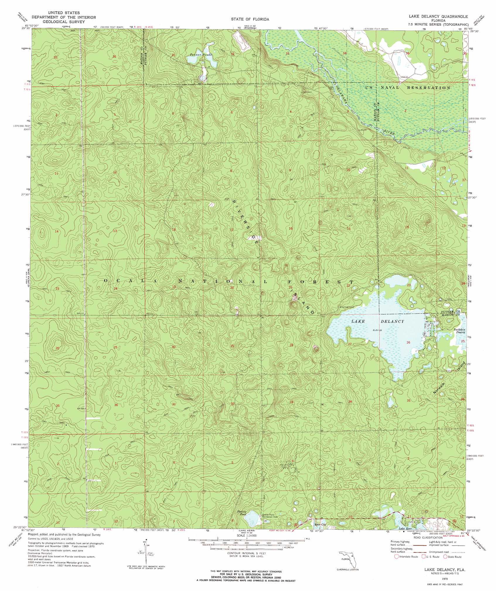
Lake Delancy Topo Map Florida
To zoom in, hover over the map of Lake Delancy
USGS Topo Quad 29081d7 - 1:24,000 scale
| Topo Map Name: | Lake Delancy |
| USGS Topo Quad ID: | 29081d7 |
| Print Size: | ca. 21 1/4" wide x 27" high |
| Southeast Coordinates: | 29.375° N latitude / 81.75° W longitude |
| Map Center Coordinates: | 29.4375° N latitude / 81.8125° W longitude |
| U.S. State: | FL |
| Filename: | O29081D7.jpg |
| Download Map JPG Image: | Lake Delancy topo map 1:24,000 scale |
| Map Type: | Topographic |
| Topo Series: | 7.5´ |
| Map Scale: | 1:24,000 |
| Source of Map Images: | United States Geological Survey (USGS) |
| Alternate Map Versions: |
Lake Delancy FL 1970, updated 1973 Download PDF Buy paper map Lake Delancy FL 1970, updated 1973 Download PDF Buy paper map Lake Delancy FL 2012 Download PDF Buy paper map Lake Delancy FL 2015 Download PDF Buy paper map |
| FStopo: | US Forest Service topo Lake Delancy is available: Download FStopo PDF Download FStopo TIF |
1:24,000 Topo Quads surrounding Lake Delancy
Melrose |
Putnam Hall |
Baywood |
Palatka |
Hastings |
Hawthorne |
Keuka |
Rodman |
Satsuma |
San Mateo |
Citra |
Eureka Dam |
Lake Delancy |
Welaka |
Crescent City |
Anthony |
Fort Mccoy |
Lake Kerr |
Salt Springs |
Welaka Se |
Ocala East |
Lynne |
Halfmoon Lake |
Juniper Springs |
Astor |
> Back to 29081a1 at 1:100,000 scale
> Back to 29080a1 at 1:250,000 scale
> Back to U.S. Topo Maps home
Lake Delancy topo map: Gazetteer
Lake Delancy: Islands
Norwalk Island elevation 11m 36′Riverside Island elevation 17m 55′
Lake Delancy: Lakes
Lake Delancy elevation 6m 19′Penner Ponds elevation 7m 22′
Prairie Pond elevation 8m 26′
Lake Delancy: Parks
Grassy Pond Recreation Area elevation 10m 32′Lake Delancy Recreation Area elevation 9m 29′
Lake Delancy digital topo map on disk
Buy this Lake Delancy topo map showing relief, roads, GPS coordinates and other geographical features, as a high-resolution digital map file on DVD: