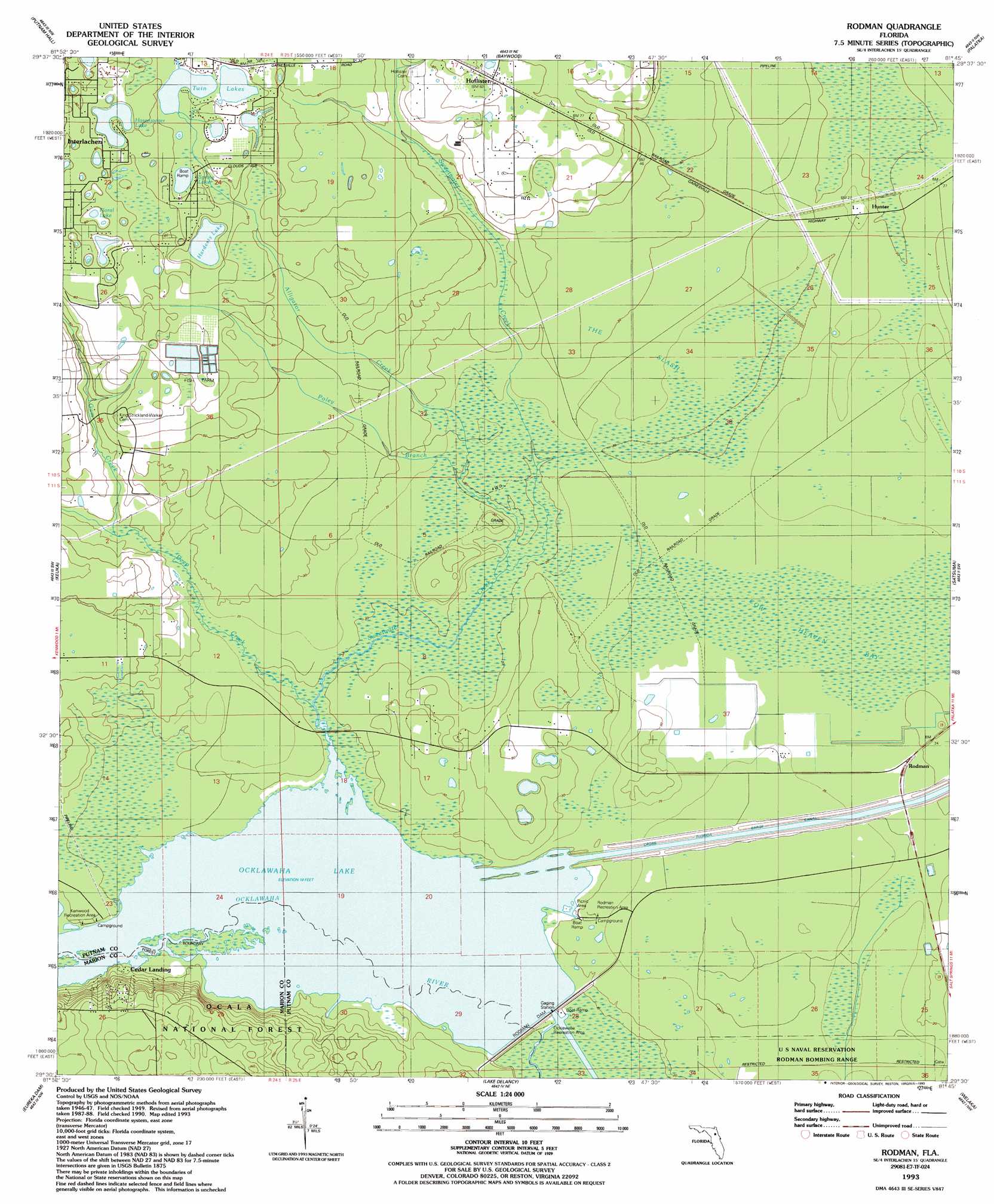
Rodman Topo Map Florida
To zoom in, hover over the map of Rodman
USGS Topo Quad 29081e7 - 1:24,000 scale
| Topo Map Name: | Rodman |
| USGS Topo Quad ID: | 29081e7 |
| Print Size: | ca. 21 1/4" wide x 27" high |
| Southeast Coordinates: | 29.5° N latitude / 81.75° W longitude |
| Map Center Coordinates: | 29.5625° N latitude / 81.8125° W longitude |
| U.S. State: | FL |
| Filename: | O29081E7.jpg |
| Download Map JPG Image: | Rodman topo map 1:24,000 scale |
| Map Type: | Topographic |
| Topo Series: | 7.5´ |
| Map Scale: | 1:24,000 |
| Source of Map Images: | United States Geological Survey (USGS) |
| Alternate Map Versions: |
Rodman FL 1949, updated 1953 Download PDF Buy paper map Rodman FL 1949, updated 1972 Download PDF Buy paper map Rodman FL 1949, updated 1972 Download PDF Buy paper map Rodman FL 1993, updated 1993 Download PDF Buy paper map Rodman FL 2012 Download PDF Buy paper map Rodman FL 2015 Download PDF Buy paper map |
| FStopo: | US Forest Service topo Rodman is available: Download FStopo PDF Download FStopo TIF |
1:24,000 Topo Quads surrounding Rodman
Keystone Heights |
Gold Head Branch |
Rice Creek |
Bostwick |
Riverdale |
Melrose |
Putnam Hall |
Baywood |
Palatka |
Hastings |
Hawthorne |
Keuka |
Rodman |
Satsuma |
San Mateo |
Citra |
Eureka Dam |
Lake Delancy |
Welaka |
Crescent City |
Anthony |
Fort Mccoy |
Lake Kerr |
Salt Springs |
Welaka Se |
> Back to 29081e1 at 1:100,000 scale
> Back to 29080a1 at 1:250,000 scale
> Back to U.S. Topo Maps home
Rodman topo map: Gazetteer
Rodman: Dams
Rodman Dam elevation 5m 16′Rodman: Lakes
Hardesty Lake elevation 19m 62′Hasenjaeger Lake elevation 22m 72′
Spring Lake elevation 22m 72′
Twin Lakes elevation 22m 72′
Rodman: Populated Places
Hollister elevation 24m 78′Hunter elevation 8m 26′
Rodman elevation 10m 32′
Rodman: Springs
Blue Springs elevation 6m 19′Rodman: Streams
Alligator Creek elevation 6m 19′Deep Creek elevation 6m 19′
Gum Creek elevation 8m 26′
Poley Branch elevation 6m 19′
Sweetwater Creek elevation 6m 19′
Rodman: Swamps
Cow Heaven Bay elevation 7m 22′The Slash elevation 8m 26′
Rodman digital topo map on disk
Buy this Rodman topo map showing relief, roads, GPS coordinates and other geographical features, as a high-resolution digital map file on DVD: