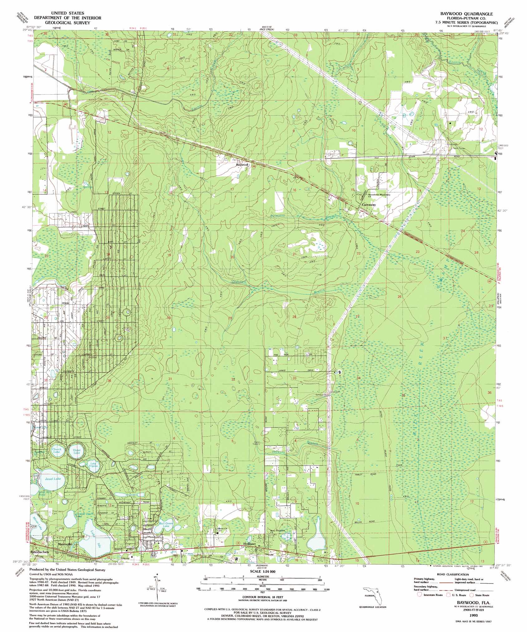
Baywood Topo Map Florida
To zoom in, hover over the map of Baywood
USGS Topo Quad 29081f7 - 1:24,000 scale
| Topo Map Name: | Baywood |
| USGS Topo Quad ID: | 29081f7 |
| Print Size: | ca. 21 1/4" wide x 27" high |
| Southeast Coordinates: | 29.625° N latitude / 81.75° W longitude |
| Map Center Coordinates: | 29.6875° N latitude / 81.8125° W longitude |
| U.S. State: | FL |
| Filename: | O29081F7.jpg |
| Download Map JPG Image: | Baywood topo map 1:24,000 scale |
| Map Type: | Topographic |
| Topo Series: | 7.5´ |
| Map Scale: | 1:24,000 |
| Source of Map Images: | United States Geological Survey (USGS) |
| Alternate Map Versions: |
Baywood FL 1949, updated 1953 Download PDF Buy paper map Baywood FL 1949, updated 1972 Download PDF Buy paper map Baywood FL 1949, updated 1980 Download PDF Buy paper map Baywood FL 1993, updated 1993 Download PDF Buy paper map Baywood FL 2012 Download PDF Buy paper map Baywood FL 2015 Download PDF Buy paper map |
1:24,000 Topo Quads surrounding Baywood
Starke |
Kingsley |
Penney Farms |
Green Cove Springs |
Picolata |
Keystone Heights |
Gold Head Branch |
Rice Creek |
Bostwick |
Riverdale |
Melrose |
Putnam Hall |
Baywood |
Palatka |
Hastings |
Hawthorne |
Keuka |
Rodman |
Satsuma |
San Mateo |
Citra |
Eureka Dam |
Lake Delancy |
Welaka |
Crescent City |
> Back to 29081e1 at 1:100,000 scale
> Back to 29080a1 at 1:250,000 scale
> Back to U.S. Topo Maps home
Baywood topo map: Gazetteer
Baywood: Lakes
Boll Green Lake elevation 23m 75′Church Lake elevation 29m 95′
Faye Lake elevation 26m 85′
Jewel Lake elevation 26m 85′
Lake Ida elevation 23m 75′
Lake Virginia elevation 29m 95′
Mirror Lake elevation 23m 75′
Sand Hill Pond elevation 26m 85′
Up and Down Lake elevation 22m 72′
Violet Lake elevation 29m 95′
Baywood: Populated Places
Baywood elevation 40m 131′Carraway elevation 24m 78′
Mannville elevation 24m 78′
Baywood: Post Offices
Hollister Post Office elevation 25m 82′Baywood: Streams
Hickory Branch elevation 12m 39′Oldtown Branch elevation 12m 39′
Palmetto Branch elevation 12m 39′
Baywood: Swamps
Rice Creek Swamp elevation 6m 19′Baywood digital topo map on disk
Buy this Baywood topo map showing relief, roads, GPS coordinates and other geographical features, as a high-resolution digital map file on DVD: