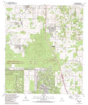
Shady Topo Map Florida
To zoom in, hover over the map of Shady
USGS Topo Quad 29082a2 - 1:24,000 scale
| Topo Map Name: | Shady |
| USGS Topo Quad ID: | 29082a2 |
| Print Size: | ca. 21 1/4" wide x 27" high |
| Southeast Coordinates: | 29° N latitude / 82.125° W longitude |
| Map Center Coordinates: | 29.0625° N latitude / 82.1875° W longitude |
| U.S. State: | FL |
| Filename: | O29082A2.jpg |
| Download Map JPG Image: | Shady topo map 1:24,000 scale |
| Map Type: | Topographic |
| Topo Series: | 7.5´ |
| Map Scale: | 1:24,000 |
| Source of Map Images: | United States Geological Survey (USGS) |
| Alternate Map Versions: |
Shady FL 1968, updated 1970 Download PDF Buy paper map Shady FL 1991, updated 1991 Download PDF Buy paper map Shady FL 2012 Download PDF Buy paper map Shady FL 2015 Download PDF Buy paper map |
1:24,000 Topo Quads surrounding Shady
> Back to 29082a1 at 1:100,000 scale
> Back to 29082a1 at 1:250,000 scale
> Back to U.S. Topo Maps home
Shady topo map: Gazetteer
Shady: Airports
McGinley Airport elevation 26m 85′Shady International Airport elevation 25m 82′
Shady: Bridges
Cross Florida Greenway - I-75 Overpass elevation 24m 78′Shady: Populated Places
Marion Oaks elevation 25m 82′Ocala Waterway elevation 27m 88′
Paddock Park South Mobile Home Park elevation 27m 88′
Ross Prairie elevation 15m 49′
Shady elevation 32m 104′
Shady Road Villas Mobile Home Park elevation 28m 91′
Shady digital topo map on disk
Buy this Shady topo map showing relief, roads, GPS coordinates and other geographical features, as a high-resolution digital map file on DVD:


