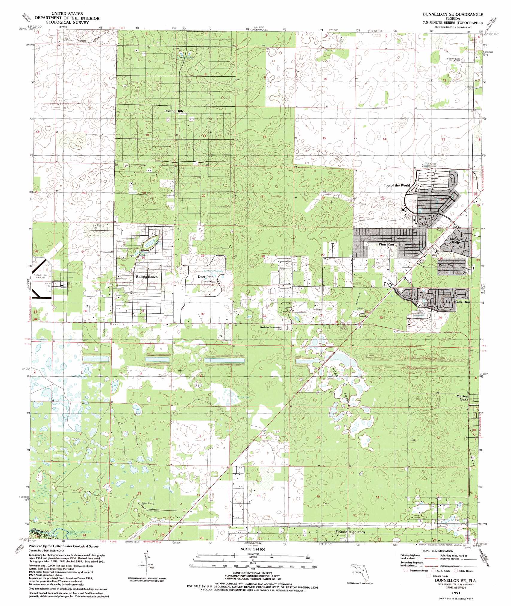
Dunnellon Se Topo Map Florida
To zoom in, hover over the map of Dunnellon Se
USGS Topo Quad 29082a3 - 1:24,000 scale
| Topo Map Name: | Dunnellon Se |
| USGS Topo Quad ID: | 29082a3 |
| Print Size: | ca. 21 1/4" wide x 27" high |
| Southeast Coordinates: | 29° N latitude / 82.25° W longitude |
| Map Center Coordinates: | 29.0625° N latitude / 82.3125° W longitude |
| U.S. State: | FL |
| Filename: | O29082A3.jpg |
| Download Map JPG Image: | Dunnellon Se topo map 1:24,000 scale |
| Map Type: | Topographic |
| Topo Series: | 7.5´ |
| Map Scale: | 1:24,000 |
| Source of Map Images: | United States Geological Survey (USGS) |
| Alternate Map Versions: |
Dunnellon SE FL 1954, updated 1955 Download PDF Buy paper map Dunnellon SE FL 1954, updated 1966 Download PDF Buy paper map Dunnellon SE FL 1991, updated 1991 Download PDF Buy paper map Dunnellon SE FL 2012 Download PDF Buy paper map Dunnellon SE FL 2015 Download PDF Buy paper map |
1:24,000 Topo Quads surrounding Dunnellon Se
Bronson Se |
Morriston |
Fairfield |
Reddick |
Anthony |
Tidewater |
Romeo |
Cotton Plant |
Ocala West |
Ocala East |
Yankeetown Se |
Dunnellon |
Dunnellon Se |
Shady |
Belleview |
Crystal River |
Holder |
Stokes Ferry |
Lake Panasoffkee Nw |
Oxford |
Homosassa |
Lecanto |
Inverness |
Rutland |
Wildwood |
> Back to 29082a1 at 1:100,000 scale
> Back to 29082a1 at 1:250,000 scale
> Back to U.S. Topo Maps home
Dunnellon Se topo map: Gazetteer
Dunnellon Se: Flats
Ross Prairie elevation 16m 52′Dunnellon Se: Islands
Adams Hammock elevation 23m 75′Dunnellon Se: Lakes
Lake Otting elevation 13m 42′Leroy Ponds elevation 13m 42′
Ross Pond elevation 15m 49′
String of Ponds elevation 16m 52′
Dunnellon Se: Populated Places
Rolling Hills elevation 24m 78′Rolling Ranches elevation 21m 68′
Dunnellon Se digital topo map on disk
Buy this Dunnellon Se topo map showing relief, roads, GPS coordinates and other geographical features, as a high-resolution digital map file on DVD: