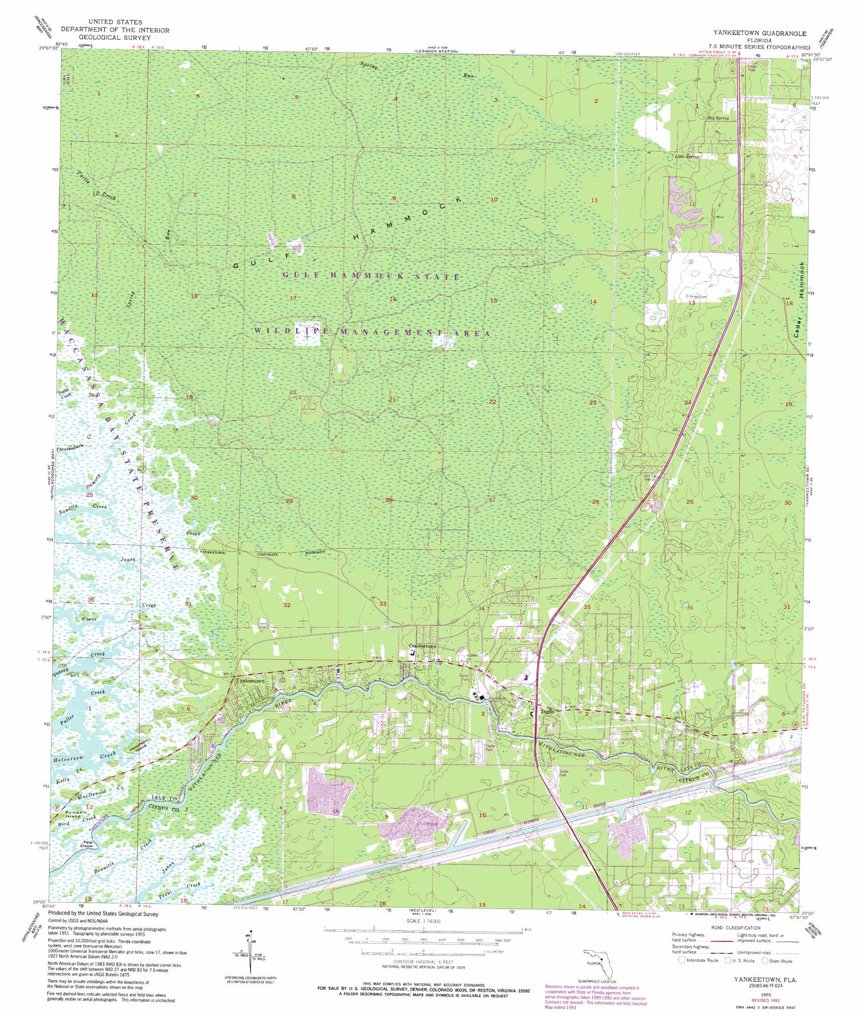
Yankeetown Topo Map Florida
To zoom in, hover over the map of Yankeetown
USGS Topo Quad 29082a6 - 1:24,000 scale
| Topo Map Name: | Yankeetown |
| USGS Topo Quad ID: | 29082a6 |
| Print Size: | ca. 21 1/4" wide x 27" high |
| Southeast Coordinates: | 29° N latitude / 82.625° W longitude |
| Map Center Coordinates: | 29.0625° N latitude / 82.6875° W longitude |
| U.S. State: | FL |
| Filename: | O29082A6.jpg |
| Download Map JPG Image: | Yankeetown topo map 1:24,000 scale |
| Map Type: | Topographic |
| Topo Series: | 7.5´ |
| Map Scale: | 1:24,000 |
| Source of Map Images: | United States Geological Survey (USGS) |
| Alternate Map Versions: |
Yankeetown FL 1955, updated 1956 Download PDF Buy paper map Yankeetown FL 1955, updated 1963 Download PDF Buy paper map Yankeetown FL 1955, updated 1972 Download PDF Buy paper map Yankeetown FL 1955, updated 1988 Download PDF Buy paper map Yankeetown FL 1955, updated 1993 Download PDF Buy paper map Yankeetown FL 2012 Download PDF Buy paper map Yankeetown FL 2015 Download PDF Buy paper map |
1:24,000 Topo Quads surrounding Yankeetown
Chiefland Sw |
Otter Creek |
Bronson Sw |
Bronson Se |
Morriston |
Sumner |
Waccasassa Bay |
Lebanon Station |
Tidewater |
Romeo |
Withlacoochee Bay |
Yankeetown |
Yankeetown Se |
Dunnellon |
|
Red Level |
Crystal River |
Holder |
||
Ozello |
Homosassa |
Lecanto |
> Back to 29082a1 at 1:100,000 scale
> Back to 29082a1 at 1:250,000 scale
> Back to U.S. Topo Maps home
Yankeetown topo map: Gazetteer
Yankeetown: Bends
Pats Elbow elevation 1m 3′Yankeetown: Canals
Cross Florida Barge Canal elevation 0m 0′Yankeetown: Guts
Sandfly Creek elevation 0m 0′Yankeetown: Islands
Gulf Hammock elevation 3m 9′Helverson Island elevation 1m 3′
Yankeetown: Parks
Gulf Hammock State Wildlife Management Area elevation 3m 9′Gulf Hammock Wildlife Management Area elevation 3m 9′
Yankeetown: Populated Places
Crackertown elevation 3m 9′Inglis elevation 5m 16′
Yankeetown elevation 3m 9′
Yankeetown: Post Offices
Inglis Post Office elevation 5m 16′Yankeetown Post Office elevation 3m 9′
Yankeetown: Springs
Big Spring elevation 6m 19′Little Spring elevation 6m 19′
Sulphur Spring elevation 3m 9′
Yankeetown digital topo map on disk
Buy this Yankeetown topo map showing relief, roads, GPS coordinates and other geographical features, as a high-resolution digital map file on DVD: