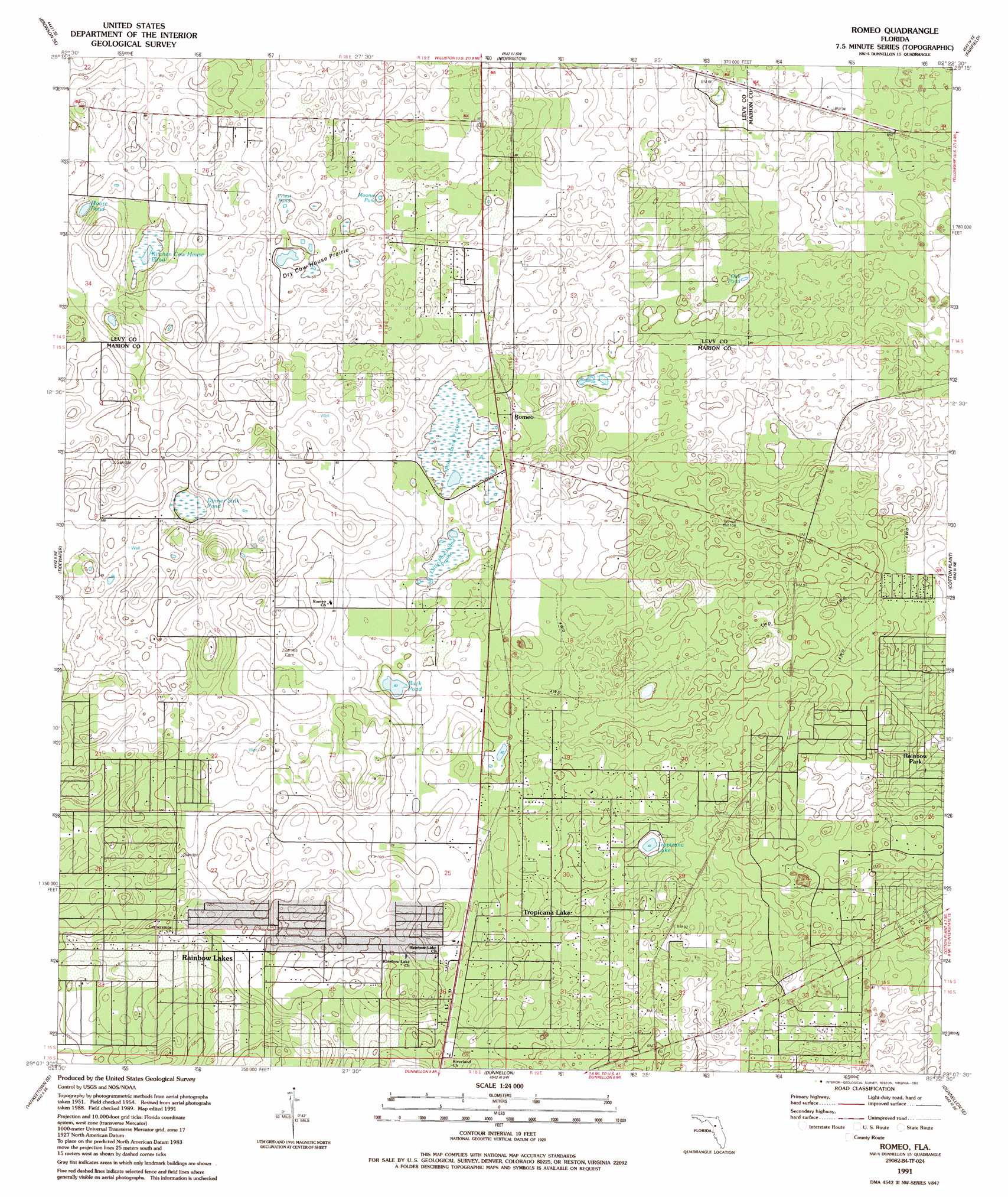
Romeo Topo Map Florida
To zoom in, hover over the map of Romeo
USGS Topo Quad 29082b4 - 1:24,000 scale
| Topo Map Name: | Romeo |
| USGS Topo Quad ID: | 29082b4 |
| Print Size: | ca. 21 1/4" wide x 27" high |
| Southeast Coordinates: | 29.125° N latitude / 82.375° W longitude |
| Map Center Coordinates: | 29.1875° N latitude / 82.4375° W longitude |
| U.S. State: | FL |
| Filename: | O29082B4.jpg |
| Download Map JPG Image: | Romeo topo map 1:24,000 scale |
| Map Type: | Topographic |
| Topo Series: | 7.5´ |
| Map Scale: | 1:24,000 |
| Source of Map Images: | United States Geological Survey (USGS) |
| Alternate Map Versions: |
Romeo FL 1954, updated 1955 Download PDF Buy paper map Romeo FL 1954, updated 1966 Download PDF Buy paper map Romeo FL 1991, updated 1991 Download PDF Buy paper map Romeo FL 2012 Download PDF Buy paper map Romeo FL 2015 Download PDF Buy paper map |
1:24,000 Topo Quads surrounding Romeo
Bronson |
Bronson Ne |
Williston |
Flemington |
Mcintosh |
Bronson Sw |
Bronson Se |
Morriston |
Fairfield |
Reddick |
Lebanon Station |
Tidewater |
Romeo |
Cotton Plant |
Ocala West |
Yankeetown |
Yankeetown Se |
Dunnellon |
Dunnellon Se |
Shady |
Red Level |
Crystal River |
Holder |
Stokes Ferry |
Lake Panasoffkee Nw |
> Back to 29082a1 at 1:100,000 scale
> Back to 29082a1 at 1:250,000 scale
> Back to U.S. Topo Maps home
Romeo topo map: Gazetteer
Romeo: Flats
Dry Cow House Prairie elevation 14m 45′Romeo: Lakes
Buck Pond elevation 13m 42′Kitchen Cow House Pond elevation 13m 42′
Mooney Pond elevation 14m 45′
Moore Pond elevation 14m 45′
Oak Pond elevation 14m 45′
Pine Island Prairie elevation 14m 45′
Priest Pond elevation 14m 45′
Romeo: Populated Places
Hoyt elevation 30m 98′Luddersville elevation 19m 62′
Rainbow Lakes Estates elevation 38m 124′
Romeo elevation 17m 55′
Romeo: Swamps
Dinner Sink Pond elevation 20m 65′Little Pine Island Prairie elevation 14m 45′
Romeo digital topo map on disk
Buy this Romeo topo map showing relief, roads, GPS coordinates and other geographical features, as a high-resolution digital map file on DVD: