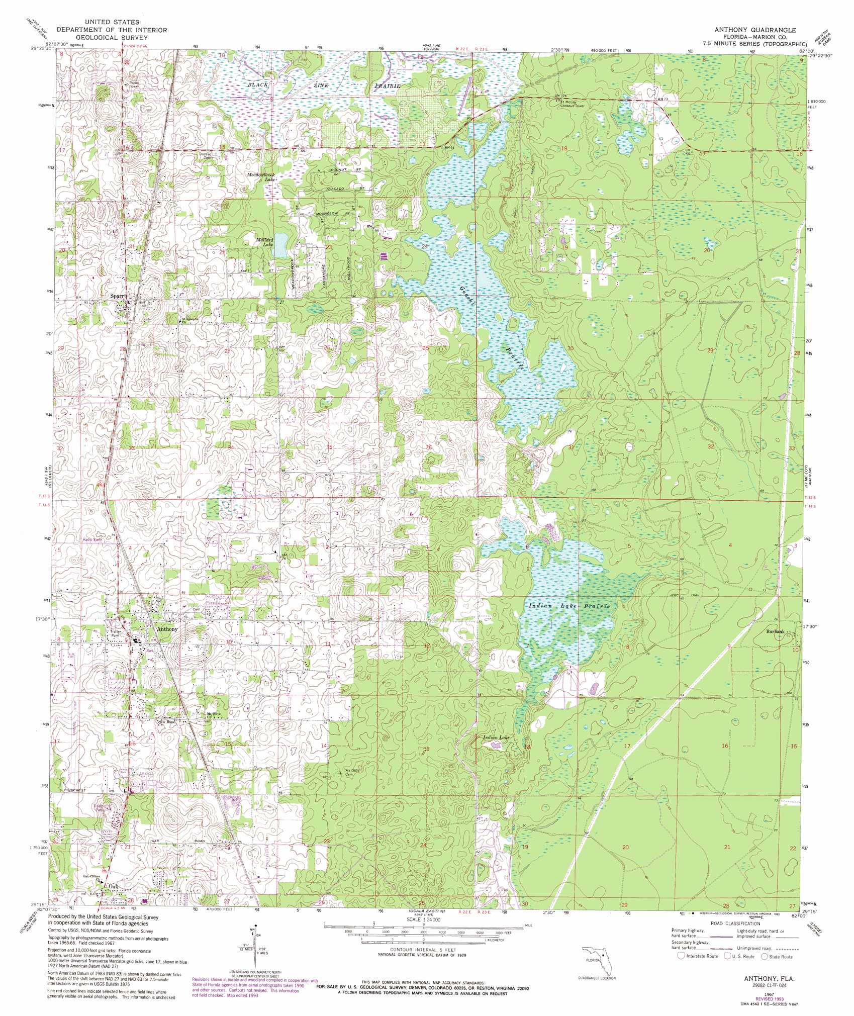
Anthony Topo Map Florida
To zoom in, hover over the map of Anthony
USGS Topo Quad 29082c1 - 1:24,000 scale
| Topo Map Name: | Anthony |
| USGS Topo Quad ID: | 29082c1 |
| Print Size: | ca. 21 1/4" wide x 27" high |
| Southeast Coordinates: | 29.25° N latitude / 82° W longitude |
| Map Center Coordinates: | 29.3125° N latitude / 82.0625° W longitude |
| U.S. State: | FL |
| Filename: | O29082C1.jpg |
| Download Map JPG Image: | Anthony topo map 1:24,000 scale |
| Map Type: | Topographic |
| Topo Series: | 7.5´ |
| Map Scale: | 1:24,000 |
| Source of Map Images: | United States Geological Survey (USGS) |
| Alternate Map Versions: |
Anthony FL 1967, updated 1970 Download PDF Buy paper map Anthony FL 1967, updated 1993 Download PDF Buy paper map Anthony FL 2012 Download PDF Buy paper map Anthony FL 2015 Download PDF Buy paper map |
1:24,000 Topo Quads surrounding Anthony
Micanopy |
Rochelle |
Hawthorne |
Keuka |
Rodman |
Flemington |
Mcintosh |
Citra |
Eureka Dam |
Lake Delancy |
Fairfield |
Reddick |
Anthony |
Fort Mccoy |
Lake Kerr |
Cotton Plant |
Ocala West |
Ocala East |
Lynne |
Halfmoon Lake |
Dunnellon Se |
Shady |
Belleview |
Lake Weir |
Lake Mary |
> Back to 29082a1 at 1:100,000 scale
> Back to 29082a1 at 1:250,000 scale
> Back to U.S. Topo Maps home
Anthony topo map: Gazetteer
Anthony: Airports
Greystone Airport elevation 27m 88′Anthony: Lakes
Indian Lake elevation 14m 45′Mallard Lake elevation 16m 52′
Meadowbrook Lake elevation 16m 52′
Anthony: Populated Places
Anthony elevation 26m 85′Burbank elevation 22m 72′
Cyrs Mobile Home Park elevation 24m 78′
Oak elevation 22m 72′
Oak Mobile Home Park elevation 21m 68′
Sparr elevation 28m 91′
Victory Mobile Home Park elevation 25m 82′
Anthony: Post Offices
Anthony Post Office elevation 24m 78′Sparr Post Office elevation 30m 98′
Anthony: Swamps
Gooski Prairie elevation 16m 52′Indian Lake Prairie elevation 16m 52′
Anthony digital topo map on disk
Buy this Anthony topo map showing relief, roads, GPS coordinates and other geographical features, as a high-resolution digital map file on DVD: