Bronson Sw Topo Map Florida
To zoom in, hover over the map of Bronson Sw
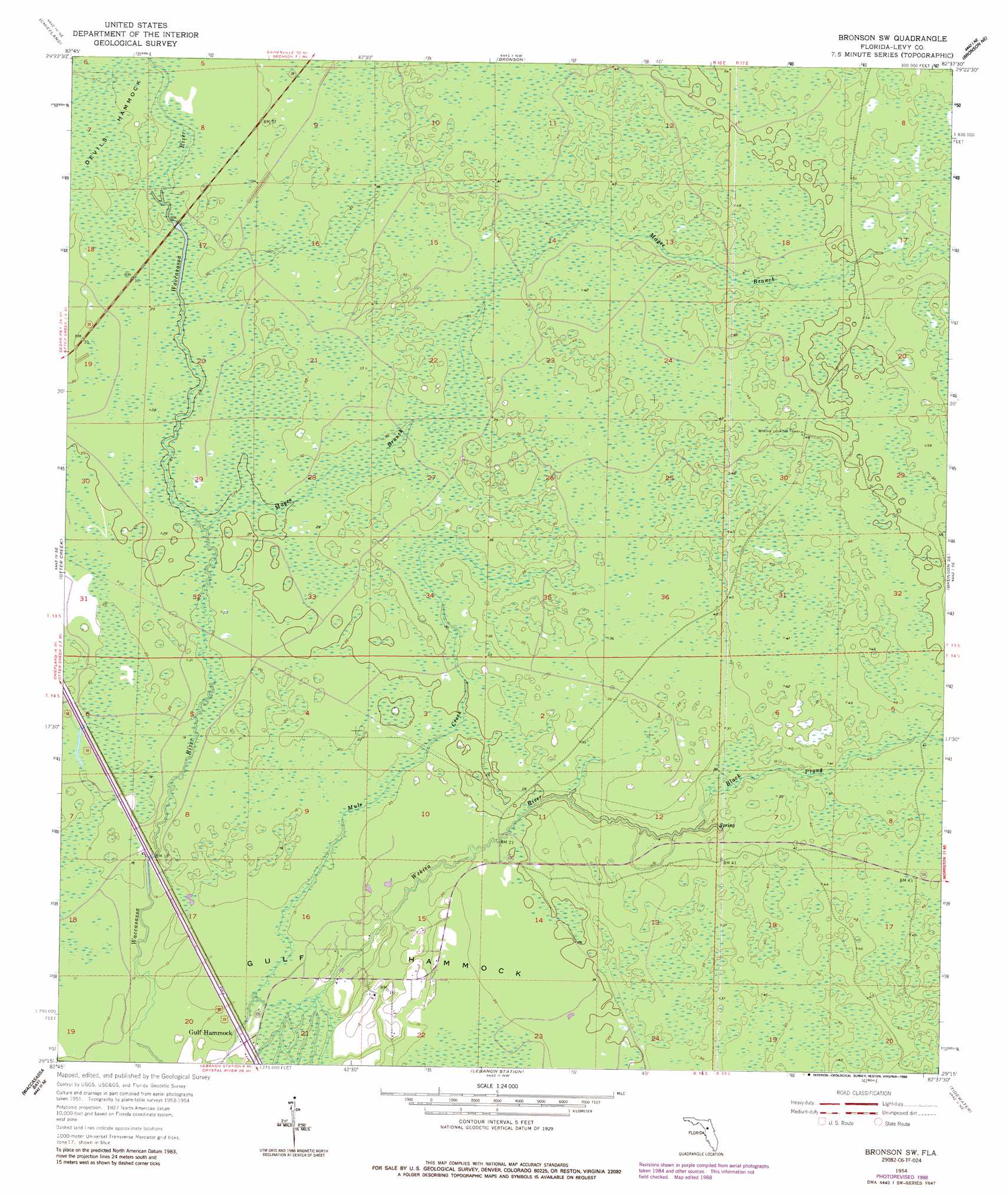
USGS Topo Quad 29082c6 - 1:24,000 scale
| Topo Map Name: | Bronson Sw |
| USGS Topo Quad ID: | 29082c6 |
| Print Size: | ca. 21 1/4" wide x 27" high |
| Southeast Coordinates: | 29.25° N latitude / 82.625° W longitude |
| Map Center Coordinates: | 29.3125° N latitude / 82.6875° W longitude |
| U.S. State: | FL |
| Filename: | O29082C6.jpg |
| Download Map JPG Image: | Bronson Sw topo map 1:24,000 scale |
| Map Type: | Topographic |
| Topo Series: | 7.5´ |
| Map Scale: | 1:24,000 |
| Source of Map Images: | United States Geological Survey (USGS) |
| Alternate Map Versions: |
Bronson SW FL 1954, updated 1956 Download PDF Buy paper map Bronson SW FL 1954, updated 1971 Download PDF Buy paper map Bronson SW FL 1954, updated 1988 Download PDF Buy paper map Bronson SW FL 2012 Download PDF Buy paper map Bronson SW FL 2015 Download PDF Buy paper map |
1:24,000 Topo Quads surrounding Bronson Sw
Suwannee River |
Trenton |
Newberry Sw |
Archer |
Arredondo |
Manatee Springs |
Chiefland |
Bronson |
Bronson Ne |
Williston |
Chiefland Sw |
Otter Creek |
Bronson Sw |
Bronson Se |
Morriston |
Sumner |
Waccasassa Bay |
Lebanon Station |
Tidewater |
Romeo |
Withlacoochee Bay |
Yankeetown |
Yankeetown Se |
Dunnellon |
> Back to 29082a1 at 1:100,000 scale
> Back to 29082a1 at 1:250,000 scale
> Back to U.S. Topo Maps home
Bronson Sw topo map: Gazetteer
Bronson Sw: Parks
Henry Beck County Park elevation 7m 22′Bronson Sw: Populated Places
Gulf Hammock elevation 3m 9′Bronson Sw: Post Offices
Gulf Hammock Post Office elevation 4m 13′Bronson Sw: Streams
Magee Branch elevation 6m 19′Bronson Sw digital topo map on disk
Buy this Bronson Sw topo map showing relief, roads, GPS coordinates and other geographical features, as a high-resolution digital map file on DVD: