Alachua Topo Map Florida
To zoom in, hover over the map of Alachua
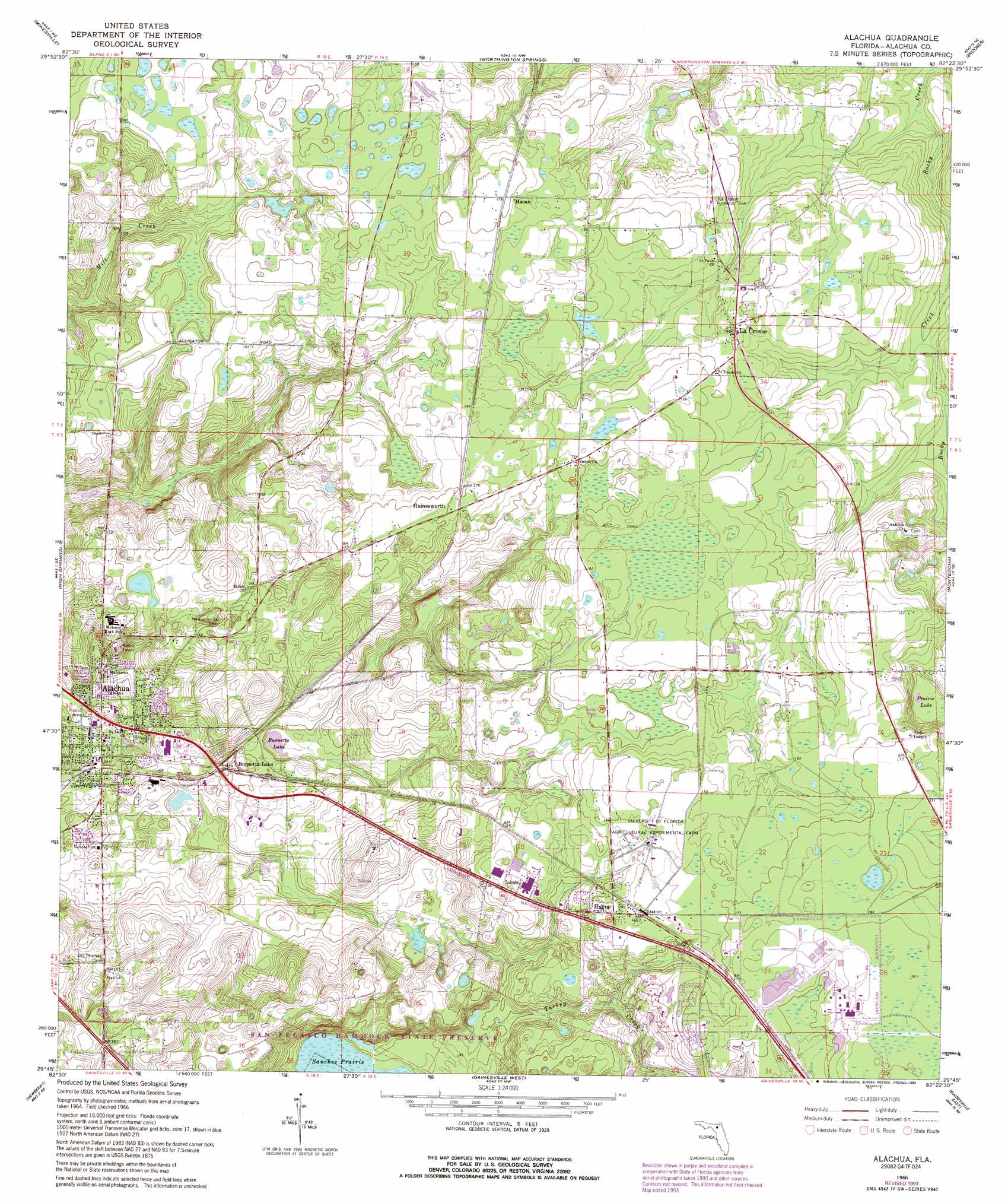
USGS Topo Quad 29082g4 - 1:24,000 scale
| Topo Map Name: | Alachua |
| USGS Topo Quad ID: | 29082g4 |
| Print Size: | ca. 21 1/4" wide x 27" high |
| Southeast Coordinates: | 29.75° N latitude / 82.375° W longitude |
| Map Center Coordinates: | 29.8125° N latitude / 82.4375° W longitude |
| U.S. State: | FL |
| Filename: | O29082G4.jpg |
| Download Map JPG Image: | Alachua topo map 1:24,000 scale |
| Map Type: | Topographic |
| Topo Series: | 7.5´ |
| Map Scale: | 1:24,000 |
| Source of Map Images: | United States Geological Survey (USGS) |
| Alternate Map Versions: |
Alachua FL 1966, updated 1967 Download PDF Buy paper map Alachua FL 1966, updated 1981 Download PDF Buy paper map Alachua FL 1966, updated 1990 Download PDF Buy paper map Alachua FL 1966, updated 1993 Download PDF Buy paper map Alachua FL 2012 Download PDF Buy paper map Alachua FL 2015 Download PDF Buy paper map |
1:24,000 Topo Quads surrounding Alachua
Columbia |
Ellisville |
Lulu |
Lake Butler |
Raiford |
Fort White |
Mikesville |
Worthington Springs |
Brooker |
Sampson |
High Springs Sw |
High Springs |
Alachua |
Monteocha |
Waldo |
Waters Lake |
Newberry |
Gainesville West |
Gainesville East |
Orange Heights |
Newberry Sw |
Archer |
Arredondo |
Micanopy |
Rochelle |
> Back to 29082e1 at 1:100,000 scale
> Back to 29082a1 at 1:250,000 scale
> Back to U.S. Topo Maps home
Alachua topo map: Gazetteer
Alachua: Lakes
Burnetts Lake elevation 19m 62′Prairie Lake elevation 36m 118′
Sweet Water Lake elevation 54m 177′
Alachua: Populated Places
Alachua elevation 42m 137′Autumn Leaves Mobile Home Park elevation 23m 75′
Bonners Mobile Home Park elevation 24m 78′
Burnetts Lake elevation 23m 75′
Hague elevation 48m 157′
Hainesworth elevation 52m 170′
Hasan elevation 53m 173′
La Crosse elevation 44m 144′
Newnansville elevation 43m 141′
Alachua: Post Offices
Alachua Post Office elevation 19m 62′La Crosse Post Office elevation 44m 144′
Alachua: Streams
Mill Creek elevation 43m 141′Turkey Creek elevation 29m 95′
Alachua digital topo map on disk
Buy this Alachua topo map showing relief, roads, GPS coordinates and other geographical features, as a high-resolution digital map file on DVD: