Hatchbend Topo Map Florida
To zoom in, hover over the map of Hatchbend
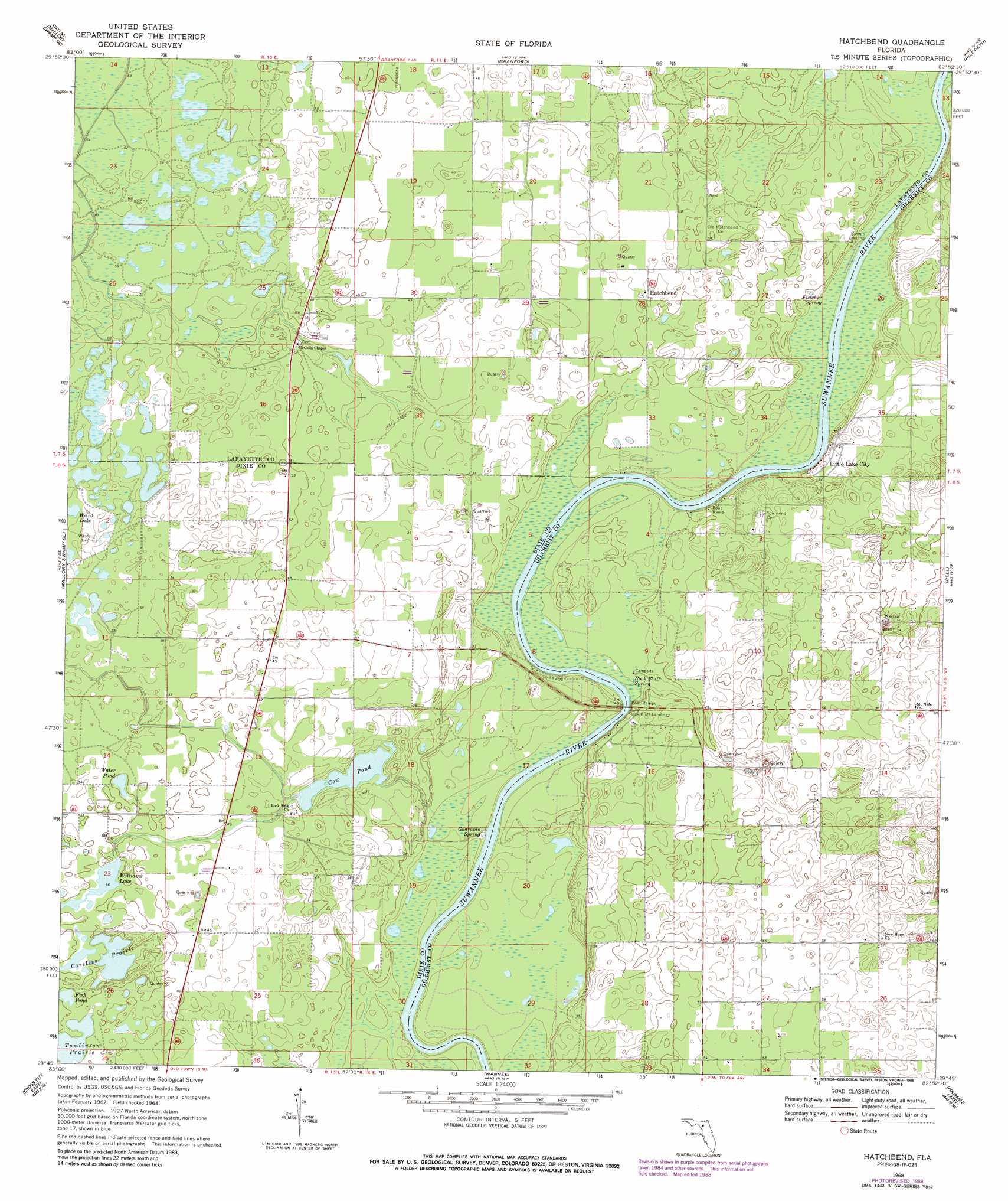
USGS Topo Quad 29082g8 - 1:24,000 scale
| Topo Map Name: | Hatchbend |
| USGS Topo Quad ID: | 29082g8 |
| Print Size: | ca. 21 1/4" wide x 27" high |
| Southeast Coordinates: | 29.75° N latitude / 82.875° W longitude |
| Map Center Coordinates: | 29.8125° N latitude / 82.9375° W longitude |
| U.S. State: | FL |
| Filename: | O29082G8.jpg |
| Download Map JPG Image: | Hatchbend topo map 1:24,000 scale |
| Map Type: | Topographic |
| Topo Series: | 7.5´ |
| Map Scale: | 1:24,000 |
| Source of Map Images: | United States Geological Survey (USGS) |
| Alternate Map Versions: |
Hatchbend FL 1968, updated 1971 Download PDF Buy paper map Hatchbend FL 1968, updated 1977 Download PDF Buy paper map Hatchbend FL 1968, updated 1988 Download PDF Buy paper map Hatchbend FL 2012 Download PDF Buy paper map Hatchbend FL 2015 Download PDF Buy paper map |
1:24,000 Topo Quads surrounding Hatchbend
Mayo |
Mayo Se |
O'Brien |
O'Brien Se |
Columbia |
Mallory Swamp Nw |
Mallory Swamp Ne |
Branford |
Hildreth |
Fort White |
Mallory Swamp Sw |
Mallory Swamp Se |
Hatchbend |
Bell |
High Springs Sw |
Cross City West |
Cross City East |
Wannee |
Fourmile Lake |
Waters Lake |
Cross City Sw |
Eugene |
Suwannee River |
Trenton |
Newberry Sw |
> Back to 29082e1 at 1:100,000 scale
> Back to 29082a1 at 1:250,000 scale
> Back to U.S. Topo Maps home
Hatchbend topo map: Gazetteer
Hatchbend: Airports
Darrah Air Park elevation 21m 68′Shady Bend Airport elevation 14m 45′
Hatchbend: Flats
Tomlinson Prairie elevation 12m 39′Hatchbend: Lakes
Careless Prairie elevation 13m 42′Cow Pond elevation 9m 29′
Water Pond elevation 15m 49′
Williams Lake elevation 15m 49′
Hatchbend: Populated Places
Hatchbend elevation 13m 42′Little Lake City elevation 14m 45′
Hatchbend: Springs
Fletcher Spring elevation 10m 32′Guaranto Spring elevation 8m 26′
Rock Bluff Spring elevation 17m 55′
Hatchbend digital topo map on disk
Buy this Hatchbend topo map showing relief, roads, GPS coordinates and other geographical features, as a high-resolution digital map file on DVD: