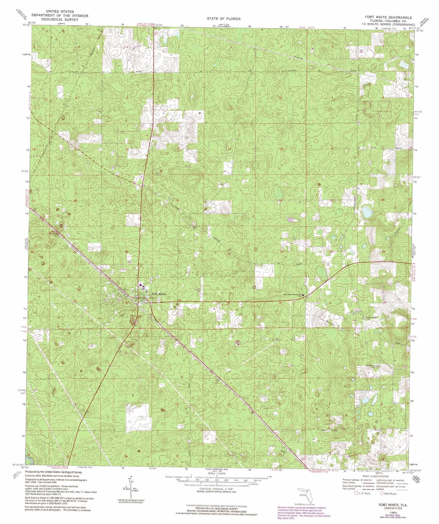
Fort White Topo Map Florida
To zoom in, hover over the map of Fort White
USGS Topo Quad 29082h6 - 1:24,000 scale
| Topo Map Name: | Fort White |
| USGS Topo Quad ID: | 29082h6 |
| Print Size: | ca. 21 1/4" wide x 27" high |
| Southeast Coordinates: | 29.875° N latitude / 82.625° W longitude |
| Map Center Coordinates: | 29.9375° N latitude / 82.6875° W longitude |
| U.S. State: | FL |
| Filename: | O29082H6.jpg |
| Download Map JPG Image: | Fort White topo map 1:24,000 scale |
| Map Type: | Topographic |
| Topo Series: | 7.5´ |
| Map Scale: | 1:24,000 |
| Source of Map Images: | United States Geological Survey (USGS) |
| Alternate Map Versions: |
Fort White FL 1969, updated 1971 Download PDF Buy paper map Fort White FL 1969, updated 1990 Download PDF Buy paper map Fort White FL 1969, updated 1993 Download PDF Buy paper map Fort White FL 2012 Download PDF Buy paper map Fort White FL 2015 Download PDF Buy paper map |
1:24,000 Topo Quads surrounding Fort White
Mcalpin |
Wellborn |
Lake City West |
Lake City East |
Olustee |
O'Brien |
O'Brien Se |
Columbia |
Ellisville |
Lulu |
Branford |
Hildreth |
Fort White |
Mikesville |
Worthington Springs |
Hatchbend |
Bell |
High Springs Sw |
High Springs |
Alachua |
Wannee |
Fourmile Lake |
Waters Lake |
Newberry |
Gainesville West |
> Back to 29082e1 at 1:100,000 scale
> Back to 29082a1 at 1:250,000 scale
> Back to U.S. Topo Maps home
Fort White topo map: Gazetteer
Fort White: Airports
Almeidas Landing Airport elevation 20m 65′Bradley Airport elevation 22m 72′
Fort White: Parks
Bethlehem Community Park elevation 31m 101′Deese Memorial Park elevation 21m 68′
Fort White High School Football Stadium elevation 21m 68′
Fort White: Populated Places
Fort White elevation 21m 68′Woftoka (historical) elevation 22m 72′
Fort White: Post Offices
Fort White Florida Post Office elevation 21m 68′Fort White digital topo map on disk
Buy this Fort White topo map showing relief, roads, GPS coordinates and other geographical features, as a high-resolution digital map file on DVD: