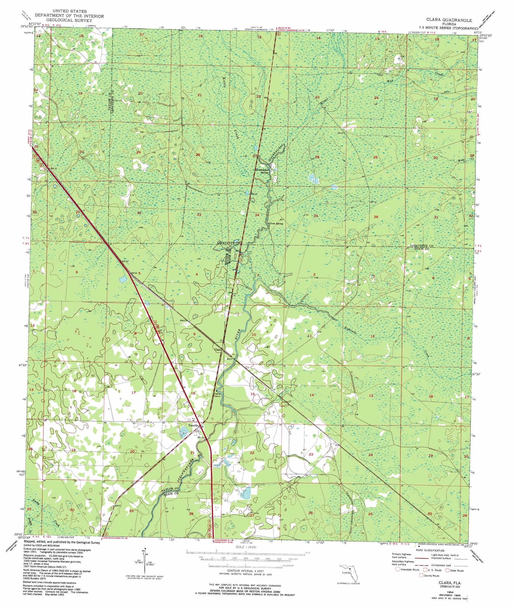
Clara Topo Map Florida
To zoom in, hover over the map of Clara
USGS Topo Quad 29083g3 - 1:24,000 scale
| Topo Map Name: | Clara |
| USGS Topo Quad ID: | 29083g3 |
| Print Size: | ca. 21 1/4" wide x 27" high |
| Southeast Coordinates: | 29.75° N latitude / 83.25° W longitude |
| Map Center Coordinates: | 29.8125° N latitude / 83.3125° W longitude |
| U.S. State: | FL |
| Filename: | O29083G3.jpg |
| Download Map JPG Image: | Clara topo map 1:24,000 scale |
| Map Type: | Topographic |
| Topo Series: | 7.5´ |
| Map Scale: | 1:24,000 |
| Source of Map Images: | United States Geological Survey (USGS) |
| Alternate Map Versions: |
Clara FL 1954, updated 1955 Download PDF Buy paper map Clara FL 1954, updated 1971 Download PDF Buy paper map Clara FL 1954, updated 1993 Download PDF Buy paper map Clara FL 2012 Download PDF Buy paper map Clara FL 2015 Download PDF Buy paper map |
1:24,000 Topo Quads surrounding Clara
Perry |
Fenholloway |
Day Se |
Mayo |
Mayo Se |
Warrior Swamp |
Salem |
Cooks Hammock |
Mallory Swamp Nw |
Mallory Swamp Ne |
Keaton Beach |
Salem Sw |
Clara |
Mallory Swamp Sw |
Mallory Swamp Se |
Crooked Point |
Steinhatchee |
Jena |
Cross City West |
Cross City East |
Steinhatchee Sw |
Steinhatchee Se |
Cross City Sw |
Eugene |
> Back to 29083e1 at 1:100,000 scale
> Back to 29082a1 at 1:250,000 scale
> Back to U.S. Topo Maps home
Clara topo map: Gazetteer
Clara: Populated Places
Clara elevation 9m 29′Tennille elevation 6m 19′
Clara: Springs
Iron Spring elevation 7m 22′Steinhatchee Spring elevation 7m 22′
Clara: Streams
Eightmile Creek elevation 6m 19′Kettle Creek elevation 7m 22′
Mud Creek elevation 9m 29′
Wolf Creek elevation 10m 32′
Clara digital topo map on disk
Buy this Clara topo map showing relief, roads, GPS coordinates and other geographical features, as a high-resolution digital map file on DVD: