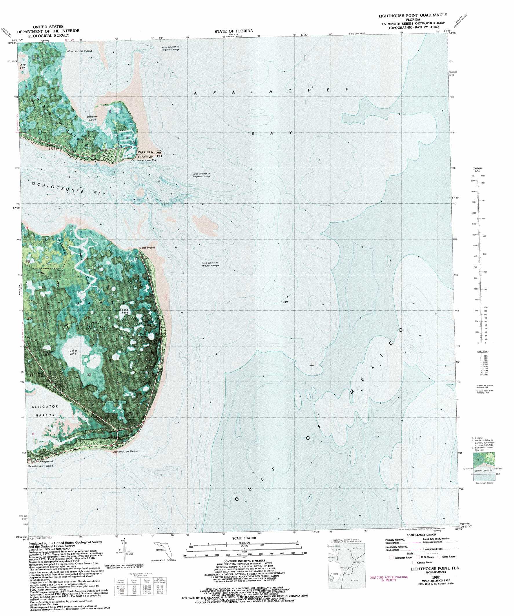
Lighthouse Point Topo Map Florida
To zoom in, hover over the map of Lighthouse Point
USGS Topo Quad 29084h3 - 1:24,000 scale
| Topo Map Name: | Lighthouse Point |
| USGS Topo Quad ID: | 29084h3 |
| Print Size: | ca. 21 1/4" wide x 27" high |
| Southeast Coordinates: | 29.875° N latitude / 84.25° W longitude |
| Map Center Coordinates: | 29.9375° N latitude / 84.3125° W longitude |
| U.S. State: | FL |
| Filename: | P29084h3.jpg |
| Download Map JPG Image: | Lighthouse Point topo map 1:24,000 scale |
| Map Type: | Orthophoto |
| Topo Series: | 7.5´ |
| Map Scale: | 1:24,000 |
| Source of Map Images: | United States Geological Survey (USGS) |
| Alternate Map Versions: |
Lighthouse Point FL 1943, updated 1976 Download PDF Buy paper map Lighthouse Point FL 1945, updated 1960 Download PDF Buy paper map Lighthouse Point FL 1982, updated 1982 Download PDF Buy paper map Lighthouse Point FL 1982, updated 1992 Download PDF Buy paper map Lighthouse Point FL 2012 Download PDF Buy paper map Lighthouse Point FL 2015 Download PDF Buy paper map |
1:24,000 Topo Quads surrounding Lighthouse Point
Bradwell Bay |
Crawfordville West |
Crawfordville East |
Saint Marks |
Saint Marks Ne |
Sanborn |
Sopchoppy |
Spring Creek |
Sprague Island |
Cobb Rocks |
Mcintyre |
Saint Teresa Beach |
Lighthouse Point |
||
Dog Island |
||||
> Back to 29084e1 at 1:100,000 scale
> Back to 29084a1 at 1:250,000 scale
> Back to U.S. Topo Maps home
Lighthouse Point topo map: Gazetteer
Lighthouse Point: Bays
Dickson Bay elevation 0m 0′Levy Bay elevation 0m 0′
Ullmore Cove elevation 0m 0′
Lighthouse Point: Capes
Bald Point elevation 0m 0′Lighthouse Point elevation 1m 3′
Ochlockonee Point elevation 0m 0′
Whetstone Point elevation 0m 0′
Lighthouse Point: Islands
Mashes Island elevation 1m 3′Lighthouse Point: Lakes
Double Pond elevation 2m 6′Mullet Pond elevation 0m 0′
Sand Pond elevation 0m 0′
Tucker Lake elevation 0m 0′
Lighthouse Point: Populated Places
Sun N Sand Beaches elevation 4m 13′Lighthouse Point: Reservoirs
Little Tucker Lake elevation 1m 3′Lighthouse Point: Streams
Chaires Creek elevation 0m 0′Lady Creek elevation 0m 0′
Little Chaires Creek elevation 0m 0′
Sand Creek elevation 1m 3′
Lighthouse Point: Summits
Southern Dunes elevation 2m 6′Lighthouse Point digital topo map on disk
Buy this Lighthouse Point topo map showing relief, roads, GPS coordinates and other geographical features, as a high-resolution digital map file on DVD:
Gulf Coast (LA, MS, AL, FL) & Southwestern Georgia
Buy digital topo maps: Gulf Coast (LA, MS, AL, FL) & Southwestern Georgia
 & Southwestern Georgia map DVD")