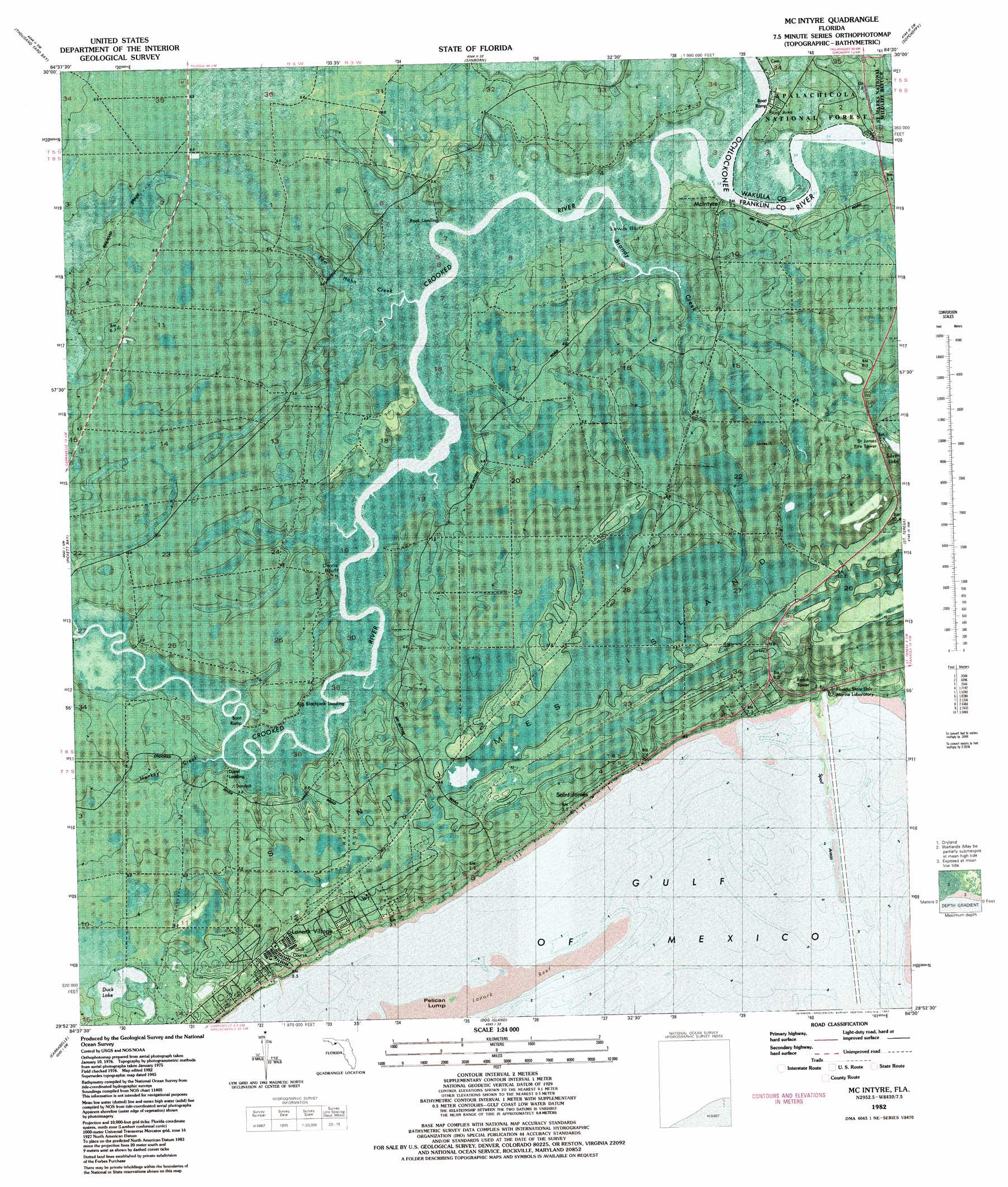
Mcintyre Topo Map Florida
To zoom in, hover over the map of Mcintyre
USGS Topo Quad 29084h5 - 1:24,000 scale
| Topo Map Name: | Mcintyre |
| USGS Topo Quad ID: | 29084h5 |
| Print Size: | ca. 21 1/4" wide x 27" high |
| Southeast Coordinates: | 29.875° N latitude / 84.5° W longitude |
| Map Center Coordinates: | 29.9375° N latitude / 84.5625° W longitude |
| U.S. State: | FL |
| Filename: | P29084h5.jpg |
| Download Map JPG Image: | Mcintyre topo map 1:24,000 scale |
| Map Type: | Orthophoto |
| Topo Series: | 7.5´ |
| Map Scale: | 1:24,000 |
| Source of Map Images: | United States Geological Survey (USGS) |
| Alternate Map Versions: |
Mc Intyre FL 1945, updated 1960 Download PDF Buy paper map McIntyre FL 1945, updated 1960 Download PDF Buy paper map McIntyre FL 1945, updated 1960 Download PDF Buy paper map Mc Intyre FL 1982, updated 1982 Download PDF Buy paper map McIntyre FL 1982, updated 1982 Download PDF Buy paper map McIntyre FL 1982, updated 1992 Download PDF Buy paper map McIntyre FL 2012 Download PDF Buy paper map McIntyre FL 2015 Download PDF Buy paper map |
| FStopo: | US Forest Service topo McIntyre is available: Download FStopo PDF Download FStopo TIF |
1:24,000 Topo Quads surrounding Mcintyre
Queens Bay |
Smith Creek |
Bradwell Bay |
Crawfordville West |
Crawfordville East |
Owens Bridge |
Thousand Yard Bay |
Sanborn |
Sopchoppy |
Spring Creek |
Tates Hell Swamp |
Pickett Bay |
Mcintyre |
Saint Teresa Beach |
Lighthouse Point |
Green Point |
Carrabelle |
Dog Island |
||
Goose Island |
Sugar Hill |
> Back to 29084e1 at 1:100,000 scale
> Back to 29084a1 at 1:250,000 scale
> Back to U.S. Topo Maps home
Mcintyre topo map: Gazetteer
Mcintyre: Bridges
E L Moore Bridge elevation 1m 3′Pine Log Bridge elevation 1m 3′
Mcintyre: Cliffs
Davis Bluff elevation 2m 6′Lewis Bluff elevation 2m 6′
Mcintyre: Islands
Saint James Island elevation 10m 32′Mcintyre: Lakes
Duck Lake elevation 5m 16′Mcintyre: Populated Places
Big Blackjack Landing elevation 0m 0′Lanark Village elevation 8m 26′
McIntyre elevation 2m 6′
Pine Log elevation 3m 9′
Mcintyre: Streams
Brandy Creek elevation 0m 0′Monkey Creek elevation 1m 3′
Pine Log Creek elevation 1m 3′
Tom Hahn Creek elevation 0m 0′
Mcintyre digital topo map on disk
Buy this Mcintyre topo map showing relief, roads, GPS coordinates and other geographical features, as a high-resolution digital map file on DVD:
Gulf Coast (LA, MS, AL, FL) & Southwestern Georgia
Buy digital topo maps: Gulf Coast (LA, MS, AL, FL) & Southwestern Georgia
 & Southwestern Georgia map DVD")