Tates Hell Swamp Topo Map Florida
To zoom in, hover over the map of Tates Hell Swamp
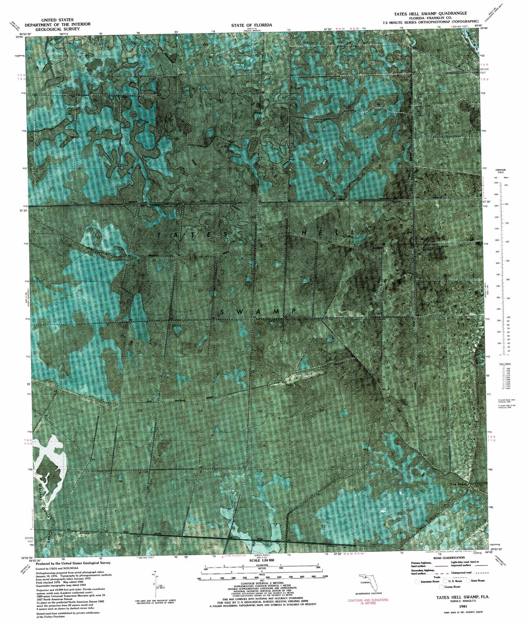
USGS Topo Quad 29084h7 - 1:24,000 scale
| Topo Map Name: | Tates Hell Swamp |
| USGS Topo Quad ID: | 29084h7 |
| Print Size: | ca. 21 1/4" wide x 27" high |
| Southeast Coordinates: | 29.875° N latitude / 84.75° W longitude |
| Map Center Coordinates: | 29.9375° N latitude / 84.8125° W longitude |
| U.S. State: | FL |
| Filename: | P29084h7.jpg |
| Download Map JPG Image: | Tates Hell Swamp topo map 1:24,000 scale |
| Map Type: | Orthophoto |
| Topo Series: | 7.5´ |
| Map Scale: | 1:24,000 |
| Source of Map Images: | United States Geological Survey (USGS) |
| Alternate Map Versions: |
Tates Hell Swamp FL 1945, updated 1960 Download PDF Buy paper map Tates Hell Swamp FL 1981, updated 1982 Download PDF Buy paper map Tates Hell Swamp FL 2012 Download PDF Buy paper map Tates Hell Swamp FL 2015 Download PDF Buy paper map |
1:24,000 Topo Quads surrounding Tates Hell Swamp
Orange |
Wilma |
Queens Bay |
Smith Creek |
Bradwell Bay |
Kennedy Creek |
Sumatra |
Owens Bridge |
Thousand Yard Bay |
Sanborn |
Forbes Island |
Fort Gadsden |
Tates Hell Swamp |
Pickett Bay |
Mcintyre |
Jackson River |
Beverly |
Green Point |
Carrabelle |
Dog Island |
West Pass |
Apalachicola |
Goose Island |
Sugar Hill |
> Back to 29084e1 at 1:100,000 scale
> Back to 29084a1 at 1:250,000 scale
> Back to U.S. Topo Maps home
Tates Hell Swamp topo map: Gazetteer
Tates Hell Swamp: Guts
Big Slough Branch elevation 10m 32′Tates Hell Swamp: Swamps
Big Slough Branch elevation 9m 29′Tates Hell Swamp elevation 7m 22′
Tates Hell Swamp digital topo map on disk
Buy this Tates Hell Swamp topo map showing relief, roads, GPS coordinates and other geographical features, as a high-resolution digital map file on DVD:
Gulf Coast (LA, MS, AL, FL) & Southwestern Georgia
Buy digital topo maps: Gulf Coast (LA, MS, AL, FL) & Southwestern Georgia
 & Southwestern Georgia map DVD")