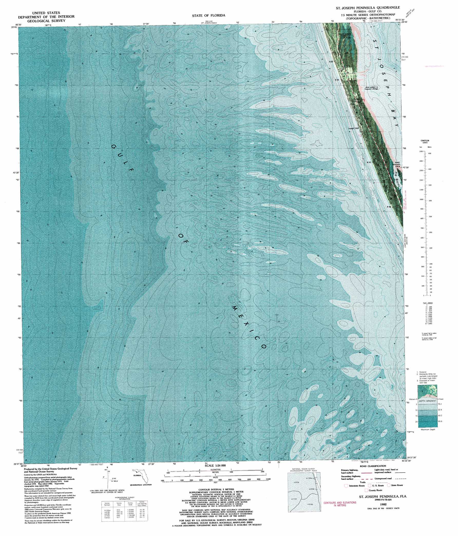
Saint Joseph Spit Topo Map Florida
To zoom in, hover over the map of Saint Joseph Spit
USGS Topo Quad 29085f4 - 1:24,000 scale
| Topo Map Name: | Saint Joseph Spit |
| USGS Topo Quad ID: | 29085f4 |
| Print Size: | ca. 21 1/4" wide x 27" high |
| Southeast Coordinates: | 29.625° N latitude / 85.375° W longitude |
| Map Center Coordinates: | 29.6875° N latitude / 85.4375° W longitude |
| U.S. State: | FL |
| Filename: | P29085F4.jpg |
| Download Map JPG Image: | Saint Joseph Spit topo map 1:24,000 scale |
| Map Type: | Orthophoto |
| Topo Series: | 7.5´ |
| Map Scale: | 1:24,000 |
| Source of Map Images: | United States Geological Survey (USGS) |
| Alternate Map Versions: |
St. Joseph Spit FL 1943, updated 1960 Download PDF Buy paper map St. Joseph Peninsula FL 1982, updated 1983 Download PDF Buy paper map Saint Joseph Peninsula FL 2012 Download PDF Buy paper map Saint Joseph Peninsula FL 2015 Download PDF Buy paper map |
1:24,000 Topo Quads surrounding Saint Joseph Spit
Crooked Island |
Beacon Hill |
Overstreet |
White City |
|
Saint Joseph Point |
Port Saint Joe |
Lake Wimico |
||
Saint Joseph Spit |
Cape San Blas |
Indian Pass |
||
> Back to 29085e1 at 1:100,000 scale
> Back to 29084a1 at 1:250,000 scale
> Back to U.S. Topo Maps home
Saint Joseph Spit topo map: Gazetteer
Saint Joseph Spit: Parks
T H Stone Memorial Saint Joseph Peninsula State Park elevation 1m 3′Saint Joseph Spit digital topo map on disk
Buy this Saint Joseph Spit topo map showing relief, roads, GPS coordinates and other geographical features, as a high-resolution digital map file on DVD:
Gulf Coast (LA, MS, AL, FL) & Southwestern Georgia
Buy digital topo maps: Gulf Coast (LA, MS, AL, FL) & Southwestern Georgia
 & Southwestern Georgia map DVD")