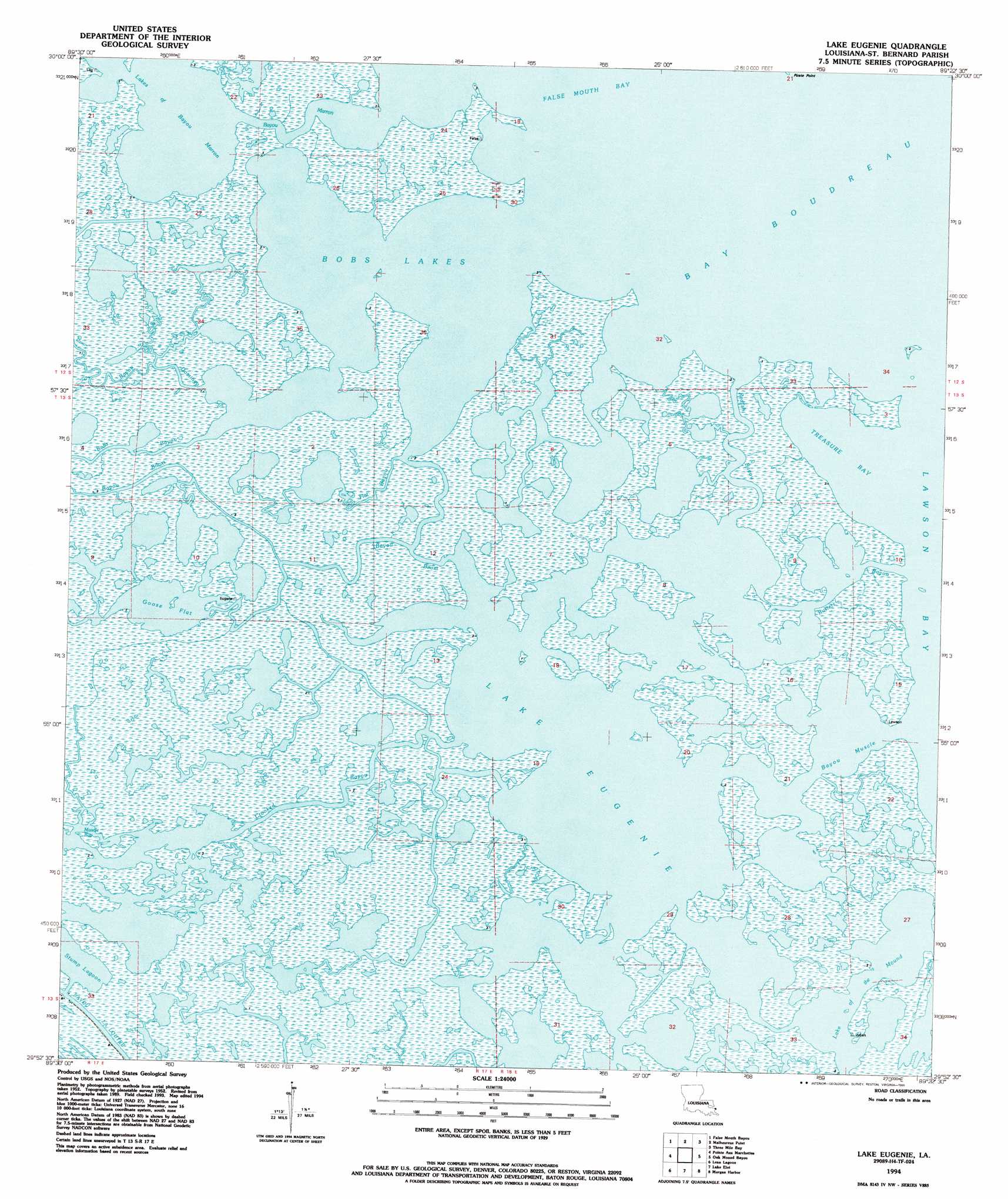
Lake Eugenie Topo Map Louisiana
To zoom in, hover over the map of Lake Eugenie
USGS Topo Quad 29089h4 - 1:24,000 scale
| Topo Map Name: | Lake Eugenie |
| USGS Topo Quad ID: | 29089h4 |
| Print Size: | ca. 21 1/4" wide x 27" high |
| Southeast Coordinates: | 29.875° N latitude / 89.375° W longitude |
| Map Center Coordinates: | 29.9375° N latitude / 89.4375° W longitude |
| U.S. State: | LA |
| Filename: | o29089h4.jpg |
| Download Map JPG Image: | Lake Eugenie topo map 1:24,000 scale |
| Map Type: | Topographic |
| Topo Series: | 7.5´ |
| Map Scale: | 1:24,000 |
| Source of Map Images: | United States Geological Survey (USGS) |
| Alternate Map Versions: |
Lake Eugenie LA 1955, updated 1959 Download PDF Buy paper map Lake Eugenie LA 1955, updated 1975 Download PDF Buy paper map Lake Eugenie LA 1955, updated 1991 Download PDF Buy paper map Lake Eugenie LA 1994, updated 1995 Download PDF Buy paper map Lake Eugenie LA 2012 Download PDF Buy paper map Lake Eugenie LA 2015 Download PDF Buy paper map |
1:24,000 Topo Quads surrounding Lake Eugenie
Rigolets |
English Lookout |
Grand Island Pass |
Isle Au Pitre |
|
Alligator Point |
False Mouth Bayou |
Malheureux Point |
Three Mile Bay |
Door Point |
Proctor Point |
Pte Aux Marchettes |
Lake Eugenie |
Oak Mound Bayou |
Mitchell Key |
Yscloskey |
Lena Lagoon |
Lake Eloi |
Morgan Harbor |
|
Lake Cuatro Caballo |
Black Bay North |
Lake Athanasio |
Point Chicot |
> Back to 29089e1 at 1:100,000 scale
> Back to 29088a1 at 1:250,000 scale
> Back to U.S. Topo Maps home
Lake Eugenie topo map: Gazetteer
Lake Eugenie: Bays
Bobs Lakes elevation 0m 0′Lake Eugenie: Capes
Cat Fish Point elevation 0m 0′Pirate Point elevation 1m 3′
Lake Eugenie: Guts
Bayou Domingo elevation 1m 3′Bayou Marron elevation 0m 0′
Bayou Muscle elevation 0m 0′
Bobs Bayou elevation 1m 3′
Busters Bayou elevation 0m 0′
Crooked Bayou elevation 1m 3′
Flat Bayou elevation 1m 3′
Redfish Bayou elevation 0m 0′
Lake Eugenie: Islands
Wild Goose Island elevation 1m 3′Lake Eugenie: Lakes
Goose Flat elevation -1m -4′Lake Eugenie elevation 0m 0′
Lake of the Mound elevation 0m 0′
Lakes of Bayou Marron elevation 0m 0′
Lake Eugenie digital topo map on disk
Buy this Lake Eugenie topo map showing relief, roads, GPS coordinates and other geographical features, as a high-resolution digital map file on DVD:
Gulf Coast (LA, MS, AL, FL) & Southwestern Georgia
Buy digital topo maps: Gulf Coast (LA, MS, AL, FL) & Southwestern Georgia
 & Southwestern Georgia map DVD")