Golden Meadow Farms Topo Map Louisiana
To zoom in, hover over the map of Golden Meadow Farms
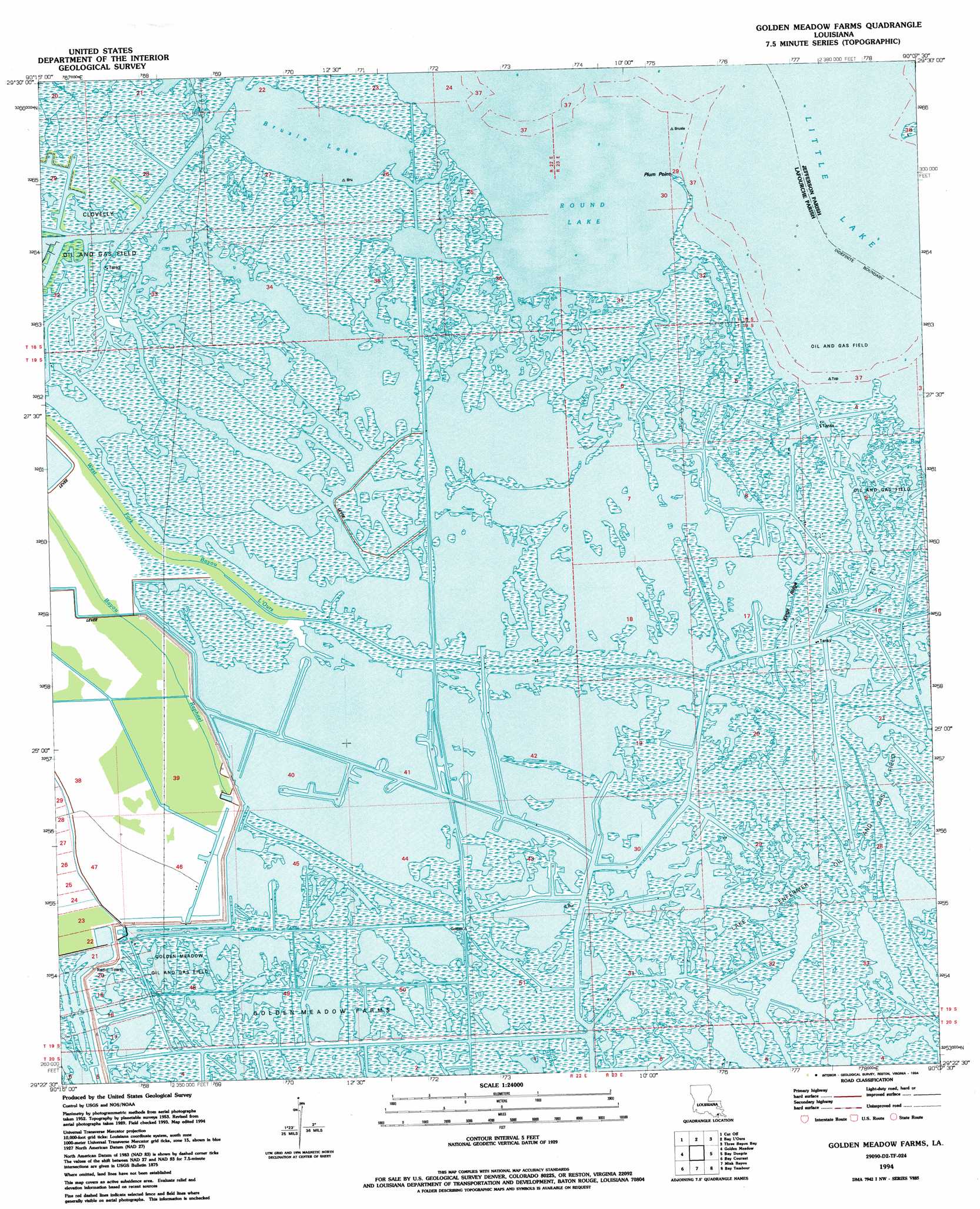
USGS Topo Quad 29090d2 - 1:24,000 scale
| Topo Map Name: | Golden Meadow Farms |
| USGS Topo Quad ID: | 29090d2 |
| Print Size: | ca. 21 1/4" wide x 27" high |
| Southeast Coordinates: | 29.375° N latitude / 90.125° W longitude |
| Map Center Coordinates: | 29.4375° N latitude / 90.1875° W longitude |
| U.S. State: | LA |
| Filename: | o29090d2.jpg |
| Download Map JPG Image: | Golden Meadow Farms topo map 1:24,000 scale |
| Map Type: | Topographic |
| Topo Series: | 7.5´ |
| Map Scale: | 1:24,000 |
| Source of Map Images: | United States Geological Survey (USGS) |
| Alternate Map Versions: |
Golden Meadow Farms LA 1956, updated 1959 Download PDF Buy paper map Golden Meadow Farms LA 1994, updated 1994 Download PDF Buy paper map Golden Meadow Farms LA 2012 Download PDF Buy paper map Golden Meadow Farms LA 2015 Download PDF Buy paper map |
1:24,000 Topo Quads surrounding Golden Meadow Farms
Gheens |
Catahoula Bay |
Barataria |
Lafitte |
Phoenix |
Larose |
Cut Off |
Bay L'Ours |
Three Bayou Bay |
Lake Laurier |
Lake Bully Camp |
Golden Meadow |
Golden Meadow Farms |
Bay Dosgris |
Wilkinson Bay |
Lake Felicity |
Bay Courant |
Mink Bayou |
Bay Tambour |
Barataria Pass |
Jacko Bay |
Pelican Pass |
Leeville |
Caminada Pass |
Grand Isle |
> Back to 29090a1 at 1:100,000 scale
> Back to 29090a1 at 1:250,000 scale
> Back to U.S. Topo Maps home
Golden Meadow Farms topo map: Gazetteer
Golden Meadow Farms: Bays
Round Lake elevation 0m 0′Golden Meadow Farms: Canals
Kings Canal elevation 0m 0′Yankee Canal elevation 0m 0′
Golden Meadow Farms: Capes
Plum Point elevation 0m 0′Golden Meadow Farms: Guts
Bayou de Chene elevation 0m 0′John the Fool Bayou elevation 0m 0′
Golden Meadow Farms: Lakes
Brusle Lake elevation 0m 0′Golden Meadow Farms: Oilfields
Lake Enfermer Oil and Gas Field elevation 0m 0′Golden Meadow Farms: Ridges
Kings Ridge elevation 1m 3′Golden Meadow Farms digital topo map on disk
Buy this Golden Meadow Farms topo map showing relief, roads, GPS coordinates and other geographical features, as a high-resolution digital map file on DVD: