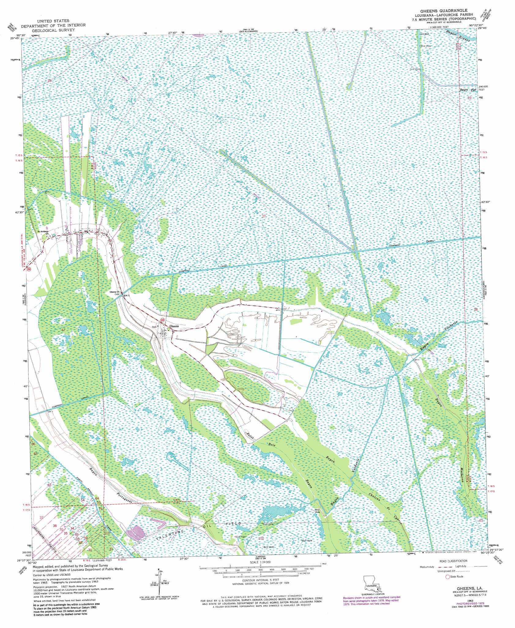
Gheens Topo Map Louisiana
To zoom in, hover over the map of Gheens
USGS Topo Quad 29090f4 - 1:24,000 scale
| Topo Map Name: | Gheens |
| USGS Topo Quad ID: | 29090f4 |
| Print Size: | ca. 21 1/4" wide x 27" high |
| Southeast Coordinates: | 29.625° N latitude / 90.375° W longitude |
| Map Center Coordinates: | 29.6875° N latitude / 90.4375° W longitude |
| U.S. State: | LA |
| Filename: | o29090f4.jpg |
| Download Map JPG Image: | Gheens topo map 1:24,000 scale |
| Map Type: | Topographic |
| Topo Series: | 7.5´ |
| Map Scale: | 1:24,000 |
| Source of Map Images: | United States Geological Survey (USGS) |
| Alternate Map Versions: |
Gheens LA 1963, updated 1964 Download PDF Buy paper map Gheens LA 1963, updated 1975 Download PDF Buy paper map Gheens LA 1963, updated 1980 Download PDF Buy paper map Gheens LA 1963, updated 1980 Download PDF Buy paper map Gheens LA 2012 Download PDF Buy paper map Gheens LA 2015 Download PDF Buy paper map |
1:24,000 Topo Quads surrounding Gheens
Lower Vacherie |
Lac Des Allemands |
Hahnville |
Luling |
New Orleans West |
Kraemer |
Bayou Boeuf |
Des Allemands |
Lake Cataouatche West |
Lake Cataouatche East |
Savoie |
Lockport |
Gheens |
Catahoula Bay |
Barataria |
Houma |
Bourg |
Larose |
Cut Off |
Bay L'Ours |
Dulac |
Montegut |
Lake Bully Camp |
Golden Meadow |
Golden Meadow Farms |
> Back to 29090e1 at 1:100,000 scale
> Back to 29090a1 at 1:250,000 scale
> Back to U.S. Topo Maps home
Gheens topo map: Gazetteer
Gheens: Canals
Company Canal elevation 1m 3′Gheens: Guts
Bayou Chateau De Cypres elevation 0m 0′Bayou Rixner elevation 0m 0′
Petit Bois Bayou elevation 1m 3′
Gheens: Oilfields
Valentine Oil Field elevation 1m 3′Gheens: Populated Places
Gheens elevation 1m 3′Gheens: Post Offices
Gheens Post Office elevation 1m 3′Gheens digital topo map on disk
Buy this Gheens topo map showing relief, roads, GPS coordinates and other geographical features, as a high-resolution digital map file on DVD: