Savoie Topo Map Louisiana
To zoom in, hover over the map of Savoie
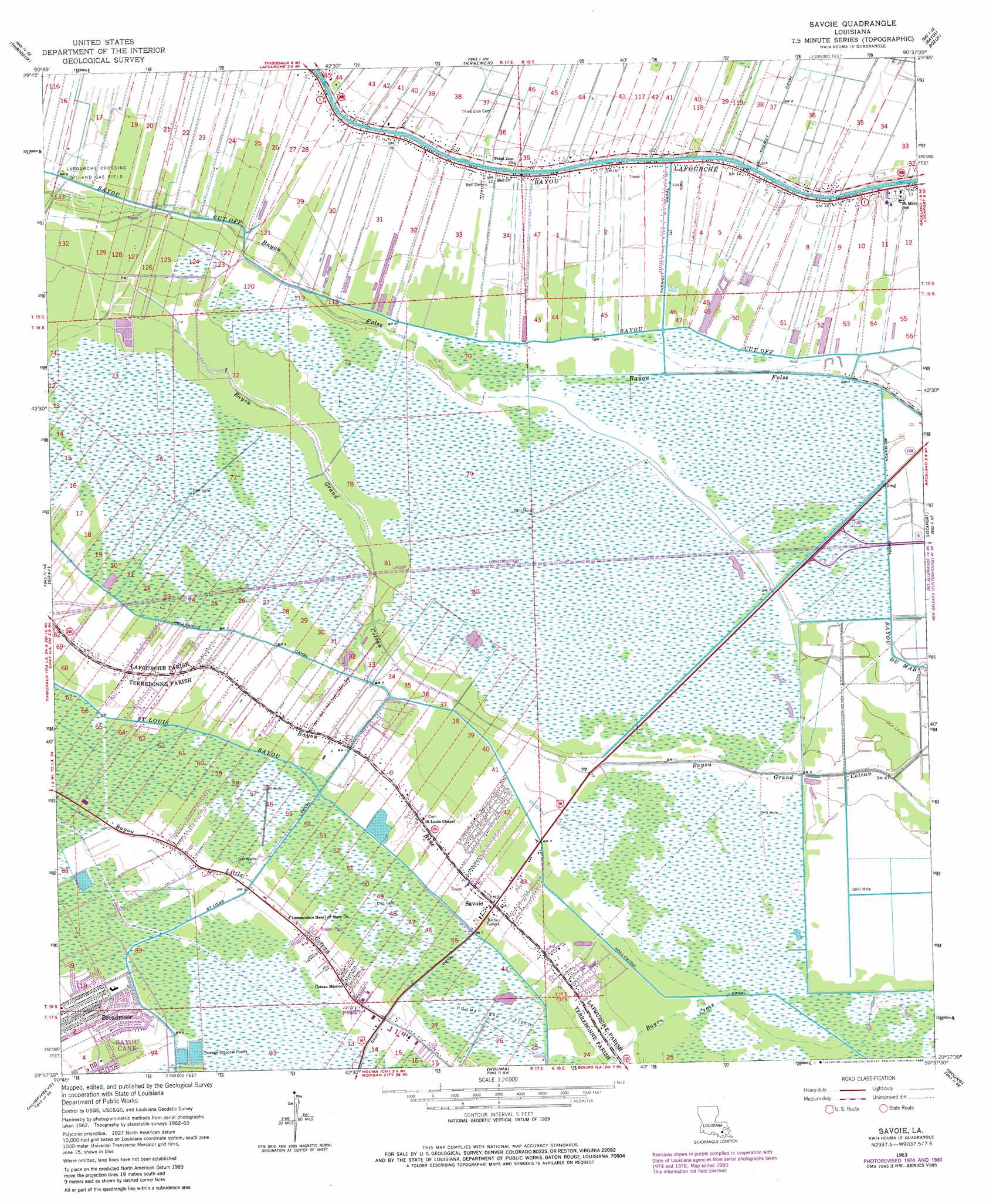
USGS Topo Quad 29090f6 - 1:24,000 scale
| Topo Map Name: | Savoie |
| USGS Topo Quad ID: | 29090f6 |
| Print Size: | ca. 21 1/4" wide x 27" high |
| Southeast Coordinates: | 29.625° N latitude / 90.625° W longitude |
| Map Center Coordinates: | 29.6875° N latitude / 90.6875° W longitude |
| U.S. State: | LA |
| Filename: | o29090f6.jpg |
| Download Map JPG Image: | Savoie topo map 1:24,000 scale |
| Map Type: | Topographic |
| Topo Series: | 7.5´ |
| Map Scale: | 1:24,000 |
| Source of Map Images: | United States Geological Survey (USGS) |
| Alternate Map Versions: |
Savoie LA 1963, updated 1964 Download PDF Buy paper map Savoie LA 1963, updated 1975 Download PDF Buy paper map Savoie LA 1963, updated 1981 Download PDF Buy paper map Savoie LA 1963, updated 1983 Download PDF Buy paper map Savoie LA 1998, updated 2000 Download PDF Buy paper map Savoie LA 2012 Download PDF Buy paper map Savoie LA 2015 Download PDF Buy paper map |
1:24,000 Topo Quads surrounding Savoie
Madewood |
Lagan |
Lower Vacherie |
Lac Des Allemands |
Hahnville |
Labadieville |
Thibodaux |
Kraemer |
Bayou Boeuf |
Des Allemands |
Gibson |
Gray |
Savoie |
Lockport |
Gheens |
Bayou Cocodrie |
Humphreys |
Houma |
Bourg |
Larose |
Lake Penchant |
Lake Theriot |
Dulac |
Montegut |
Lake Bully Camp |
> Back to 29090e1 at 1:100,000 scale
> Back to 29090a1 at 1:250,000 scale
> Back to U.S. Topo Maps home
Savoie topo map: Gazetteer
Savoie: Canals
Caro Canal elevation 1m 3′Hollywood Canal elevation 3m 9′
McMahon Canal elevation 0m 0′
Savoie: Oilfields
Lafourche Crossing Oil and Gas Field elevation 1m 3′Northeast Houma Gas Field elevation -1m -4′
Willow Woods Gas Field elevation 0m 0′
Savoie: Populated Places
Broadmoor elevation 2m 6′Savoie elevation 2m 6′
Savoie: Streams
Bayou Croix elevation 1m 3′Savoie digital topo map on disk
Buy this Savoie topo map showing relief, roads, GPS coordinates and other geographical features, as a high-resolution digital map file on DVD: