Lake Cataouatche West Topo Map Louisiana
To zoom in, hover over the map of Lake Cataouatche West
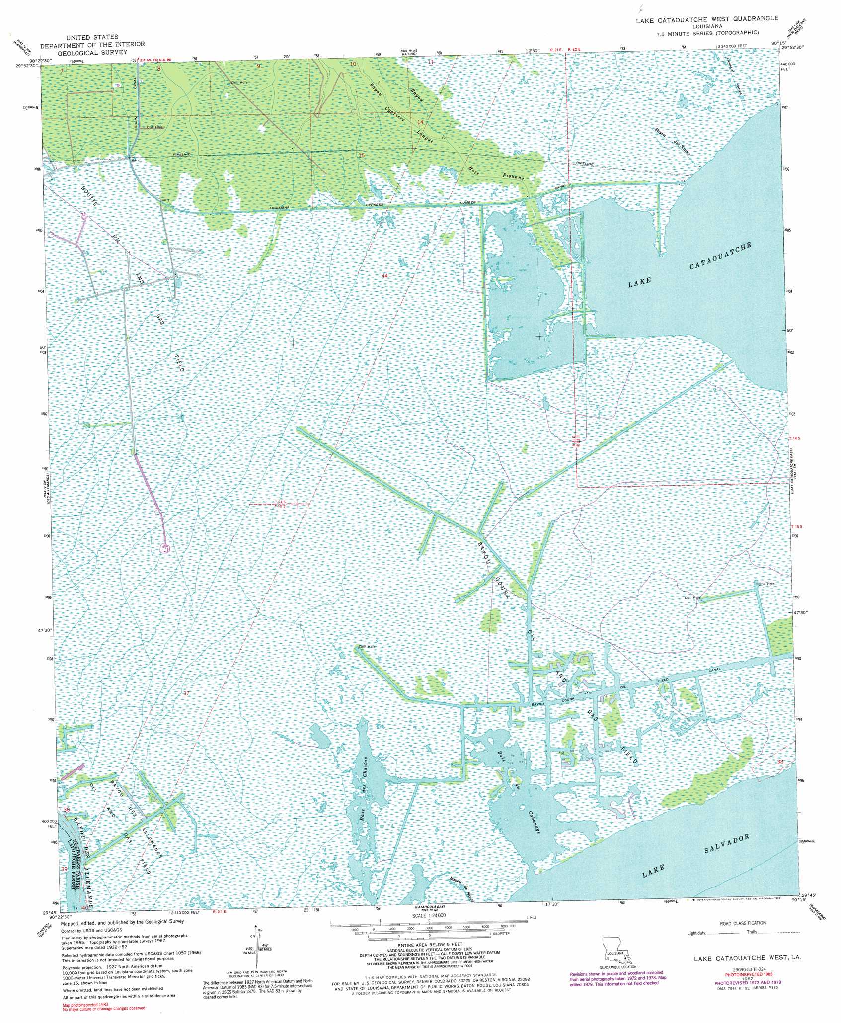
USGS Topo Quad 29090g3 - 1:24,000 scale
| Topo Map Name: | Lake Cataouatche West |
| USGS Topo Quad ID: | 29090g3 |
| Print Size: | ca. 21 1/4" wide x 27" high |
| Southeast Coordinates: | 29.75° N latitude / 90.25° W longitude |
| Map Center Coordinates: | 29.8125° N latitude / 90.3125° W longitude |
| U.S. State: | LA |
| Filename: | o29090g3.jpg |
| Download Map JPG Image: | Lake Cataouatche West topo map 1:24,000 scale |
| Map Type: | Topographic |
| Topo Series: | 7.5´ |
| Map Scale: | 1:24,000 |
| Source of Map Images: | United States Geological Survey (USGS) |
| Alternate Map Versions: |
Lake Cataouatche West LA 1952, updated 1953 Download PDF Buy paper map Lake Cataouatche West LA 1952, updated 1959 Download PDF Buy paper map Lake Cataouatche West LA 1967, updated 1968 Download PDF Buy paper map Lake Cataouatche West LA 1967, updated 1973 Download PDF Buy paper map Lake Cataouatche West LA 1967, updated 1980 Download PDF Buy paper map Lake Cataouatche West LA 1967, updated 1984 Download PDF Buy paper map Lake Cataouatche West LA 1967, updated 1991 Download PDF Buy paper map Lake Cataouatche West LA 2012 Download PDF Buy paper map Lake Cataouatche West LA 2015 Download PDF Buy paper map |
1:24,000 Topo Quads surrounding Lake Cataouatche West
Reserve |
Laplace |
La Branche |
Indian Beach |
Spanish Fort |
Lac Des Allemands |
Hahnville |
Luling |
New Orleans West |
New Orleans East |
Bayou Boeuf |
Des Allemands |
Lake Cataouatche West |
Lake Cataouatche East |
Bertrandville |
Lockport |
Gheens |
Catahoula Bay |
Barataria |
Lafitte |
Bourg |
Larose |
Cut Off |
Bay L'Ours |
Three Bayou Bay |
> Back to 29090e1 at 1:100,000 scale
> Back to 29090a1 at 1:250,000 scale
> Back to U.S. Topo Maps home
Lake Cataouatche West topo map: Gazetteer
Lake Cataouatche West: Canals
Bayou Couba Oil Field Canal elevation 0m 0′Louisiana Cypress Lumber Canal elevation 0m 0′
Lake Cataouatche West: Guts
Bayou Bois Piquant elevation 0m 0′Lake Cataouatche West: Lakes
Baie des Chactas elevation 0m 0′Baie du Cabanage elevation 0m 0′
Lake Cataouatche West: Oilfields
Bayou Couba Oil and Gas Field elevation 0m 0′Boutte Oil and Gas Field elevation 0m 0′
Lake Cataouatche West: Streams
Bayou des Saules elevation 0m 0′Lake Cataouatche West digital topo map on disk
Buy this Lake Cataouatche West topo map showing relief, roads, GPS coordinates and other geographical features, as a high-resolution digital map file on DVD: