Carencro Bayou Topo Map Louisiana
To zoom in, hover over the map of Carencro Bayou
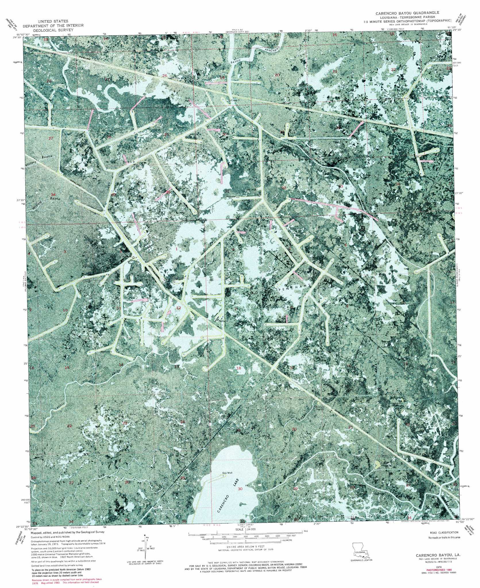
USGS Topo Quad 29091d1 - 1:24,000 scale
| Topo Map Name: | Carencro Bayou |
| USGS Topo Quad ID: | 29091d1 |
| Print Size: | ca. 21 1/4" wide x 27" high |
| Southeast Coordinates: | 29.375° N latitude / 91° W longitude |
| Map Center Coordinates: | 29.4375° N latitude / 91.0625° W longitude |
| U.S. State: | LA |
| Filename: | p29091d1.jpg |
| Download Map JPG Image: | Carencro Bayou topo map 1:24,000 scale |
| Map Type: | Orthophoto |
| Topo Series: | 7.5´ |
| Map Scale: | 1:24,000 |
| Source of Map Images: | United States Geological Survey (USGS) |
| Alternate Map Versions: |
Carencro Bayou LA 1974, updated 1976 Download PDF Buy paper map Carencro Bayou LA 1974, updated 1981 Download PDF Buy paper map Carencro Bayou LA 2012 Download PDF Buy paper map Carencro Bayou LA 2015 Download PDF Buy paper map |
1:24,000 Topo Quads surrounding Carencro Bayou
Patterson |
Morgan City |
Amelia |
Gibson |
Gray |
Lake Salve |
Morgan City Sw |
Morgan City Se |
Bayou Cocodrie |
Humphreys |
Point Au Fer Ne |
Plumb Bayou |
Carencro Bayou |
Lake Penchant |
Lake Theriot |
Point Au Fer |
Fourleague Bay |
Lost Lake |
Lake Mechant |
Bayou Sauveur |
Oyster Bayou |
East Bay Junop |
Grand Bayou Du Large |
Dog Lake |
> Back to 29091a1 at 1:100,000 scale
> Back to 29090a1 at 1:250,000 scale
> Back to U.S. Topo Maps home
Carencro Bayou topo map: Gazetteer
Carencro Bayou: Islands
Biscuit Island elevation 1m 3′Hebert Island elevation 1m 3′
Lovell Island elevation 0m 0′
Carencro Bayou: Lakes
Carencro Lake elevation 0m 0′Carencro Bayou: Oilfields
Bayou Penchant Oil and Gas Field elevation 1m 3′Carencro Bayou: Streams
Biscuit Bayou elevation 0m 0′Carencro Bayou elevation 0m 0′
Carencro Bayou digital topo map on disk
Buy this Carencro Bayou topo map showing relief, roads, GPS coordinates and other geographical features, as a high-resolution digital map file on DVD: