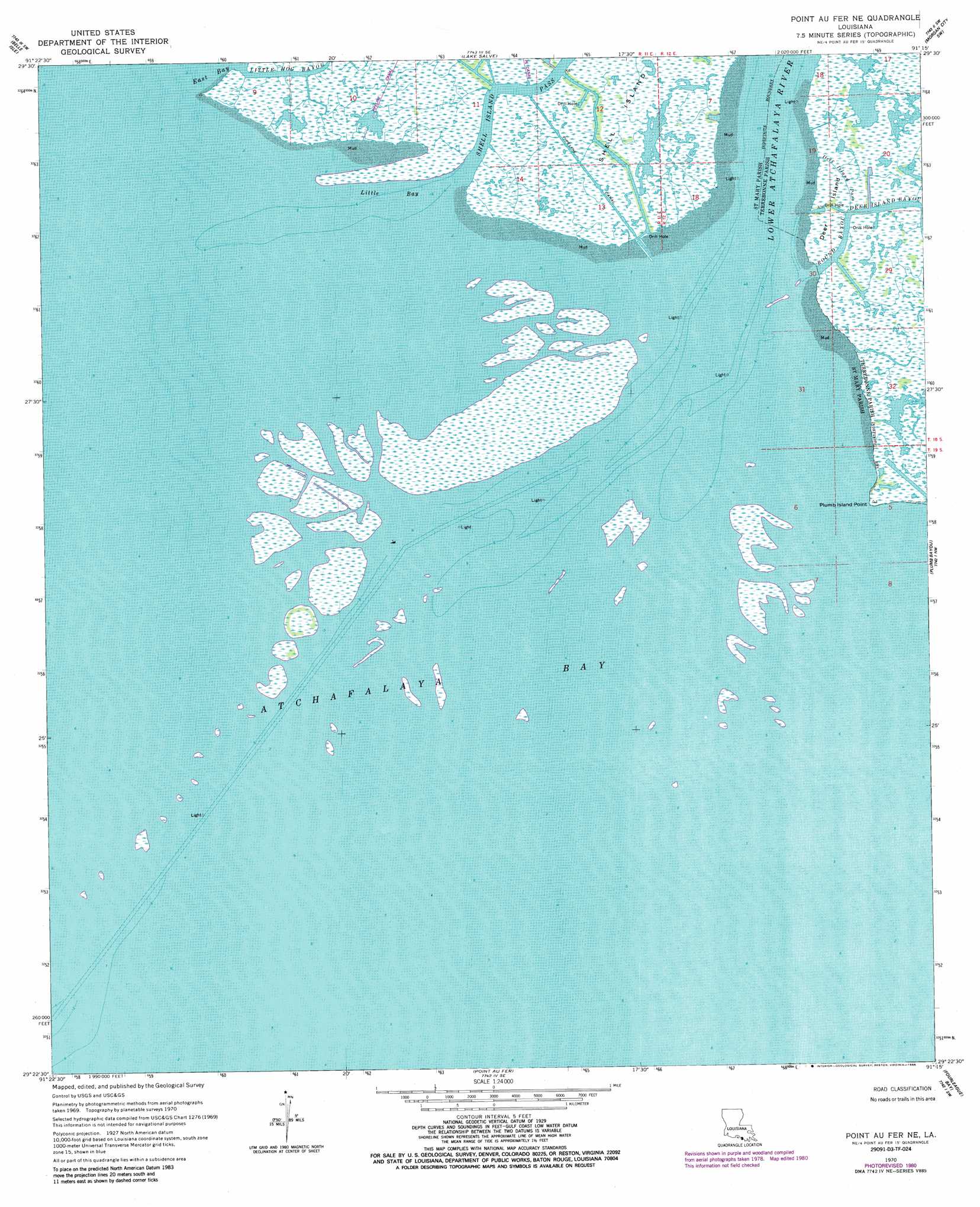
Point Au Fer Ne Topo Map Louisiana
To zoom in, hover over the map of Point Au Fer Ne
USGS Topo Quad 29091d3 - 1:24,000 scale
| Topo Map Name: | Point Au Fer Ne |
| USGS Topo Quad ID: | 29091d3 |
| Print Size: | ca. 21 1/4" wide x 27" high |
| Southeast Coordinates: | 29.375° N latitude / 91.25° W longitude |
| Map Center Coordinates: | 29.4375° N latitude / 91.3125° W longitude |
| U.S. State: | LA |
| Filename: | o29091d3.jpg |
| Download Map JPG Image: | Point Au Fer Ne topo map 1:24,000 scale |
| Map Type: | Topographic |
| Topo Series: | 7.5´ |
| Map Scale: | 1:24,000 |
| Source of Map Images: | United States Geological Survey (USGS) |
| Alternate Map Versions: |
Point Au Fer NE LA 1970, updated 1971 Download PDF Buy paper map Point Au Fer NE LA 1970, updated 1981 Download PDF Buy paper map Point Au Fer NE LA 1970, updated 1986 Download PDF Buy paper map Point Au Fer NE LA 1994, updated 1998 Download PDF Buy paper map Point Au Fer NE LA 1998, updated 2001 Download PDF Buy paper map Point au Fer NE LA 2012 Download PDF Buy paper map Point au Fer NE LA 2015 Download PDF Buy paper map |
1:24,000 Topo Quads surrounding Point Au Fer Ne
Ellerslie |
North Bend |
Patterson |
Morgan City |
Amelia |
Point Chevreuil |
Belle Isle |
Lake Salve |
Morgan City Sw |
Morgan City Se |
Point Au Fer Ne |
Plumb Bayou |
Carencro Bayou |
||
Point Au Fer |
Fourleague Bay |
Lost Lake |
||
Oyster Bayou |
East Bay Junop |
> Back to 29091a1 at 1:100,000 scale
> Back to 29090a1 at 1:250,000 scale
> Back to U.S. Topo Maps home
Point Au Fer Ne topo map: Gazetteer
Point Au Fer Ne: Bays
Atchafalaya Bay elevation 3m 9′Little Bay elevation 0m 0′
Point Au Fer Ne: Capes
Plumb Island Point elevation 1m 3′Point Au Fer Ne: Channels
Plumb Island Pass elevation 1m 3′Plumb Island Pass elevation 1m 3′
Point Au Fer Ne: Guts
Deer Island Pass elevation 1m 3′Round Bayou elevation 3m 9′
Point Au Fer Ne: Islands
Deer Island elevation 0m 0′Plumb Island elevation 1m 3′
Shell Island elevation 1m 3′
Point Au Fer Ne: Parks
Atchafalaya Delta State Wildlife Management Area elevation 0m 0′Point Au Fer Ne: Streams
Deer Island Bayou elevation 0m 0′Little Hog Bayou elevation 0m 0′
Lower Atchafalaya River elevation 0m 0′
Point Au Fer Ne digital topo map on disk
Buy this Point Au Fer Ne topo map showing relief, roads, GPS coordinates and other geographical features, as a high-resolution digital map file on DVD: