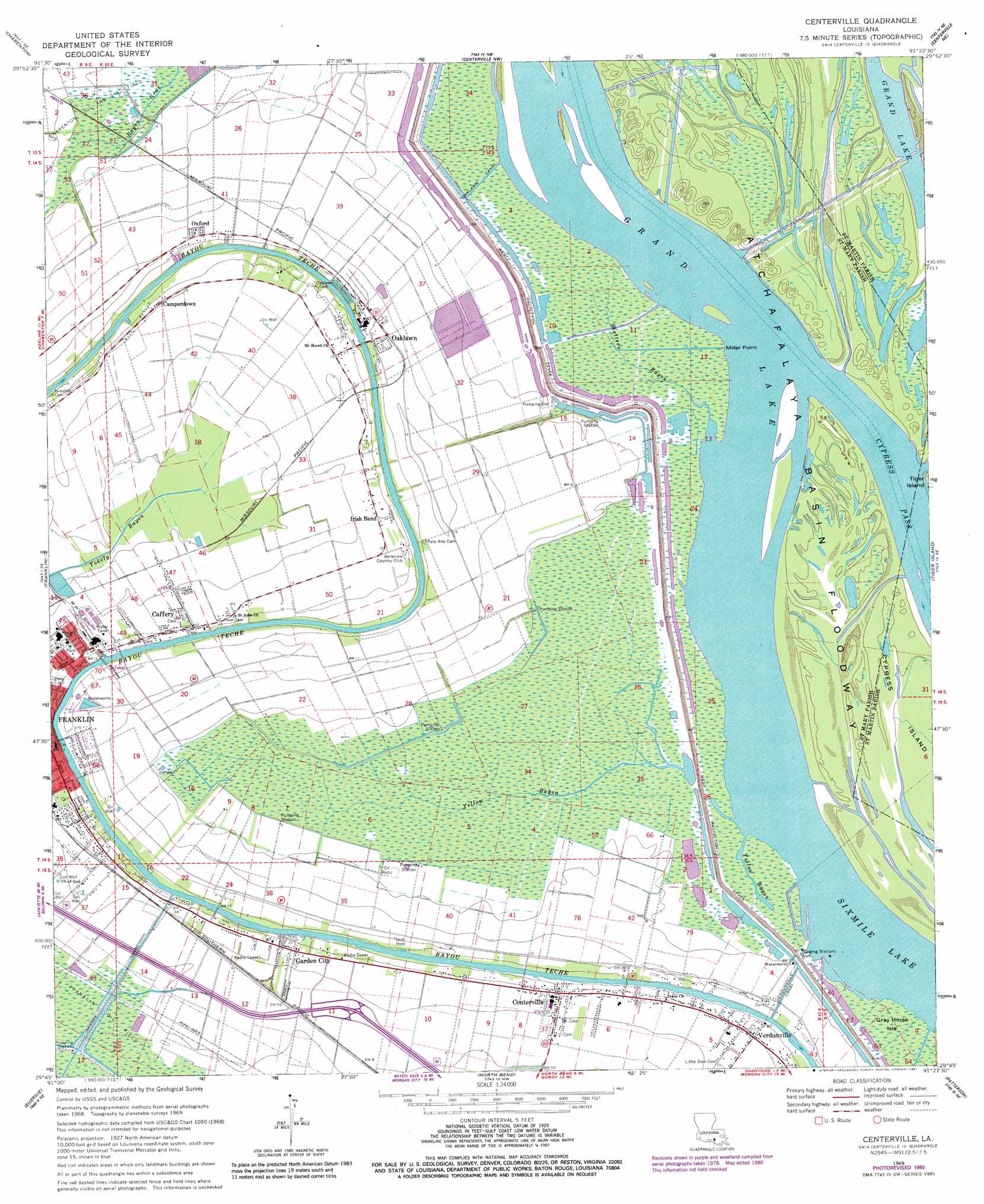
Centerville Topo Map Louisiana
To zoom in, hover over the map of Centerville
USGS Topo Quad 29091g4 - 1:24,000 scale
| Topo Map Name: | Centerville |
| USGS Topo Quad ID: | 29091g4 |
| Print Size: | ca. 21 1/4" wide x 27" high |
| Southeast Coordinates: | 29.75° N latitude / 91.375° W longitude |
| Map Center Coordinates: | 29.8125° N latitude / 91.4375° W longitude |
| U.S. State: | LA |
| Filename: | o29091g4.jpg |
| Download Map JPG Image: | Centerville topo map 1:24,000 scale |
| Map Type: | Topographic |
| Topo Series: | 7.5´ |
| Map Scale: | 1:24,000 |
| Source of Map Images: | United States Geological Survey (USGS) |
| Alternate Map Versions: |
Centerville LA 1969, updated 1971 Download PDF Buy paper map Centerville LA 1969, updated 1974 Download PDF Buy paper map Centerville LA 1969, updated 1981 Download PDF Buy paper map Centerville LA 1994, updated 1998 Download PDF Buy paper map Centerville LA 2012 Download PDF Buy paper map Centerville LA 2015 Download PDF Buy paper map |
1:24,000 Topo Quads surrounding Centerville
Loreauville |
Jackass Bay |
Lake Chicot |
Pigeon |
Lone Star |
Jeanerette |
Charenton |
Centerville Nw |
Centerville Ne |
Pierre Part |
Kemper |
Franklin |
Centerville |
Tiger Island |
Napoleonville Sw |
Marone Point |
Ellerslie |
North Bend |
Patterson |
Morgan City |
Lake Point |
Point Chevreuil |
Belle Isle |
Lake Salve |
Morgan City Sw |
> Back to 29091e1 at 1:100,000 scale
> Back to 29090a1 at 1:250,000 scale
> Back to U.S. Topo Maps home
Centerville topo map: Gazetteer
Centerville: Canals
Oaklawn Canal elevation 2m 6′Verdunville Canal elevation 0m 0′
Centerville: Capes
Miller Point elevation 2m 6′Centerville: Dams
Louisiana Noname 50 Dam elevation 2m 6′Centerville: Guts
Yellow Bayou elevation 1m 3′Centerville: Islands
Gray Horse Isle elevation 1m 3′Centerville: Levees
West Protection Levee elevation 2m 6′Centerville: Oilfields
East Franklin Gas Field elevation 0m 0′Franklin Oil Field elevation 0m 0′
South Myette Point Gas Field elevation 5m 16′
Centerville: Parks
City Park elevation 3m 9′Centerville: Populated Places
Caffery elevation 2m 6′Camperdown elevation 5m 16′
Centerville elevation 3m 9′
Garden City elevation 4m 13′
Irish Bend elevation 3m 9′
Oaklawn elevation 4m 13′
Oxford elevation 4m 13′
Sterling elevation 3m 9′
Verdunville elevation 2m 6′
Centerville: Post Offices
Centerville Post Office elevation 3m 9′Garden City Post Office elevation 4m 13′
Centerville: Streams
Shatters Bayou elevation 1m 3′Yellow Bayou elevation 0m 0′
Centerville digital topo map on disk
Buy this Centerville topo map showing relief, roads, GPS coordinates and other geographical features, as a high-resolution digital map file on DVD: