Five Lakes Topo Map Louisiana
To zoom in, hover over the map of Five Lakes
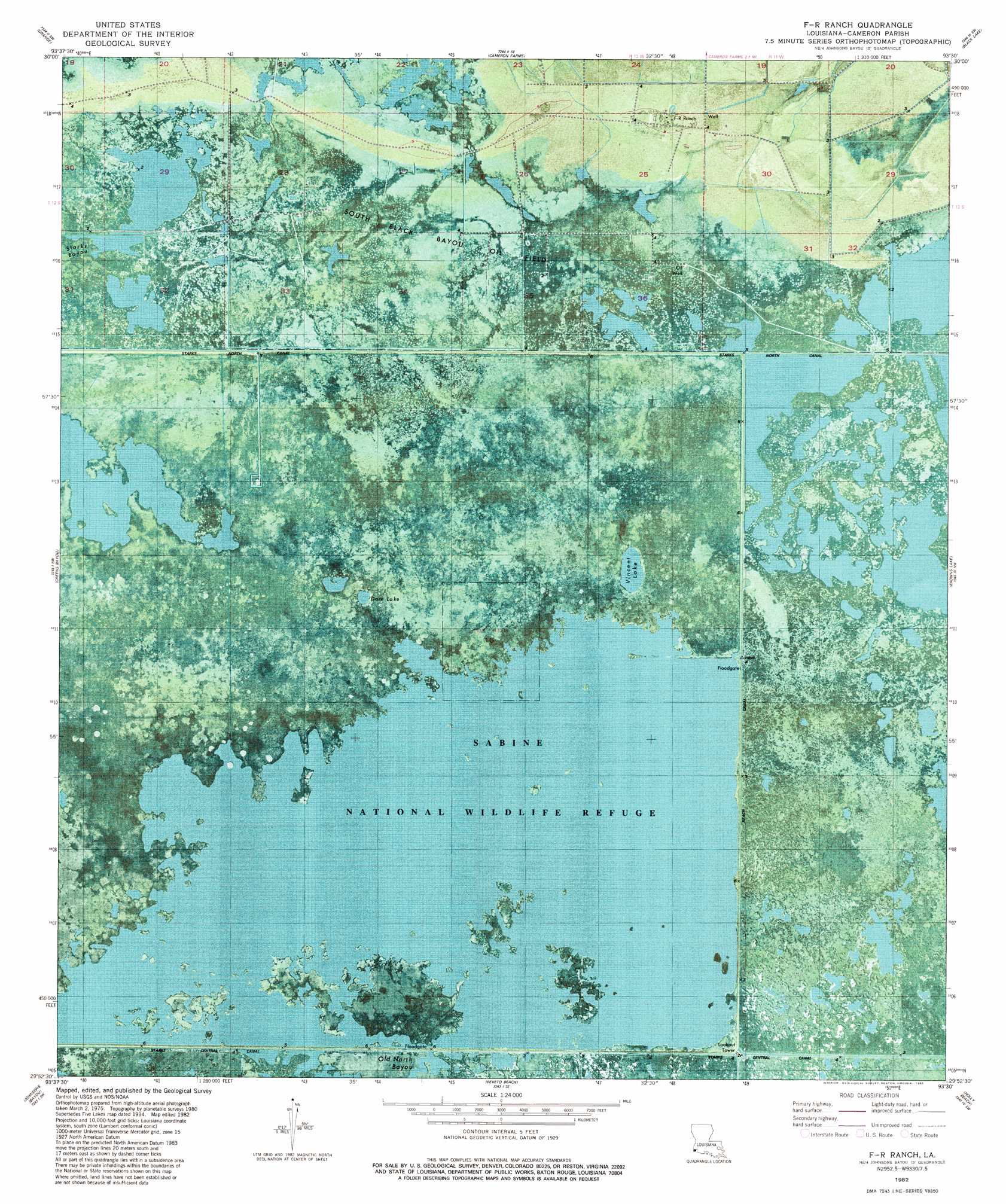
USGS Topo Quad 29093h5 - 1:24,000 scale
| Topo Map Name: | Five Lakes |
| USGS Topo Quad ID: | 29093h5 |
| Print Size: | ca. 21 1/4" wide x 27" high |
| Southeast Coordinates: | 29.875° N latitude / 93.5° W longitude |
| Map Center Coordinates: | 29.9375° N latitude / 93.5625° W longitude |
| U.S. State: | LA |
| Filename: | p29093h5.jpg |
| Download Map JPG Image: | Five Lakes topo map 1:24,000 scale |
| Map Type: | Orthophoto |
| Topo Series: | 7.5´ |
| Map Scale: | 1:24,000 |
| Source of Map Images: | United States Geological Survey (USGS) |
| Alternate Map Versions: |
Five Lakes LA 1934, updated 1961 Download PDF Buy paper map Five Lakes LA 1934, updated 1976 Download PDF Buy paper map F-R Ranch LA 1982, updated 1982 Download PDF Buy paper map F-R Ranch LA 2012 Download PDF Buy paper map F-R Ranch LA 2015 Download PDF Buy paper map |
1:24,000 Topo Quads surrounding Five Lakes
Mauriceville |
Echo |
Vinton |
Sulphur |
Westlake |
Orangefield |
Orange |
Cameron Farms |
Black Lake |
Moss Lake |
West Of Greens Bayou |
Greens Bayou |
Five Lakes |
Browns Lake |
Hackberry |
West Of Johnsons Bayou |
Johnsons Bayou |
Peveto Beach |
Holly Beach |
Cameron |
Texas Point |
Smith Bayou |
> Back to 29093e1 at 1:100,000 scale
> Back to 29092a1 at 1:250,000 scale
> Back to U.S. Topo Maps home
Five Lakes topo map: Gazetteer
Five Lakes: Canals
Starks Central Canal elevation 0m 0′Five Lakes: Lakes
Dore Lake elevation 0m 0′Five Lakes elevation 0m 0′
Vincent Lake elevation 0m 0′
Five Lakes: Oilfields
South Black Bayou Oil Field elevation 0m 0′Five Lakes: Parks
Sabine National Wildlife Refuge elevation 1m 3′Five Lakes digital topo map on disk
Buy this Five Lakes topo map showing relief, roads, GPS coordinates and other geographical features, as a high-resolution digital map file on DVD: