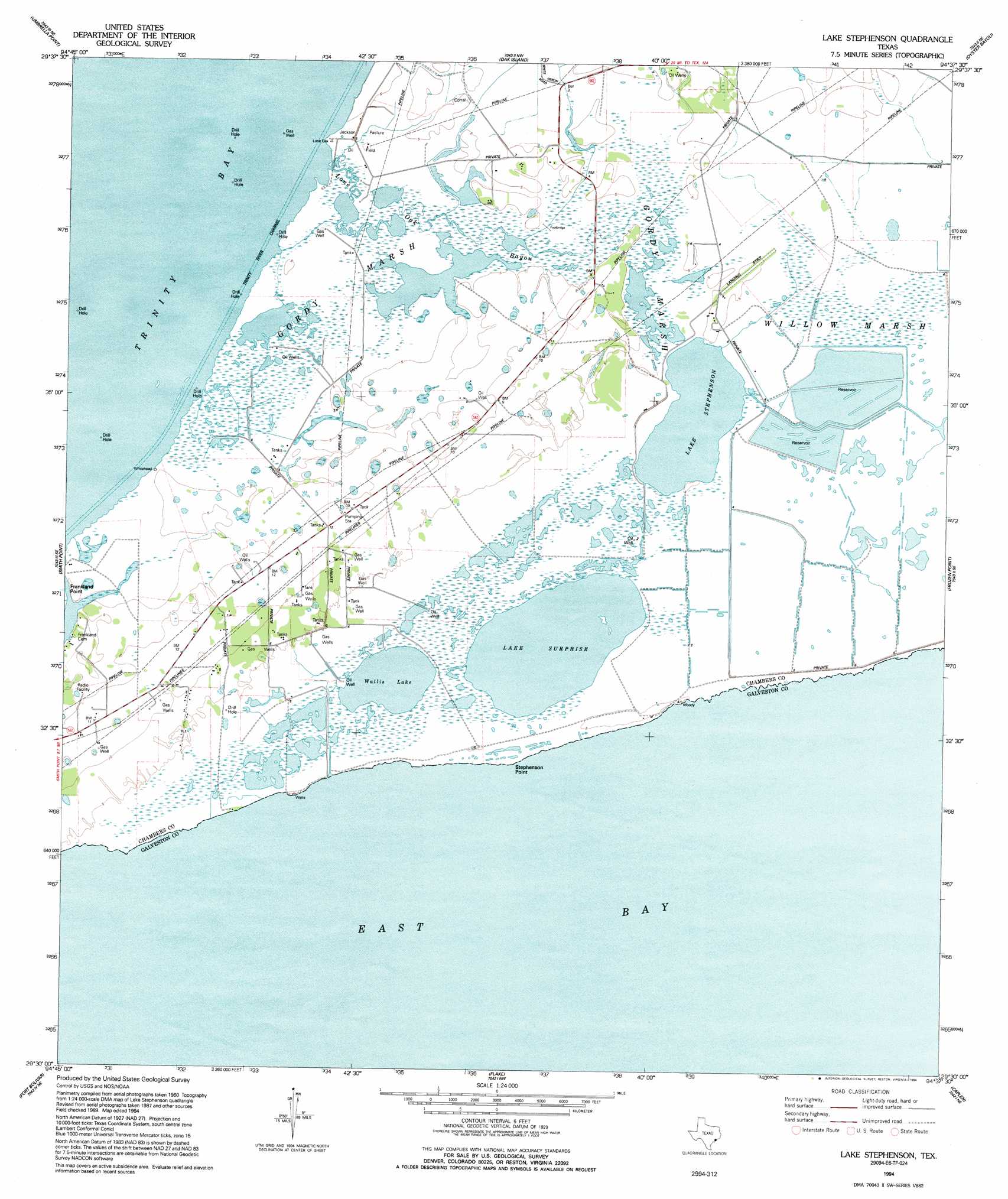
Lake Stephenson Topo Map Texas
To zoom in, hover over the map of Lake Stephenson
USGS Topo Quad 29094e6 - 1:24,000 scale
| Topo Map Name: | Lake Stephenson |
| USGS Topo Quad ID: | 29094e6 |
| Print Size: | ca. 21 1/4" wide x 27" high |
| Southeast Coordinates: | 29.5° N latitude / 94.625° W longitude |
| Map Center Coordinates: | 29.5625° N latitude / 94.6875° W longitude |
| U.S. State: | TX |
| Filename: | o29094e6.jpg |
| Download Map JPG Image: | Lake Stephenson topo map 1:24,000 scale |
| Map Type: | Topographic |
| Topo Series: | 7.5´ |
| Map Scale: | 1:24,000 |
| Source of Map Images: | United States Geological Survey (USGS) |
| Alternate Map Versions: |
Whites Lake TX 1932 Download PDF Buy paper map Lake Stephenson TX 1943, updated 1952 Download PDF Buy paper map Lake Stephenson TX 1961, updated 1964 Download PDF Buy paper map Lake Stephenson TX 1961, updated 1977 Download PDF Buy paper map Lake Stephenson TX 1994, updated 1994 Download PDF Buy paper map Lake Stephenson TX 2010 Download PDF Buy paper map Lake Stephenson TX 2013 Download PDF Buy paper map Lake Stephenson TX 2016 Download PDF Buy paper map |
1:24,000 Topo Quads surrounding Lake Stephenson
Mont Belvieu |
Cove |
Anahuac |
Monroe City |
Stowell |
Morgan Point |
Umbrella Point |
Oak Island |
Oyster Bayou |
Stanolind Reservoir |
Bacliff |
Smith Point |
Lake Stephenson |
Frozen Point |
High Island |
Texas City |
Port Bolivar |
Flake |
Caplen |
|
Virginia Point |
Galveston |
The Jetties |
> Back to 29094e1 at 1:100,000 scale
> Back to 29094a1 at 1:250,000 scale
> Back to U.S. Topo Maps home
Lake Stephenson topo map: Gazetteer
Lake Stephenson: Bays
East Bay elevation 0m 0′Lake Stephenson: Capes
Stephenson Point elevation 1m 3′Lake Stephenson: Dams
E W Monteith Number 1 Levee elevation 1m 3′E W Monteith Number 2 Levee elevation 1m 3′
E W Monteith Number 3 Levee elevation 1m 3′
Lake Stephenson: Lakes
Lake Stephenson elevation 1m 3′Lake Surprise elevation 1m 3′
Wallis Lake elevation 1m 3′
Lake Stephenson: Oilfields
Lake Stephenson Oil Field elevation 2m 6′Mays Oil Field elevation 3m 9′
White Lake Oil Field elevation 3m 9′
Lake Stephenson: Reservoirs
E W Monteith Number 1 Reservoir elevation 1m 3′E W Monteith Number 2 Reservoir elevation 1m 3′
E W Monteith Number 3 Reservoir elevation 1m 3′
Lake Stephenson: Streams
Lone Oak Bayou elevation 0m 0′Lake Stephenson: Swamps
Gordy Marsh elevation 1m 3′Gordy Marsh elevation 2m 6′
Lake Stephenson digital topo map on disk
Buy this Lake Stephenson topo map showing relief, roads, GPS coordinates and other geographical features, as a high-resolution digital map file on DVD: