Oyster Bayou Topo Map Texas
To zoom in, hover over the map of Oyster Bayou
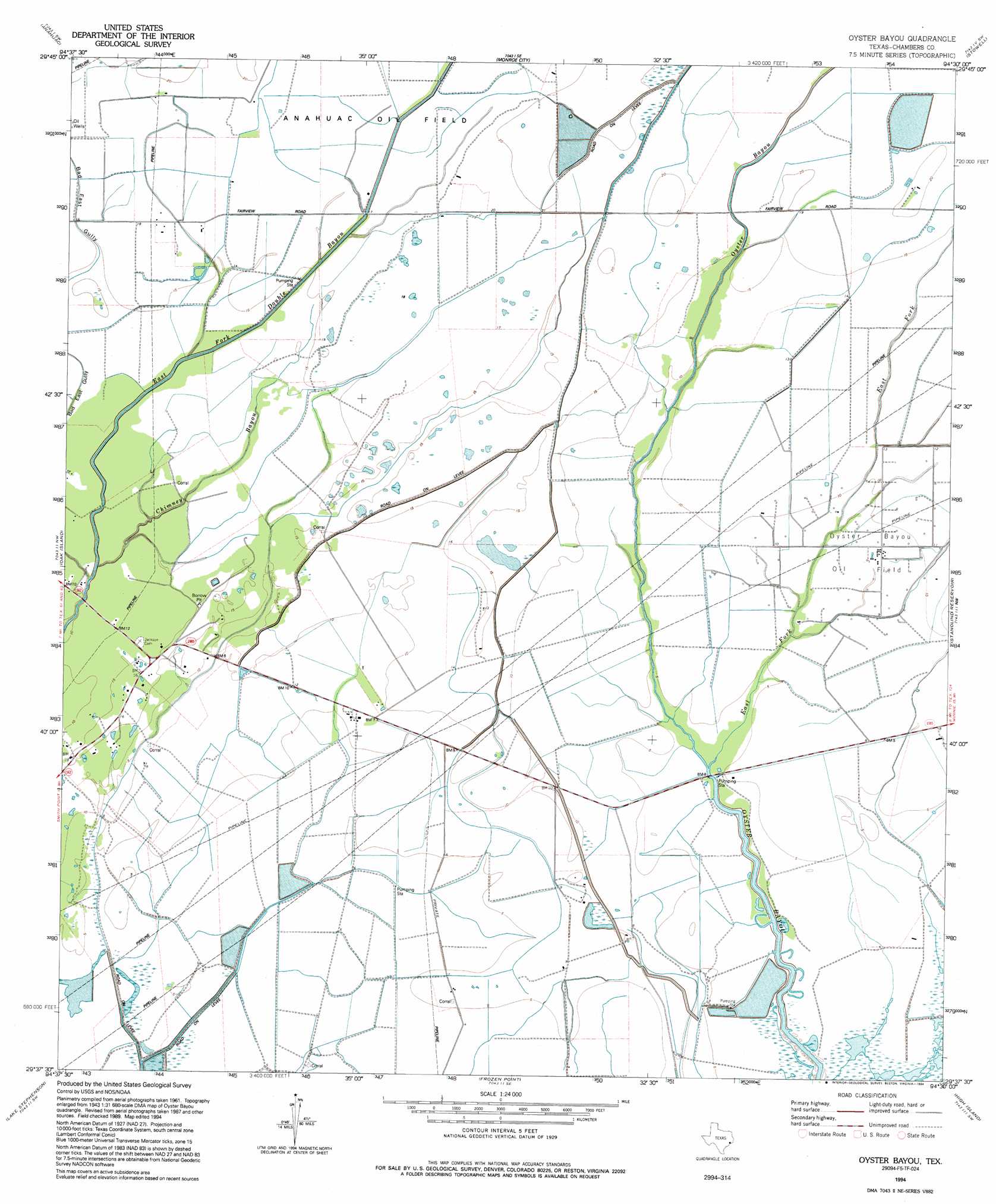
USGS Topo Quad 29094f5 - 1:24,000 scale
| Topo Map Name: | Oyster Bayou |
| USGS Topo Quad ID: | 29094f5 |
| Print Size: | ca. 21 1/4" wide x 27" high |
| Southeast Coordinates: | 29.625° N latitude / 94.5° W longitude |
| Map Center Coordinates: | 29.6875° N latitude / 94.5625° W longitude |
| U.S. State: | TX |
| Filename: | o29094f5.jpg |
| Download Map JPG Image: | Oyster Bayou topo map 1:24,000 scale |
| Map Type: | Topographic |
| Topo Series: | 7.5´ |
| Map Scale: | 1:24,000 |
| Source of Map Images: | United States Geological Survey (USGS) |
| Alternate Map Versions: |
Oyster Bayou TX 1961, updated 1964 Download PDF Buy paper map Oyster Bayou TX 1961, updated 1974 Download PDF Buy paper map Oyster Bayou TX 1961, updated 1978 Download PDF Buy paper map Oyster Bayou TX 1994, updated 1994 Download PDF Buy paper map Oyster Bayou TX 2010 Download PDF Buy paper map Oyster Bayou TX 2013 Download PDF Buy paper map Oyster Bayou TX 2016 Download PDF Buy paper map |
1:24,000 Topo Quads surrounding Oyster Bayou
Moss Bluff |
Shiloh |
Whites Bayou |
Winnie Nw |
Fannett West |
Cove |
Anahuac |
Monroe City |
Stowell |
Hamshire |
Umbrella Point |
Oak Island |
Oyster Bayou |
Stanolind Reservoir |
Whites Ranch |
Smith Point |
Lake Stephenson |
Frozen Point |
High Island |
Mud Lake |
Port Bolivar |
Flake |
Caplen |
> Back to 29094e1 at 1:100,000 scale
> Back to 29094a1 at 1:250,000 scale
> Back to U.S. Topo Maps home
Oyster Bayou topo map: Gazetteer
Oyster Bayou: Oilfields
Oyster Bayou Oil Field elevation 2m 6′Oyster Bayou: Streams
Chimney Bayou elevation 2m 6′East Fork Oyster Bayou elevation 2m 6′
Oyster Bayou: Valleys
Bad East Gully elevation 2m 6′Oyster Bayou digital topo map on disk
Buy this Oyster Bayou topo map showing relief, roads, GPS coordinates and other geographical features, as a high-resolution digital map file on DVD: