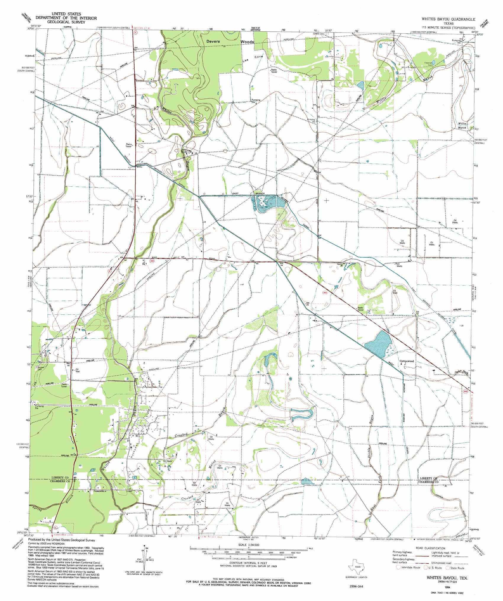
Whites Bayou Topo Map Texas
To zoom in, hover over the map of Whites Bayou
USGS Topo Quad 29094h5 - 1:24,000 scale
| Topo Map Name: | Whites Bayou |
| USGS Topo Quad ID: | 29094h5 |
| Print Size: | ca. 21 1/4" wide x 27" high |
| Southeast Coordinates: | 29.875° N latitude / 94.5° W longitude |
| Map Center Coordinates: | 29.9375° N latitude / 94.5625° W longitude |
| U.S. State: | TX |
| Filename: | o29094h5.jpg |
| Download Map JPG Image: | Whites Bayou topo map 1:24,000 scale |
| Map Type: | Topographic |
| Topo Series: | 7.5´ |
| Map Scale: | 1:24,000 |
| Source of Map Images: | United States Geological Survey (USGS) |
| Alternate Map Versions: |
Whites Bayou TX 1943 Download PDF Buy paper map Whites Bayou TX 1961, updated 1964 Download PDF Buy paper map Whites Bayou TX 1994, updated 1994 Download PDF Buy paper map Whites Bayou TX 2010 Download PDF Buy paper map Whites Bayou TX 2013 Download PDF Buy paper map Whites Bayou TX 2016 Download PDF Buy paper map |
1:24,000 Topo Quads surrounding Whites Bayou
Capers Ridge |
Hardin |
Thorson Gully |
Sour Lake |
Bevil Oaks |
Liberty |
Daisetta |
Devers |
Nome |
China |
Moss Bluff |
Shiloh |
Whites Bayou |
Winnie Nw |
Fannett West |
Cove |
Anahuac |
Monroe City |
Stowell |
Hamshire |
Umbrella Point |
Oak Island |
Oyster Bayou |
Stanolind Reservoir |
Whites Ranch |
> Back to 29094e1 at 1:100,000 scale
> Back to 29094a1 at 1:250,000 scale
> Back to U.S. Topo Maps home
Whites Bayou topo map: Gazetteer
Whites Bayou: Bays
Lee Cove elevation 16m 52′Whites Bayou: Canals
West Branch Devers Canal elevation 14m 45′Whites Bayou: Oilfields
Hankamer Oil Field elevation 10m 32′Whites Bayou: Populated Places
Abshier Settlement elevation 11m 36′Cottonwood elevation 11m 36′
Whites Bayou: Swamps
Crooked Marsh elevation 11m 36′Willis Marsh elevation 15m 49′
Whites Bayou digital topo map on disk
Buy this Whites Bayou topo map showing relief, roads, GPS coordinates and other geographical features, as a high-resolution digital map file on DVD: