San Luis Pass Topo Map Texas
To zoom in, hover over the map of San Luis Pass
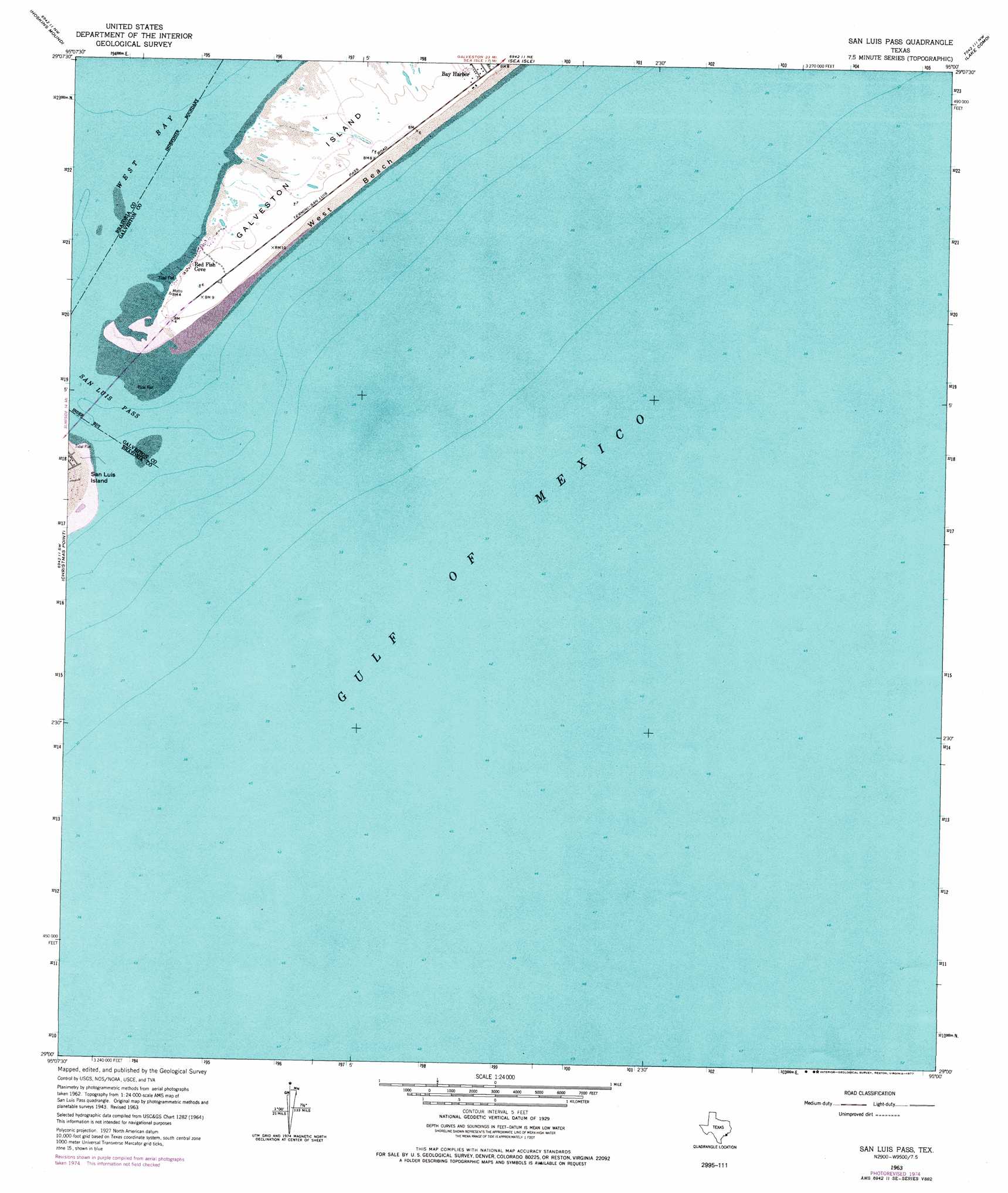
USGS Topo Quad 29095a1 - 1:24,000 scale
| Topo Map Name: | San Luis Pass |
| USGS Topo Quad ID: | 29095a1 |
| Print Size: | ca. 21 1/4" wide x 27" high |
| Southeast Coordinates: | 29° N latitude / 95° W longitude |
| Map Center Coordinates: | 29.0625° N latitude / 95.0625° W longitude |
| U.S. State: | TX |
| Filename: | o29095a1.jpg |
| Download Map JPG Image: | San Luis Pass topo map 1:24,000 scale |
| Map Type: | Topographic |
| Topo Series: | 7.5´ |
| Map Scale: | 1:24,000 |
| Source of Map Images: | United States Geological Survey (USGS) |
| Alternate Map Versions: |
San Luis Pass TX 1930 Download PDF Buy paper map San Luis Pass TX 1943, updated 1952 Download PDF Buy paper map San Luis Pass TX 1943, updated 1955 Download PDF Buy paper map San Luis Pass TX 1963, updated 1966 Download PDF Buy paper map San Luis Pass TX 1963, updated 1977 Download PDF Buy paper map San Luis Pass TX 2010 Download PDF Buy paper map San Luis Pass TX 2013 Download PDF Buy paper map San Luis Pass TX 2016 Download PDF Buy paper map |
1:24,000 Topo Quads surrounding San Luis Pass
Liverpool |
Mustang Bayou |
Hitchcock |
Virginia Point |
Galveston |
Danbury |
Hoskins Mound |
Sea Isle |
Lake Como |
|
Oyster Creek |
Christmas Point |
San Luis Pass |
||
Freeport |
||||
> Back to 29095a1 at 1:100,000 scale
> Back to 29094a1 at 1:250,000 scale
> Back to U.S. Topo Maps home
San Luis Pass topo map: Gazetteer
San Luis Pass: Channels
San Luis Pass elevation 0m 0′San Luis Pass: Populated Places
Red Fish Cove elevation 2m 6′San Luis Pass digital topo map on disk
Buy this San Luis Pass topo map showing relief, roads, GPS coordinates and other geographical features, as a high-resolution digital map file on DVD: