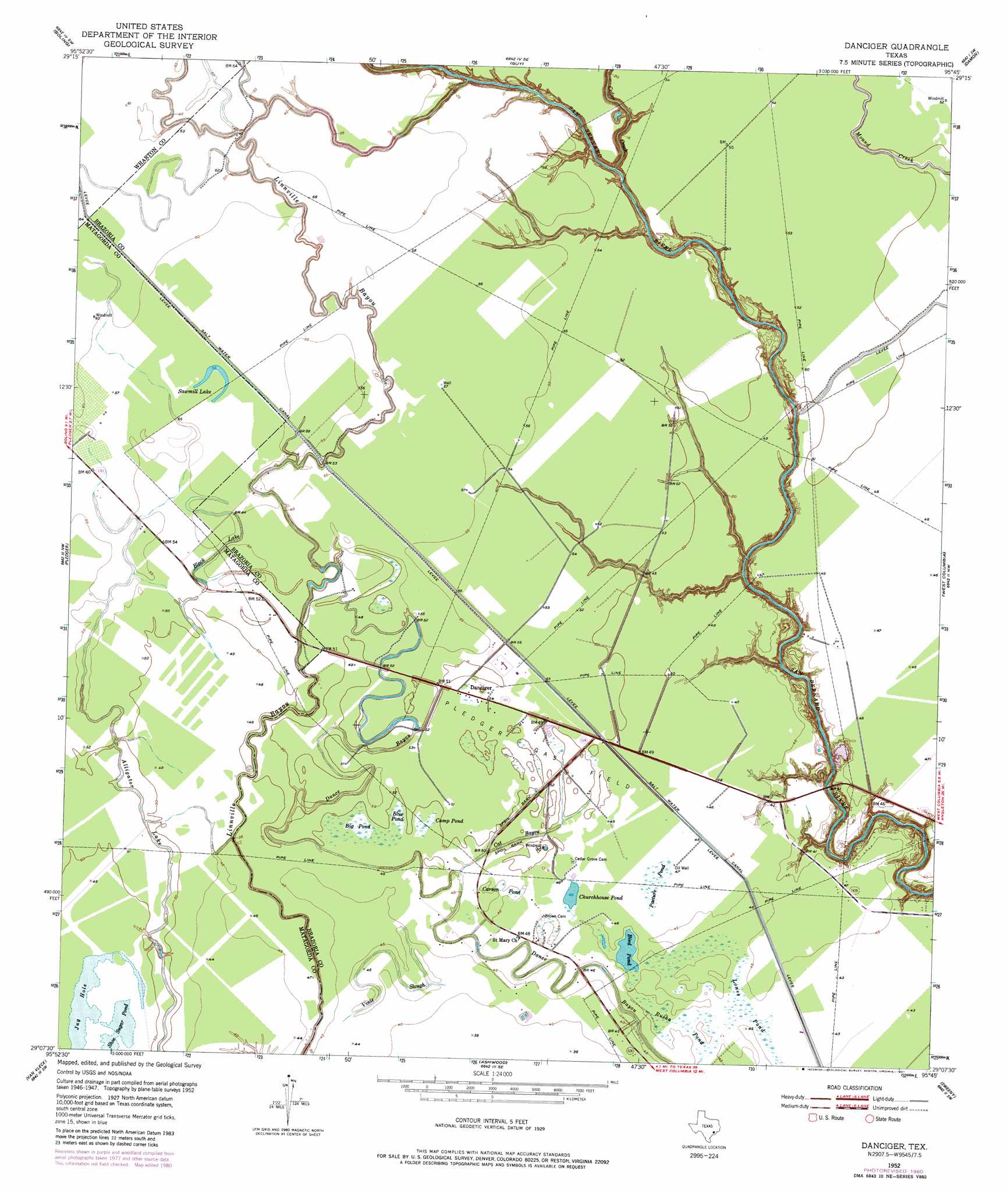
Danciger Topo Map Texas
To zoom in, hover over the map of Danciger
USGS Topo Quad 29095b7 - 1:24,000 scale
| Topo Map Name: | Danciger |
| USGS Topo Quad ID: | 29095b7 |
| Print Size: | ca. 21 1/4" wide x 27" high |
| Southeast Coordinates: | 29.125° N latitude / 95.75° W longitude |
| Map Center Coordinates: | 29.1875° N latitude / 95.8125° W longitude |
| U.S. State: | TX |
| Filename: | o29095b7.jpg |
| Download Map JPG Image: | Danciger topo map 1:24,000 scale |
| Map Type: | Topographic |
| Topo Series: | 7.5´ |
| Map Scale: | 1:24,000 |
| Source of Map Images: | United States Geological Survey (USGS) |
| Alternate Map Versions: |
Danciger TX 1952, updated 1953 Download PDF Buy paper map Danciger TX 1952, updated 1974 Download PDF Buy paper map Danciger TX 1952, updated 1981 Download PDF Buy paper map Danciger TX 2010 Download PDF Buy paper map Danciger TX 2013 Download PDF Buy paper map Danciger TX 2016 Download PDF Buy paper map |
1:24,000 Topo Quads surrounding Danciger
Hungerford |
Kendleton |
Needville |
Smithers Lake |
Thompsons |
Wharton |
Boling |
Guy |
Damon |
Otey |
Lane City |
Pledger |
Danciger |
West Columbia |
East Columbia |
Lane City Se |
Van Vleck |
Ashwood |
Sweeny |
Brazoria |
Markham |
Bay City |
Bay City Ne |
Cedar Lane |
Cedar Lane Ne |
> Back to 29095a1 at 1:100,000 scale
> Back to 29094a1 at 1:250,000 scale
> Back to U.S. Topo Maps home
Danciger topo map: Gazetteer
Danciger: Guts
Alligator Lake elevation 15m 49′Cat Bayou elevation 15m 49′
Vinie Slough elevation 14m 45′
Danciger: Lakes
Bird Pond elevation 13m 42′Black Lake elevation 15m 49′
Churchhouse Pond elevation 14m 45′
Jug Hole elevation 15m 49′
Sawmill Lake elevation 17m 55′
Shoe Sugar Pond elevation 15m 49′
Danciger: Oilfields
Pledger Gas Field elevation 15m 49′Danciger: Populated Places
Danciger elevation 15m 49′Danciger: Streams
Cedar Creek elevation 6m 19′Danciger: Swamps
Big Pond elevation 15m 49′Blue Pond elevation 15m 49′
Camp Pond elevation 15m 49′
Carson Pond elevation 14m 45′
Lones Pond elevation 14m 45′
Pasture Pond elevation 14m 45′
Rusha Pond elevation 14m 45′
Danciger digital topo map on disk
Buy this Danciger topo map showing relief, roads, GPS coordinates and other geographical features, as a high-resolution digital map file on DVD: