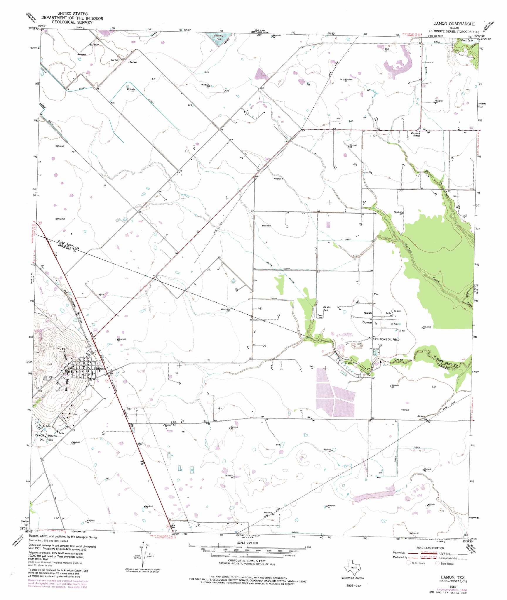
Damon Topo Map Texas
To zoom in, hover over the map of Damon
USGS Topo Quad 29095c6 - 1:24,000 scale
| Topo Map Name: | Damon |
| USGS Topo Quad ID: | 29095c6 |
| Print Size: | ca. 21 1/4" wide x 27" high |
| Southeast Coordinates: | 29.25° N latitude / 95.625° W longitude |
| Map Center Coordinates: | 29.3125° N latitude / 95.6875° W longitude |
| U.S. State: | TX |
| Filename: | o29095c6.jpg |
| Download Map JPG Image: | Damon topo map 1:24,000 scale |
| Map Type: | Topographic |
| Topo Series: | 7.5´ |
| Map Scale: | 1:24,000 |
| Source of Map Images: | United States Geological Survey (USGS) |
| Alternate Map Versions: |
Damon TX 1953, updated 1954 Download PDF Buy paper map Damon TX 1953, updated 1977 Download PDF Buy paper map Damon TX 1953, updated 1981 Download PDF Buy paper map Damon TX 2010 Download PDF Buy paper map Damon TX 2013 Download PDF Buy paper map Damon TX 2016 Download PDF Buy paper map |
1:24,000 Topo Quads surrounding Damon
Orchard |
Richmond |
Sugar Land |
Missouri City |
Almeda |
Kendleton |
Needville |
Smithers Lake |
Thompsons |
Juliff |
Boling |
Guy |
Damon |
Otey |
Rosharon |
Pledger |
Danciger |
West Columbia |
East Columbia |
Angleton |
Van Vleck |
Ashwood |
Sweeny |
Brazoria |
Lake Jackson |
> Back to 29095a1 at 1:100,000 scale
> Back to 29094a1 at 1:250,000 scale
> Back to U.S. Topo Maps home
Damon topo map: Gazetteer
Damon: Airports
H and S Airfield elevation 17m 55′Meyer Field elevation 20m 65′
Prairie Aire Field elevation 20m 65′
Damon: Oilfields
Nash Dome Oil Field elevation 16m 52′Damon: Populated Places
Damon elevation 24m 78′Damon: Streams
Turkey Creek elevation 12m 39′Damon: Summits
Damon Mound elevation 44m 144′Nash Dome elevation 17m 55′
Damon digital topo map on disk
Buy this Damon topo map showing relief, roads, GPS coordinates and other geographical features, as a high-resolution digital map file on DVD: