Sugar Land Topo Map Texas
To zoom in, hover over the map of Sugar Land
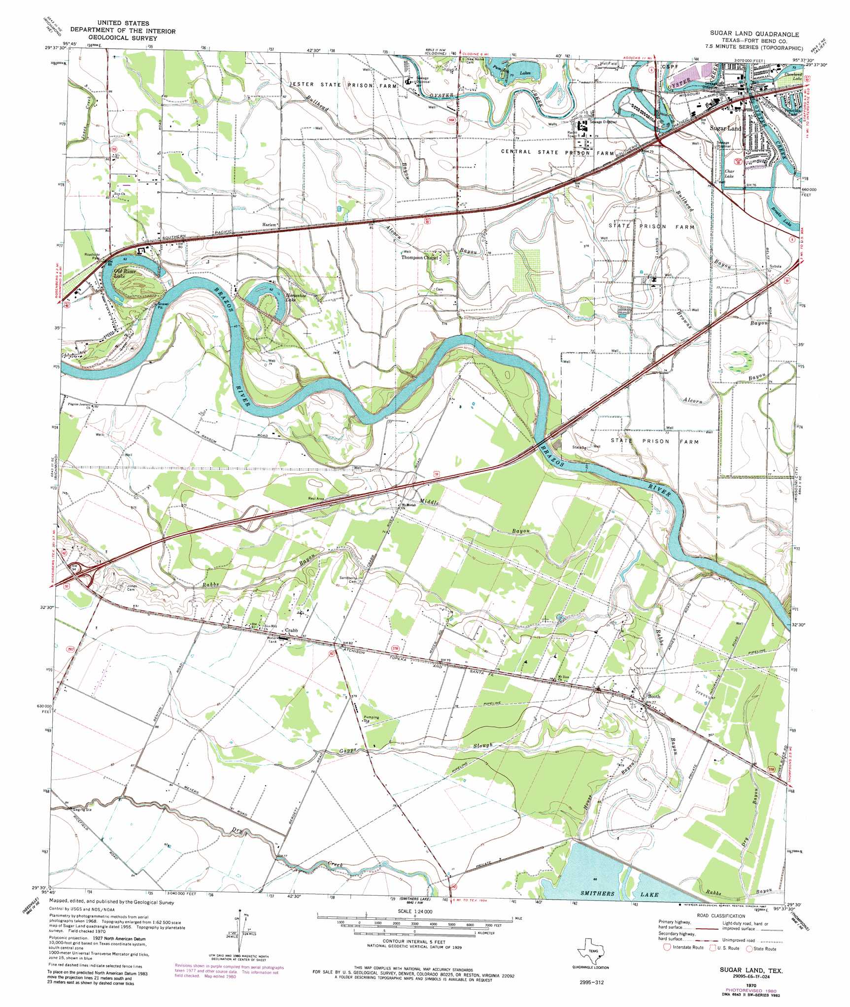
USGS Topo Quad 29095e6 - 1:24,000 scale
| Topo Map Name: | Sugar Land |
| USGS Topo Quad ID: | 29095e6 |
| Print Size: | ca. 21 1/4" wide x 27" high |
| Southeast Coordinates: | 29.5° N latitude / 95.625° W longitude |
| Map Center Coordinates: | 29.5625° N latitude / 95.6875° W longitude |
| U.S. State: | TX |
| Filename: | o29095e6.jpg |
| Download Map JPG Image: | Sugar Land topo map 1:24,000 scale |
| Map Type: | Topographic |
| Topo Series: | 7.5´ |
| Map Scale: | 1:24,000 |
| Source of Map Images: | United States Geological Survey (USGS) |
| Alternate Map Versions: |
Sugar Land TX 1970, updated 1973 Download PDF Buy paper map Sugar Land TX 1970, updated 1981 Download PDF Buy paper map Sugar Land TX 1970, updated 1987 Download PDF Buy paper map Sugar Land TX 1995, updated 1999 Download PDF Buy paper map Sugar Land TX 2010 Download PDF Buy paper map Sugar Land TX 2013 Download PDF Buy paper map Sugar Land TX 2016 Download PDF Buy paper map |
1:24,000 Topo Quads surrounding Sugar Land
Brookshire |
Katy |
Addicks |
Hedwig Village |
Houston Heights |
Fulshear |
Richmond Ne |
Clodine |
Alief |
Bellaire |
Orchard |
Richmond |
Sugar Land |
Missouri City |
Almeda |
Kendleton |
Needville |
Smithers Lake |
Thompsons |
Juliff |
Boling |
Guy |
Damon |
Otey |
Rosharon |
> Back to 29095e1 at 1:100,000 scale
> Back to 29094a1 at 1:250,000 scale
> Back to U.S. Topo Maps home
Sugar Land topo map: Gazetteer
Sugar Land: Airports
Sugar Land Municipal/Hull Field elevation 23m 75′Sugar Land: Dams
Fort Bend WCID 1 Oyster Creek Dam 1 elevation 23m 75′Fort Bend WCID 1 Oyster Creek Dam 2 elevation 23m 75′
Sugar Land: Lakes
Brooks Lake elevation 23m 75′Char Lake elevation 23m 75′
Horseshoe Lake elevation 18m 59′
Old River Lake elevation 18m 59′
Pumpkin Lakes elevation 21m 68′
Sugar Land: Populated Places
Booth elevation 23m 75′Bridlewood Estates elevation 24m 78′
Crabb elevation 26m 85′
Greatwood elevation 21m 68′
Greatwood Trails elevation 21m 68′
Greatwood Village elevation 22m 72′
Hall Lake elevation 23m 75′
Harlem elevation 24m 78′
New Territory elevation 23m 75′
Pecan Grove Plantation elevation 24m 78′
Rabbs Hill elevation 25m 82′
Sugar Land elevation 23m 75′
Venetian Estates Section 2 elevation 23m 75′
Sugar Land: Reservoirs
Brooks, Cleveland and Char Lakes elevation 23m 75′Oyster Creek Channel Reservoir elevation 23m 75′
Sugar Land: Streams
Dry Bayou elevation 18m 59′Gapps Slough elevation 19m 62′
House Bayou elevation 18m 59′
Middle Bayou elevation 14m 45′
Sugar Land digital topo map on disk
Buy this Sugar Land topo map showing relief, roads, GPS coordinates and other geographical features, as a high-resolution digital map file on DVD: