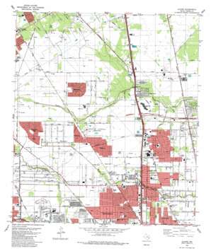
Aldine Topo Map Texas
To zoom in, hover over the map of Aldine
USGS Topo Quad 29095h4 - 1:24,000 scale
| Topo Map Name: | Aldine |
| USGS Topo Quad ID: | 29095h4 |
| Print Size: | ca. 21 1/4" wide x 27" high |
| Southeast Coordinates: | 29.875° N latitude / 95.375° W longitude |
| Map Center Coordinates: | 29.9375° N latitude / 95.4375° W longitude |
| U.S. State: | TX |
| Filename: | o29095h4.jpg |
| Download Map JPG Image: | Aldine topo map 1:24,000 scale |
| Map Type: | Topographic |
| Topo Series: | 7.5´ |
| Map Scale: | 1:24,000 |
| Source of Map Images: | United States Geological Survey (USGS) |
| Alternate Map Versions: |
Aldine TX 1916 Download PDF Buy paper map Aldine TX 1916 Download PDF Buy paper map Aldine TX 1954, updated 1956 Download PDF Buy paper map Aldine TX 1967 Download PDF Buy paper map Aldine TX 1967, updated 1969 Download PDF Buy paper map Aldine TX 1967, updated 1970 Download PDF Buy paper map Aldine TX 1982, updated 1983 Download PDF Buy paper map Aldine TX 1982, updated 1983 Download PDF Buy paper map Aldine TX 1995, updated 1999 Download PDF Buy paper map Aldine TX 2010 Download PDF Buy paper map Aldine TX 2013 Download PDF Buy paper map Aldine TX 2016 Download PDF Buy paper map |
1:24,000 Topo Quads surrounding Aldine
> Back to 29095e1 at 1:100,000 scale
> Back to 29094a1 at 1:250,000 scale
> Back to U.S. Topo Maps home
Aldine topo map: Gazetteer
Aldine: Airports
Allied Northborough Heliport elevation 28m 91′Mplha Heliport elevation 25m 82′
Station 35 Heliport elevation 35m 114′
Aldine: Crossings
Interchange 56A elevation 27m 88′Interchange 56B elevation 26m 85′
Interchange 57A elevation 27m 88′
Interchange 57B elevation 29m 95′
Interchange 59 elevation 30m 98′
Interchange 60A elevation 28m 91′
Interchange 60B elevation 29m 95′
Interchange 60C elevation 29m 95′
Interchange 62 elevation 38m 124′
Interchange 63 elevation 37m 121′
Interchange 64 elevation 36m 118′
Aldine: Parks
Aldine Athletic Stadium elevation 27m 88′Doss Park elevation 31m 101′
Dow Park elevation 26m 85′
Dow Park Number 2 elevation 26m 85′
Lincoln Park elevation 27m 88′
Mueller Park elevation 24m 78′
Northland Christian Secondary School Football Field elevation 37m 121′
Northwest Indoor Soccer Center elevation 38m 124′
Aldine: Populated Places
Airline Estates elevation 25m 82′Airline Farms elevation 25m 82′
Airline Terrace elevation 27m 88′
Aldine elevation 24m 78′
Blue Bell Manor elevation 28m 91′
Blue Bell Place elevation 26m 85′
Briar Creek elevation 32m 104′
Champions Point elevation 36m 118′
Fountainhead elevation 36m 118′
Garden City Park elevation 27m 88′
Glen Forest elevation 27m 88′
Greenbranch elevation 25m 82′
Greenfield Village elevation 32m 104′
Gum Valley elevation 29m 95′
Heather Glen elevation 28m 91′
Hidden Valley elevation 26m 85′
Highland Gardens elevation 28m 91′
Imperial Valley elevation 27m 88′
Inwood Forest elevation 25m 82′
Inwood West elevation 29m 95′
Lincoln City elevation 27m 88′
Lincoln Green East elevation 31m 101′
Lincoln Green South elevation 32m 104′
McKamy Meadow elevation 32m 104′
North Country elevation 27m 88′
Northborough elevation 29m 95′
Northcliffe Manor elevation 35m 114′
Northline Terrace elevation 26m 85′
Oak Glen Place elevation 25m 82′
Recreation Farms elevation 31m 101′
Ridge Point elevation 28m 91′
Southbrook elevation 27m 88′
Traweek Gardens elevation 26m 85′
Willow Run elevation 27m 88′
Yale Gardens elevation 29m 95′
Aldine: Trails
Lincoln Park Trail elevation 27m 88′Osborne Elementary SPARK Park Trail elevation 26m 85′
Aldine digital topo map on disk
Buy this Aldine topo map showing relief, roads, GPS coordinates and other geographical features, as a high-resolution digital map file on DVD:


