Louise Topo Map Texas
To zoom in, hover over the map of Louise
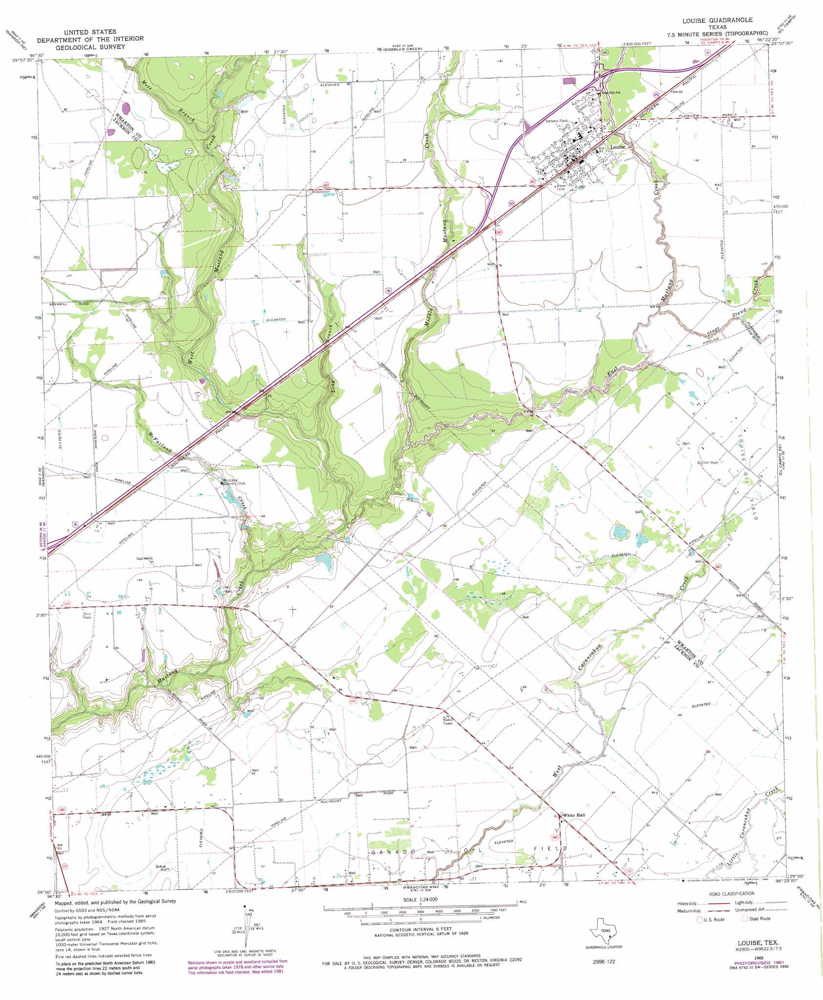
USGS Topo Quad 29096a4 - 1:24,000 scale
| Topo Map Name: | Louise |
| USGS Topo Quad ID: | 29096a4 |
| Print Size: | ca. 21 1/4" wide x 27" high |
| Southeast Coordinates: | 29° N latitude / 96.375° W longitude |
| Map Center Coordinates: | 29.0625° N latitude / 96.4375° W longitude |
| U.S. State: | TX |
| Filename: | o29096a4.jpg |
| Download Map JPG Image: | Louise topo map 1:24,000 scale |
| Map Type: | Topographic |
| Topo Series: | 7.5´ |
| Map Scale: | 1:24,000 |
| Source of Map Images: | United States Geological Survey (USGS) |
| Alternate Map Versions: |
Louise TX 1965, updated 1968 Download PDF Buy paper map Louise TX 1965, updated 1983 Download PDF Buy paper map Louise TX 2010 Download PDF Buy paper map Louise TX 2013 Download PDF Buy paper map Louise TX 2016 Download PDF Buy paper map |
1:24,000 Topo Quads surrounding Louise
Speaks |
Sheridan Se |
Hahn |
New Taiton |
Glen Flora |
Cordele |
Ganado Ne |
Gobbler Creek |
El Campo |
Pierce |
Mount Olive |
Ganado |
Louise |
El Campo Se |
Danevang |
Edna |
Manson |
Francitas Nw |
Francitas Ne |
Midfield |
La Salle |
Lolita |
La Ward |
Francitas |
Blessing |
> Back to 29096a1 at 1:100,000 scale
> Back to 29096a1 at 1:250,000 scale
> Back to U.S. Topo Maps home
Louise topo map: Gazetteer
Louise: Oilfields
Louise Oil Field elevation 21m 68′Louise: Populated Places
Louise elevation 26m 85′White Hall elevation 18m 59′
Louise: Streams
East Mustang Creek elevation 15m 49′Long Branch elevation 14m 45′
McFarland Creek elevation 13m 42′
Middle Mustang Creek elevation 14m 45′
Mott Branch elevation 21m 68′
Stage Stand Creek elevation 19m 62′
West Mustang Creek elevation 15m 49′
Louise digital topo map on disk
Buy this Louise topo map showing relief, roads, GPS coordinates and other geographical features, as a high-resolution digital map file on DVD: