Ganado Topo Map Texas
To zoom in, hover over the map of Ganado
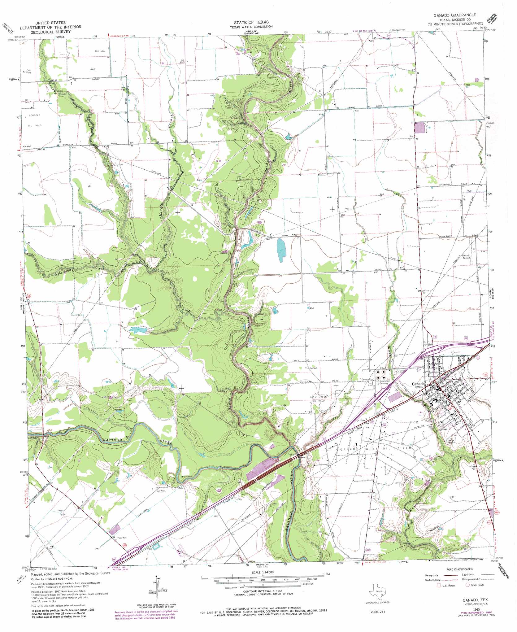
USGS Topo Quad 29096a5 - 1:24,000 scale
| Topo Map Name: | Ganado |
| USGS Topo Quad ID: | 29096a5 |
| Print Size: | ca. 21 1/4" wide x 27" high |
| Southeast Coordinates: | 29° N latitude / 96.5° W longitude |
| Map Center Coordinates: | 29.0625° N latitude / 96.5625° W longitude |
| U.S. State: | TX |
| Filename: | o29096a5.jpg |
| Download Map JPG Image: | Ganado topo map 1:24,000 scale |
| Map Type: | Topographic |
| Topo Series: | 7.5´ |
| Map Scale: | 1:24,000 |
| Source of Map Images: | United States Geological Survey (USGS) |
| Alternate Map Versions: |
Ganado TX 1963, updated 1965 Download PDF Buy paper map Ganado TX 1963, updated 1983 Download PDF Buy paper map Ganado TX 2010 Download PDF Buy paper map Ganado TX 2013 Download PDF Buy paper map Ganado TX 2016 Download PDF Buy paper map |
1:24,000 Topo Quads surrounding Ganado
Hallettsville Se |
Speaks |
Sheridan Se |
Hahn |
New Taiton |
Morales |
Cordele |
Ganado Ne |
Gobbler Creek |
El Campo |
Navidad |
Mount Olive |
Ganado |
Louise |
El Campo Se |
Inez |
Edna |
Manson |
Francitas Nw |
Francitas Ne |
Marcado Creek |
La Salle |
Lolita |
La Ward |
Francitas |
> Back to 29096a1 at 1:100,000 scale
> Back to 29096a1 at 1:250,000 scale
> Back to U.S. Topo Maps home
Ganado topo map: Gazetteer
Ganado: Airports
Calaway Airport elevation 24m 78′Jackson County Airport elevation 18m 59′
Ganado: Oilfields
Ganado West Oil Field elevation 19m 62′Sandy Creek Oil Field elevation 20m 65′
Ganado: Parks
Jaycee Park elevation 16m 52′Ganado: Populated Places
Ganado elevation 20m 65′Ganado: Streams
Brushy Creek elevation 15m 49′Devers Creek elevation 13m 42′
Middle Branch Brushy Creek elevation 15m 49′
Sandy Creek elevation 13m 42′
Sutherland Creek elevation 17m 55′
Ganado digital topo map on disk
Buy this Ganado topo map showing relief, roads, GPS coordinates and other geographical features, as a high-resolution digital map file on DVD: