Mount Olive Topo Map Texas
To zoom in, hover over the map of Mount Olive
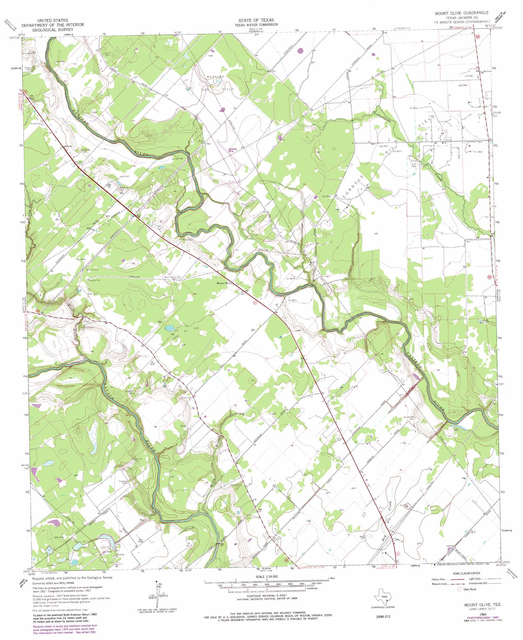
USGS Topo Quad 29096a6 - 1:24,000 scale
| Topo Map Name: | Mount Olive |
| USGS Topo Quad ID: | 29096a6 |
| Print Size: | ca. 21 1/4" wide x 27" high |
| Southeast Coordinates: | 29° N latitude / 96.625° W longitude |
| Map Center Coordinates: | 29.0625° N latitude / 96.6875° W longitude |
| U.S. State: | TX |
| Filename: | o29096a6.jpg |
| Download Map JPG Image: | Mount Olive topo map 1:24,000 scale |
| Map Type: | Topographic |
| Topo Series: | 7.5´ |
| Map Scale: | 1:24,000 |
| Source of Map Images: | United States Geological Survey (USGS) |
| Alternate Map Versions: |
Mount Olive TX 1963, updated 1965 Download PDF Buy paper map Mount Olive TX 1963, updated 1983 Download PDF Buy paper map Mount Olive TX 2010 Download PDF Buy paper map Mount Olive TX 2013 Download PDF Buy paper map Mount Olive TX 2016 Download PDF Buy paper map |
1:24,000 Topo Quads surrounding Mount Olive
Ezzell |
Hallettsville Se |
Speaks |
Sheridan Se |
Hahn |
Hope |
Morales |
Cordele |
Ganado Ne |
Gobbler Creek |
Peck Branch |
Navidad |
Mount Olive |
Ganado |
Louise |
Inez Nw |
Inez |
Edna |
Manson |
Francitas Nw |
Victoria East |
Marcado Creek |
La Salle |
Lolita |
La Ward |
> Back to 29096a1 at 1:100,000 scale
> Back to 29096a1 at 1:250,000 scale
> Back to U.S. Topo Maps home
Mount Olive topo map: Gazetteer
Mount Olive: Oilfields
Collier Oil Field elevation 26m 85′Cordele Oil Field elevation 26m 85′
Mount Olive: Populated Places
Mount Olive elevation 27m 88′Mount Olive: Streams
Milby Branch elevation 13m 42′Mount Olive digital topo map on disk
Buy this Mount Olive topo map showing relief, roads, GPS coordinates and other geographical features, as a high-resolution digital map file on DVD: