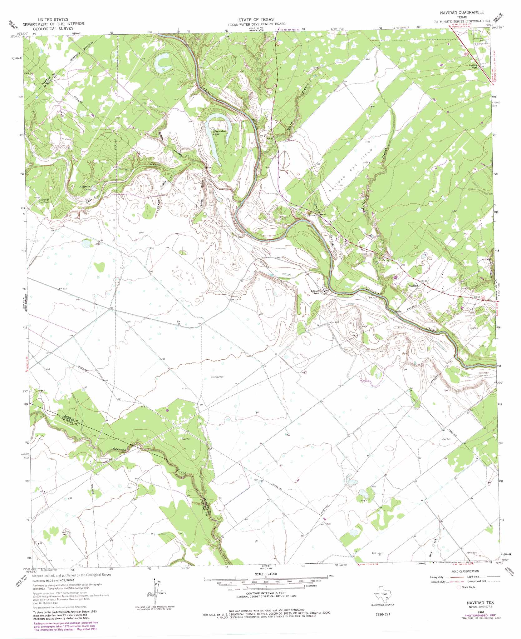
Navidad Topo Map Texas
To zoom in, hover over the map of Navidad
USGS Topo Quad 29096a7 - 1:24,000 scale
| Topo Map Name: | Navidad |
| USGS Topo Quad ID: | 29096a7 |
| Print Size: | ca. 21 1/4" wide x 27" high |
| Southeast Coordinates: | 29° N latitude / 96.75° W longitude |
| Map Center Coordinates: | 29.0625° N latitude / 96.8125° W longitude |
| U.S. State: | TX |
| Filename: | o29096a7.jpg |
| Download Map JPG Image: | Navidad topo map 1:24,000 scale |
| Map Type: | Topographic |
| Topo Series: | 7.5´ |
| Map Scale: | 1:24,000 |
| Source of Map Images: | United States Geological Survey (USGS) |
| Alternate Map Versions: |
Navidad TX 1964, updated 1966 Download PDF Buy paper map Navidad TX 1964, updated 1983 Download PDF Buy paper map Navidad TX 2010 Download PDF Buy paper map Navidad TX 2013 Download PDF Buy paper map Navidad TX 2016 Download PDF Buy paper map |
1:24,000 Topo Quads surrounding Navidad
Sweet Home |
Ezzell |
Hallettsville Se |
Speaks |
Sheridan Se |
Terryville |
Hope |
Morales |
Cordele |
Ganado Ne |
Fordtran |
Peck Branch |
Navidad |
Mount Olive |
Ganado |
Nursery |
Inez Nw |
Inez |
Edna |
Manson |
Victoria West |
Victoria East |
Marcado Creek |
La Salle |
Lolita |
> Back to 29096a1 at 1:100,000 scale
> Back to 29096a1 at 1:250,000 scale
> Back to U.S. Topo Maps home
Navidad topo map: Gazetteer
Navidad: Lakes
Alligator Lake elevation 23m 75′Horseshoe Lake elevation 23m 75′
Navidad: Oilfields
McDaniel Gas Field elevation 33m 108′Navidad Gas Field elevation 33m 108′
Navidad: Populated Places
Navidad elevation 29m 95′Navidad: Streams
Beard Branch elevation 25m 82′Chicolete Creek elevation 18m 59′
Keller Branch elevation 19m 62′
Kerr Branch elevation 21m 68′
Knopp Branch elevation 19m 62′
Navidad: Valleys
James Hollow elevation 22m 72′McCoy Hollow elevation 22m 72′
Roden Hollow elevation 21m 68′
Navidad digital topo map on disk
Buy this Navidad topo map showing relief, roads, GPS coordinates and other geographical features, as a high-resolution digital map file on DVD: