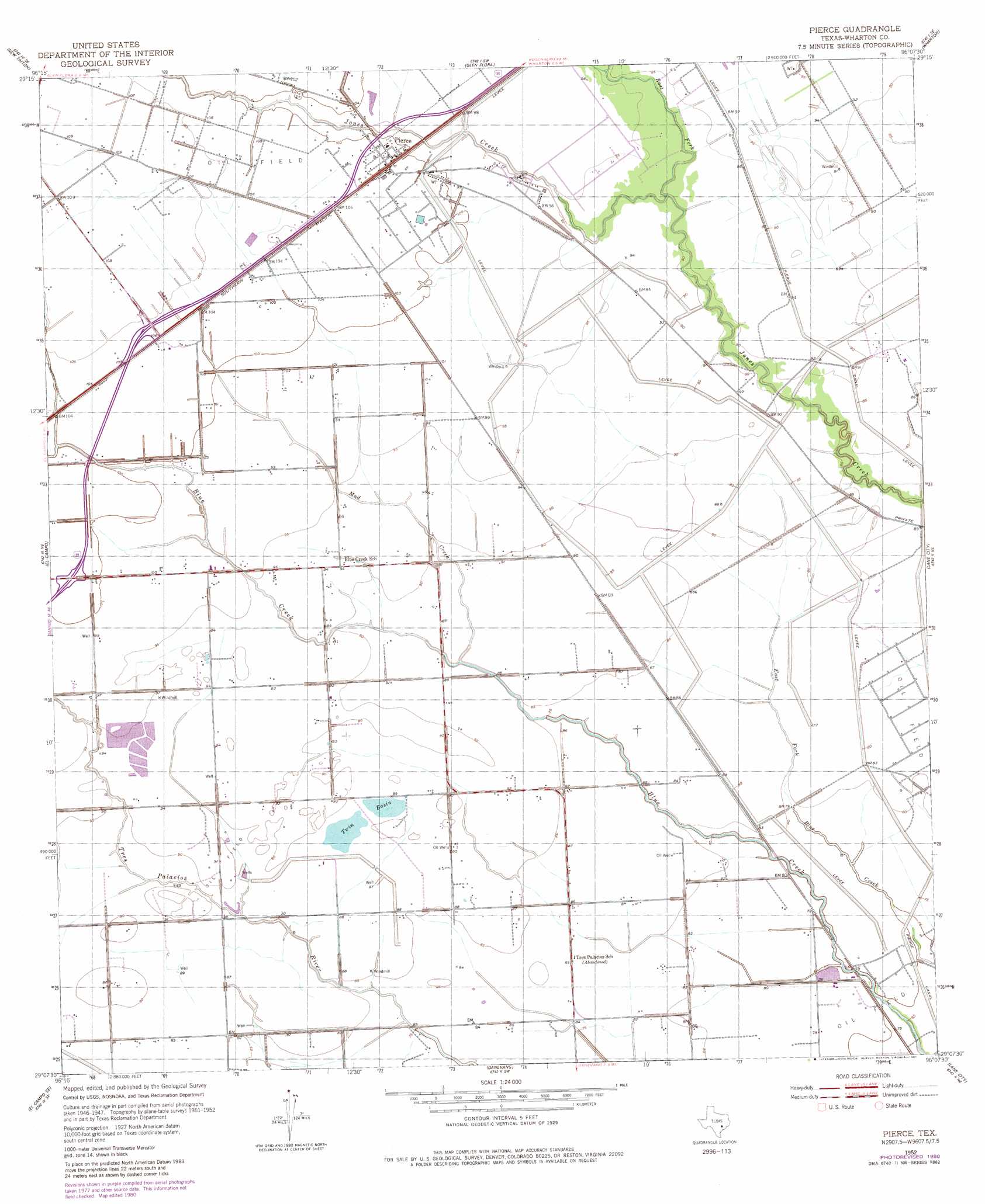
Pierce Topo Map Texas
To zoom in, hover over the map of Pierce
USGS Topo Quad 29096b2 - 1:24,000 scale
| Topo Map Name: | Pierce |
| USGS Topo Quad ID: | 29096b2 |
| Print Size: | ca. 21 1/4" wide x 27" high |
| Southeast Coordinates: | 29.125° N latitude / 96.125° W longitude |
| Map Center Coordinates: | 29.1875° N latitude / 96.1875° W longitude |
| U.S. State: | TX |
| Filename: | o29096b2.jpg |
| Download Map JPG Image: | Pierce topo map 1:24,000 scale |
| Map Type: | Topographic |
| Topo Series: | 7.5´ |
| Map Scale: | 1:24,000 |
| Source of Map Images: | United States Geological Survey (USGS) |
| Alternate Map Versions: |
Pierce TX 1952, updated 1953 Download PDF Buy paper map Pierce TX 1952, updated 1981 Download PDF Buy paper map Pierce TX 2010 Download PDF Buy paper map Pierce TX 2013 Download PDF Buy paper map Pierce TX 2016 Download PDF Buy paper map |
1:24,000 Topo Quads surrounding Pierce
Garwood |
Bonus |
Egypt |
Hungerford |
Kendleton |
Hahn |
New Taiton |
Glen Flora |
Wharton |
Boling |
Gobbler Creek |
El Campo |
Pierce |
Lane City |
Pledger |
Louise |
El Campo Se |
Danevang |
Lane City Se |
Van Vleck |
Francitas Nw |
Francitas Ne |
Midfield |
Markham |
Bay City |
> Back to 29096a1 at 1:100,000 scale
> Back to 29096a1 at 1:250,000 scale
> Back to U.S. Topo Maps home
Pierce topo map: Gazetteer
Pierce: Airports
Thompson Flyers Airport elevation 28m 91′Pierce: Dams
Roach Reservoir Dam elevation 27m 88′Pierce: Lakes
Twin Basin elevation 27m 88′Pierce: Populated Places
Pierce elevation 30m 98′Pierce: Reservoirs
Roach Reservoir elevation 27m 88′Pierce: Streams
East Fork Jones Creek elevation 25m 82′Mud Creek elevation 23m 75′
Pierce digital topo map on disk
Buy this Pierce topo map showing relief, roads, GPS coordinates and other geographical features, as a high-resolution digital map file on DVD: