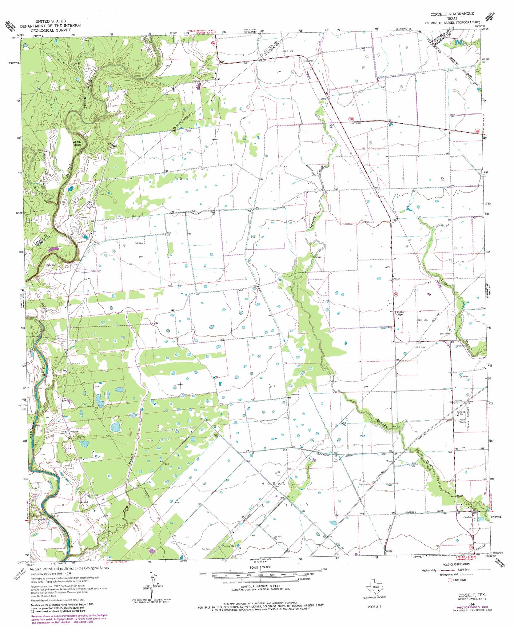
Cordele Topo Map Texas
To zoom in, hover over the map of Cordele
USGS Topo Quad 29096b6 - 1:24,000 scale
| Topo Map Name: | Cordele |
| USGS Topo Quad ID: | 29096b6 |
| Print Size: | ca. 21 1/4" wide x 27" high |
| Southeast Coordinates: | 29.125° N latitude / 96.625° W longitude |
| Map Center Coordinates: | 29.1875° N latitude / 96.6875° W longitude |
| U.S. State: | TX |
| Filename: | o29096b6.jpg |
| Download Map JPG Image: | Cordele topo map 1:24,000 scale |
| Map Type: | Topographic |
| Topo Series: | 7.5´ |
| Map Scale: | 1:24,000 |
| Source of Map Images: | United States Geological Survey (USGS) |
| Alternate Map Versions: |
Cordele TX 1964, updated 1966 Download PDF Buy paper map Cordele TX 1964, updated 1981 Download PDF Buy paper map Cordele TX 2010 Download PDF Buy paper map Cordele TX 2013 Download PDF Buy paper map Cordele TX 2016 Download PDF Buy paper map |
1:24,000 Topo Quads surrounding Cordele
Hallettsville |
Sublime |
Sheridan |
Sheridan Ne |
Garwood |
Ezzell |
Hallettsville Se |
Speaks |
Sheridan Se |
Hahn |
Hope |
Morales |
Cordele |
Ganado Ne |
Gobbler Creek |
Peck Branch |
Navidad |
Mount Olive |
Ganado |
Louise |
Inez Nw |
Inez |
Edna |
Manson |
Francitas Nw |
> Back to 29096a1 at 1:100,000 scale
> Back to 29096a1 at 1:250,000 scale
> Back to U.S. Topo Maps home
Cordele topo map: Gazetteer
Cordele: Airports
Fenner Ranch Airport elevation 39m 127′Cordele: Bends
Gandy Bend elevation 34m 111′Cordele: Oilfields
Morales Gas Field elevation 31m 101′Cordele: Populated Places
Cordele elevation 31m 101′Cordele: Streams
Hall Branch elevation 24m 78′Hardys Sandy Creek elevation 29m 95′
Sand Branch elevation 32m 104′
Stem Branch elevation 23m 75′
Cordele digital topo map on disk
Buy this Cordele topo map showing relief, roads, GPS coordinates and other geographical features, as a high-resolution digital map file on DVD: