Bonus Topo Map Texas
To zoom in, hover over the map of Bonus
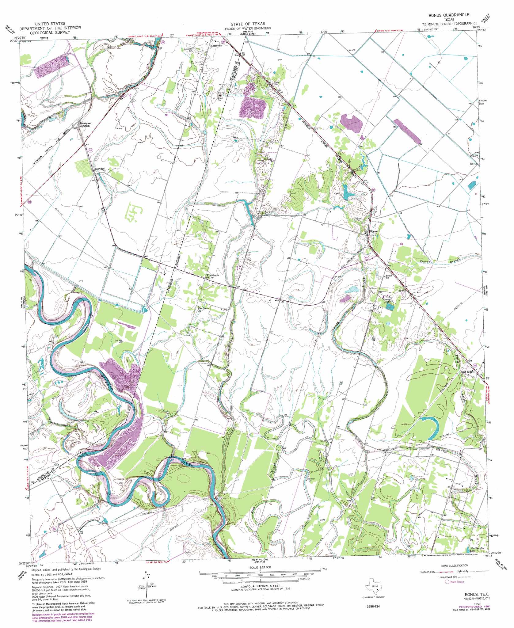
USGS Topo Quad 29096d3 - 1:24,000 scale
| Topo Map Name: | Bonus |
| USGS Topo Quad ID: | 29096d3 |
| Print Size: | ca. 21 1/4" wide x 27" high |
| Southeast Coordinates: | 29.375° N latitude / 96.25° W longitude |
| Map Center Coordinates: | 29.4375° N latitude / 96.3125° W longitude |
| U.S. State: | TX |
| Filename: | o29096d3.jpg |
| Download Map JPG Image: | Bonus topo map 1:24,000 scale |
| Map Type: | Topographic |
| Topo Series: | 7.5´ |
| Map Scale: | 1:24,000 |
| Source of Map Images: | United States Geological Survey (USGS) |
| Alternate Map Versions: |
Bonus TX 1959, updated 1960 Download PDF Buy paper map Bonus TX 1959, updated 1960 Download PDF Buy paper map Bonus TX 1959, updated 1983 Download PDF Buy paper map Bonus TX 2010 Download PDF Buy paper map Bonus TX 2013 Download PDF Buy paper map Bonus TX 2016 Download PDF Buy paper map |
1:24,000 Topo Quads surrounding Bonus
Columbus |
Alleyton |
Eagle Lake Ne |
Rexville |
Wallis |
Rock Island |
Altair |
Eagle Lake |
Lissie |
East Bernard |
Sheridan Ne |
Garwood |
Bonus |
Egypt |
Hungerford |
Sheridan Se |
Hahn |
New Taiton |
Glen Flora |
Wharton |
Ganado Ne |
Gobbler Creek |
El Campo |
Pierce |
Lane City |
> Back to 29096a1 at 1:100,000 scale
> Back to 29096a1 at 1:250,000 scale
> Back to U.S. Topo Maps home
Bonus topo map: Gazetteer
Bonus: Dams
Rockin Ranch Lake Dam elevation 41m 134′Bonus: Populated Places
Boedecker Junction elevation 44m 144′Bonus elevation 45m 147′
Eldridge elevation 44m 144′
Elm Grove elevation 42m 137′
Matthews elevation 51m 167′
Sand Ridge elevation 42m 137′
Bonus: Reservoirs
Rockin Ranch Lake elevation 41m 134′Bonus digital topo map on disk
Buy this Bonus topo map showing relief, roads, GPS coordinates and other geographical features, as a high-resolution digital map file on DVD: