Altair Topo Map Texas
To zoom in, hover over the map of Altair
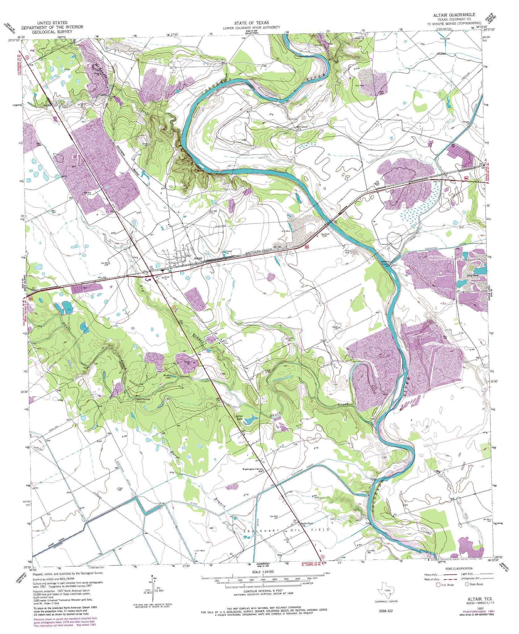
USGS Topo Quad 29096e4 - 1:24,000 scale
| Topo Map Name: | Altair |
| USGS Topo Quad ID: | 29096e4 |
| Print Size: | ca. 21 1/4" wide x 27" high |
| Southeast Coordinates: | 29.5° N latitude / 96.375° W longitude |
| Map Center Coordinates: | 29.5625° N latitude / 96.4375° W longitude |
| U.S. State: | TX |
| Filename: | o29096e4.jpg |
| Download Map JPG Image: | Altair topo map 1:24,000 scale |
| Map Type: | Topographic |
| Topo Series: | 7.5´ |
| Map Scale: | 1:24,000 |
| Source of Map Images: | United States Geological Survey (USGS) |
| Alternate Map Versions: |
Altair TX 1957, updated 1958 Download PDF Buy paper map Altair TX 1957, updated 1983 Download PDF Buy paper map Altair TX 2010 Download PDF Buy paper map Altair TX 2013 Download PDF Buy paper map Altair TX 2016 Download PDF Buy paper map |
1:24,000 Topo Quads surrounding Altair
Ellinger |
Frelsburg |
Bernardo |
Cat Spring |
Sealy |
Borden |
Columbus |
Alleyton |
Eagle Lake Ne |
Rexville |
Sawmill Branch |
Rock Island |
Altair |
Eagle Lake |
Lissie |
Sheridan |
Sheridan Ne |
Garwood |
Bonus |
Egypt |
Speaks |
Sheridan Se |
Hahn |
New Taiton |
Glen Flora |
> Back to 29096e1 at 1:100,000 scale
> Back to 29096a1 at 1:250,000 scale
> Back to U.S. Topo Maps home
Altair topo map: Gazetteer
Altair: Lakes
Heller Lake elevation 50m 164′Muddy Lake elevation 51m 167′
Altair: Populated Places
Altair elevation 63m 206′Gwinns Crossing (historical) elevation 52m 170′
Altair: Streams
Crasco Creek elevation 55m 180′Dry Branch elevation 49m 160′
McKenzie Creek elevation 44m 144′
Skull Creek elevation 41m 134′
Altair: Trails
Old Spanish Trail elevation 53m 173′Altair digital topo map on disk
Buy this Altair topo map showing relief, roads, GPS coordinates and other geographical features, as a high-resolution digital map file on DVD: