Eagle Lake Ne Topo Map Texas
To zoom in, hover over the map of Eagle Lake Ne
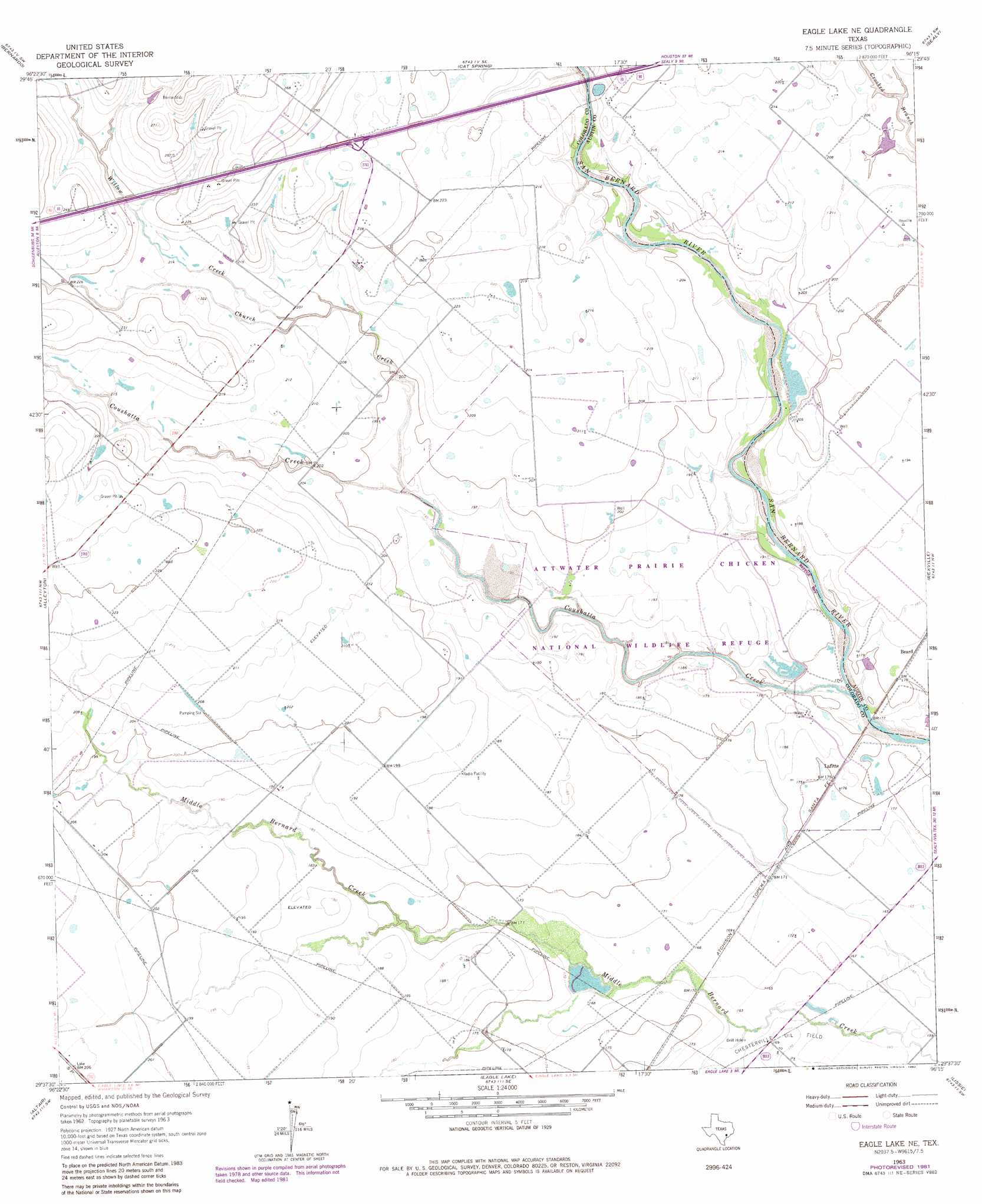
USGS Topo Quad 29096f3 - 1:24,000 scale
| Topo Map Name: | Eagle Lake Ne |
| USGS Topo Quad ID: | 29096f3 |
| Print Size: | ca. 21 1/4" wide x 27" high |
| Southeast Coordinates: | 29.625° N latitude / 96.25° W longitude |
| Map Center Coordinates: | 29.6875° N latitude / 96.3125° W longitude |
| U.S. State: | TX |
| Filename: | o29096f3.jpg |
| Download Map JPG Image: | Eagle Lake Ne topo map 1:24,000 scale |
| Map Type: | Topographic |
| Topo Series: | 7.5´ |
| Map Scale: | 1:24,000 |
| Source of Map Images: | United States Geological Survey (USGS) |
| Alternate Map Versions: |
Eagle Lake NE TX 1963, updated 1966 Download PDF Buy paper map Eagle Lake NE TX 1963, updated 1982 Download PDF Buy paper map Eagle Lake NE TX 2010 Download PDF Buy paper map Eagle Lake NE TX 2013 Download PDF Buy paper map Eagle Lake NE TX 2016 Download PDF Buy paper map |
1:24,000 Topo Quads surrounding Eagle Lake Ne
Industry |
New Ulm |
Bellville |
Burleigh |
Sunny Side |
Frelsburg |
Bernardo |
Cat Spring |
Sealy |
San Felipe |
Columbus |
Alleyton |
Eagle Lake Ne |
Rexville |
Wallis |
Rock Island |
Altair |
Eagle Lake |
Lissie |
East Bernard |
Sheridan Ne |
Garwood |
Bonus |
Egypt |
Hungerford |
> Back to 29096e1 at 1:100,000 scale
> Back to 29096a1 at 1:250,000 scale
> Back to U.S. Topo Maps home
Eagle Lake Ne topo map: Gazetteer
Eagle Lake Ne: Airports
Marios Flying Pizza Airport elevation 69m 226′Renz Ranch Airport elevation 67m 219′
Eagle Lake Ne: Dams
Plowden Lake Dam elevation 59m 193′Refuge Lake Dam elevation 54m 177′
Eagle Lake Ne: Populated Places
Beard elevation 55m 180′Lafitte elevation 55m 180′
Eagle Lake Ne: Reservoirs
Plowden Lake elevation 59m 193′Refuge Lake elevation 54m 177′
Eagle Lake Ne: Streams
Church Creek elevation 58m 190′Coushatta Creek elevation 50m 164′
Willow Creek elevation 60m 196′
Eagle Lake Ne digital topo map on disk
Buy this Eagle Lake Ne topo map showing relief, roads, GPS coordinates and other geographical features, as a high-resolution digital map file on DVD: