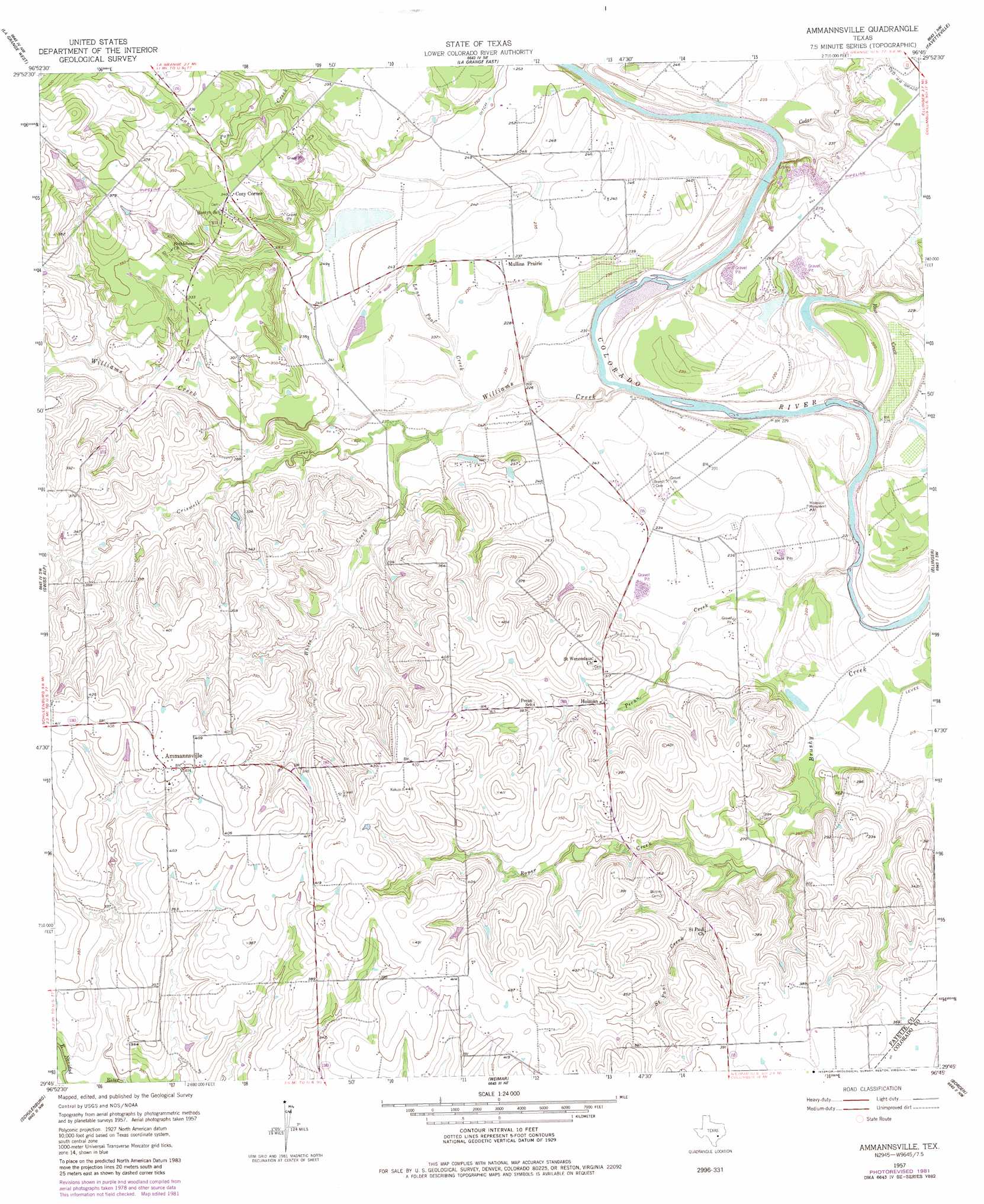
Ammannsville Topo Map Texas
To zoom in, hover over the map of Ammannsville
USGS Topo Quad 29096g7 - 1:24,000 scale
| Topo Map Name: | Ammannsville |
| USGS Topo Quad ID: | 29096g7 |
| Print Size: | ca. 21 1/4" wide x 27" high |
| Southeast Coordinates: | 29.75° N latitude / 96.75° W longitude |
| Map Center Coordinates: | 29.8125° N latitude / 96.8125° W longitude |
| U.S. State: | TX |
| Filename: | o29096g7.jpg |
| Download Map JPG Image: | Ammannsville topo map 1:24,000 scale |
| Map Type: | Topographic |
| Topo Series: | 7.5´ |
| Map Scale: | 1:24,000 |
| Source of Map Images: | United States Geological Survey (USGS) |
| Alternate Map Versions: |
Ammannsville TX 1957, updated 1958 Download PDF Buy paper map Ammannsville TX 1957, updated 1982 Download PDF Buy paper map Ammannsville TX 2010 Download PDF Buy paper map Ammannsville TX 2013 Download PDF Buy paper map Ammannsville TX 2016 Download PDF Buy paper map |
1:24,000 Topo Quads surrounding Ammannsville
Winchester |
Warda |
Nechanitz |
Round Top |
Greenvine |
West Point |
La Grange West |
La Grange East |
Fayetteville |
Industry |
Muldoon |
Swiss Alp |
Ammannsville |
Ellinger |
Frelsburg |
Flatonia |
Schulenburg |
Weimar |
Borden |
Columbus |
Komensky |
Moravia |
Oakland |
Sawmill Branch |
Rock Island |
> Back to 29096e1 at 1:100,000 scale
> Back to 29096a1 at 1:250,000 scale
> Back to U.S. Topo Maps home
Ammannsville topo map: Gazetteer
Ammannsville: Populated Places
Ammannsville elevation 123m 403′Cozy Corner elevation 105m 344′
Holman elevation 86m 282′
Mullins Prairie elevation 72m 236′
Ammannsville: Streams
Baylor Creek elevation 70m 229′Cedar Creek elevation 67m 219′
Criswell Creek elevation 69m 226′
Lane Pool Creek elevation 69m 226′
Pecan Creek elevation 60m 196′
Roper Creek elevation 75m 246′
Ross Creek elevation 63m 206′
Saint Paul Creek elevation 76m 249′
White Creek elevation 70m 229′
Williams Creek elevation 63m 206′
Ammannsville digital topo map on disk
Buy this Ammannsville topo map showing relief, roads, GPS coordinates and other geographical features, as a high-resolution digital map file on DVD: