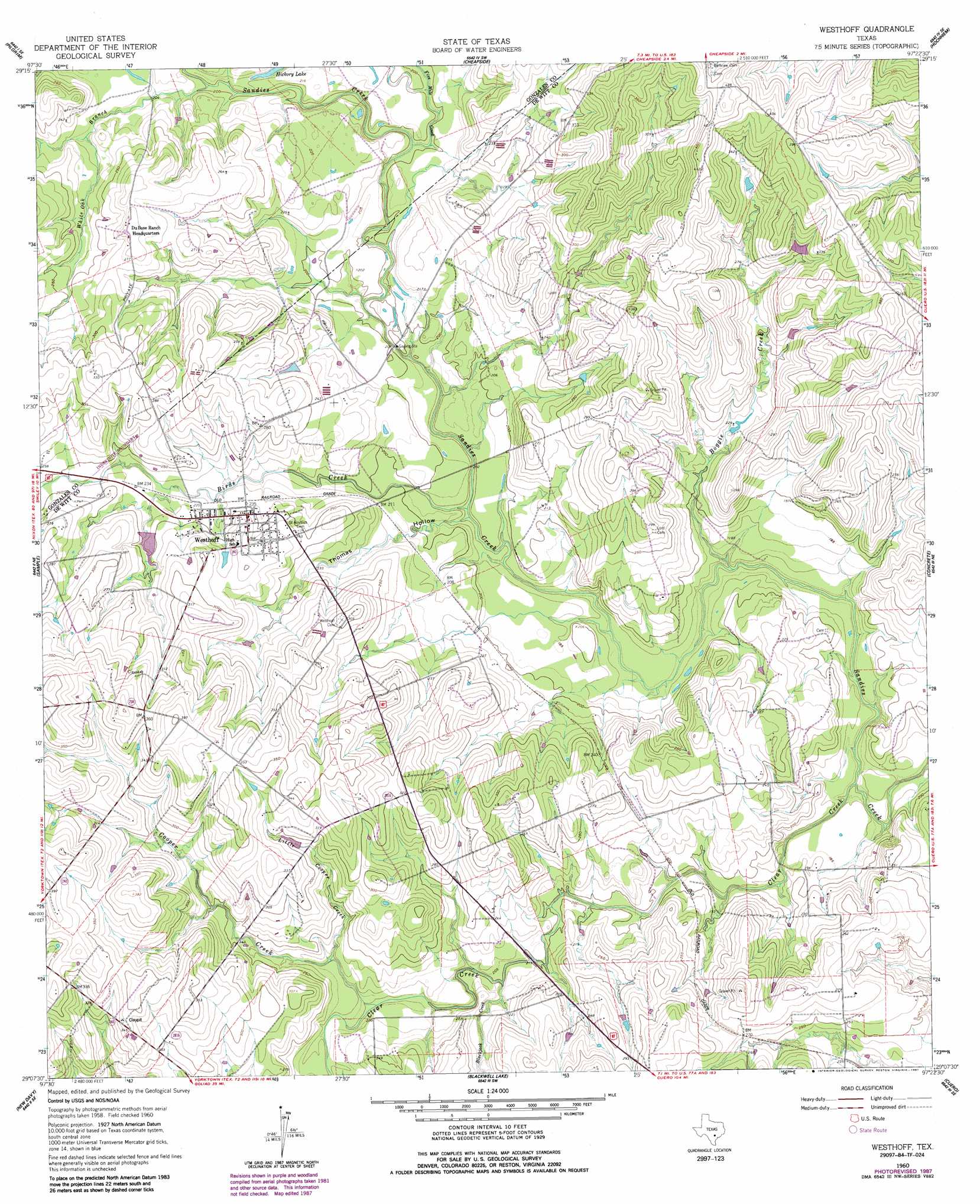
Westhoff Topo Map Texas
To zoom in, hover over the map of Westhoff
USGS Topo Quad 29097b4 - 1:24,000 scale
| Topo Map Name: | Westhoff |
| USGS Topo Quad ID: | 29097b4 |
| Print Size: | ca. 21 1/4" wide x 27" high |
| Southeast Coordinates: | 29.125° N latitude / 97.375° W longitude |
| Map Center Coordinates: | 29.1875° N latitude / 97.4375° W longitude |
| U.S. State: | TX |
| Filename: | o29097b4.jpg |
| Download Map JPG Image: | Westhoff topo map 1:24,000 scale |
| Map Type: | Topographic |
| Topo Series: | 7.5´ |
| Map Scale: | 1:24,000 |
| Source of Map Images: | United States Geological Survey (USGS) |
| Alternate Map Versions: |
Westhoff TX 1960, updated 1962 Download PDF Buy paper map Westhoff TX 1960, updated 1987 Download PDF Buy paper map Westhoff TX 2010 Download PDF Buy paper map Westhoff TX 2013 Download PDF Buy paper map Westhoff TX 2016 Download PDF Buy paper map |
1:24,000 Topo Quads surrounding Westhoff
Leesville |
Cost |
Gonzales South |
Hamon |
Shiner |
Smiley |
Pilgrim |
Cheapside |
Hochheim |
Yoakum |
Bald Mound |
Sample |
Westhoff |
Concrete |
Edgar |
Garfield |
New Davy |
Blackwell Lake |
Cuero |
Verhelle |
Runge |
Yorktown West |
Yorktown East |
Meyersville |
Mission Valley |
> Back to 29097a1 at 1:100,000 scale
> Back to 29096a1 at 1:250,000 scale
> Back to U.S. Topo Maps home
Westhoff topo map: Gazetteer
Westhoff: Dams
Barnhart Lake Dam elevation 71m 232′Westhoff: Populated Places
Westhoff elevation 80m 262′Westhoff: Reservoirs
Barnhart Lake elevation 71m 232′Westhoff: Streams
Birds Creek elevation 53m 173′Blackjack Creek elevation 61m 200′
Boggie Creek elevation 52m 170′
Clear Creek elevation 52m 170′
Cooper Creek elevation 63m 206′
Five Mile Creek elevation 59m 193′
Little Cooper Creek elevation 67m 219′
White Oak Branch elevation 61m 200′
Westhoff: Valleys
Thomas Hollow elevation 53m 173′Westhoff digital topo map on disk
Buy this Westhoff topo map showing relief, roads, GPS coordinates and other geographical features, as a high-resolution digital map file on DVD: