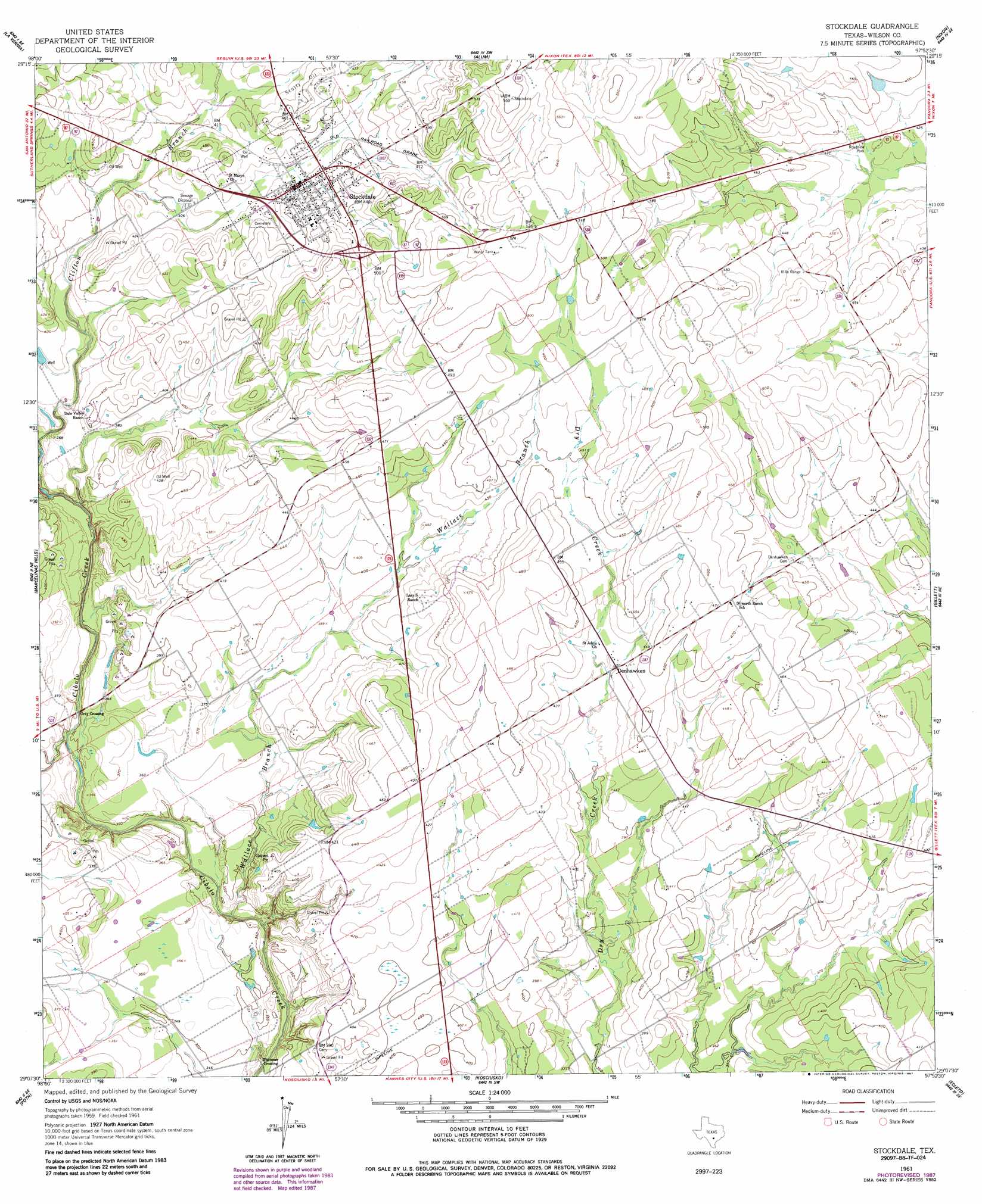
Stockdale Topo Map Texas
To zoom in, hover over the map of Stockdale
USGS Topo Quad 29097b8 - 1:24,000 scale
| Topo Map Name: | Stockdale |
| USGS Topo Quad ID: | 29097b8 |
| Print Size: | ca. 21 1/4" wide x 27" high |
| Southeast Coordinates: | 29.125° N latitude / 97.875° W longitude |
| Map Center Coordinates: | 29.1875° N latitude / 97.9375° W longitude |
| U.S. State: | TX |
| Filename: | o29097b8.jpg |
| Download Map JPG Image: | Stockdale topo map 1:24,000 scale |
| Map Type: | Topographic |
| Topo Series: | 7.5´ |
| Map Scale: | 1:24,000 |
| Source of Map Images: | United States Geological Survey (USGS) |
| Alternate Map Versions: |
Stockdale TX 1961, updated 1963 Download PDF Buy paper map Stockdale TX 1961, updated 1987 Download PDF Buy paper map Stockdale TX 2010 Download PDF Buy paper map Stockdale TX 2013 Download PDF Buy paper map Stockdale TX 2016 Download PDF Buy paper map |
1:24,000 Topo Quads surrounding Stockdale
Saint Hedwig |
New Berlin |
Thomas Springs |
Dewville |
Leesville |
La Vernia Sw |
La Vernia |
Alum |
Nixon |
Smiley |
Floresville |
Marcelinas Hills |
Stockdale |
Gillett |
Bald Mound |
Dewees |
Poth |
Kosciusko |
Ecleto |
Garfield |
Three Oaks |
Falls City |
Karnes City |
Helena |
Runge |
> Back to 29097a1 at 1:100,000 scale
> Back to 29096a1 at 1:250,000 scale
> Back to U.S. Topo Maps home
Stockdale topo map: Gazetteer
Stockdale: Populated Places
Denhawken elevation 128m 419′Gray Crossing elevation 103m 337′
Plummer Crossing elevation 97m 318′
Stockdale elevation 135m 442′
Stockdale: Streams
Wallace Branch elevation 99m 324′Stockdale digital topo map on disk
Buy this Stockdale topo map showing relief, roads, GPS coordinates and other geographical features, as a high-resolution digital map file on DVD: