Hochheim Topo Map Texas
To zoom in, hover over the map of Hochheim
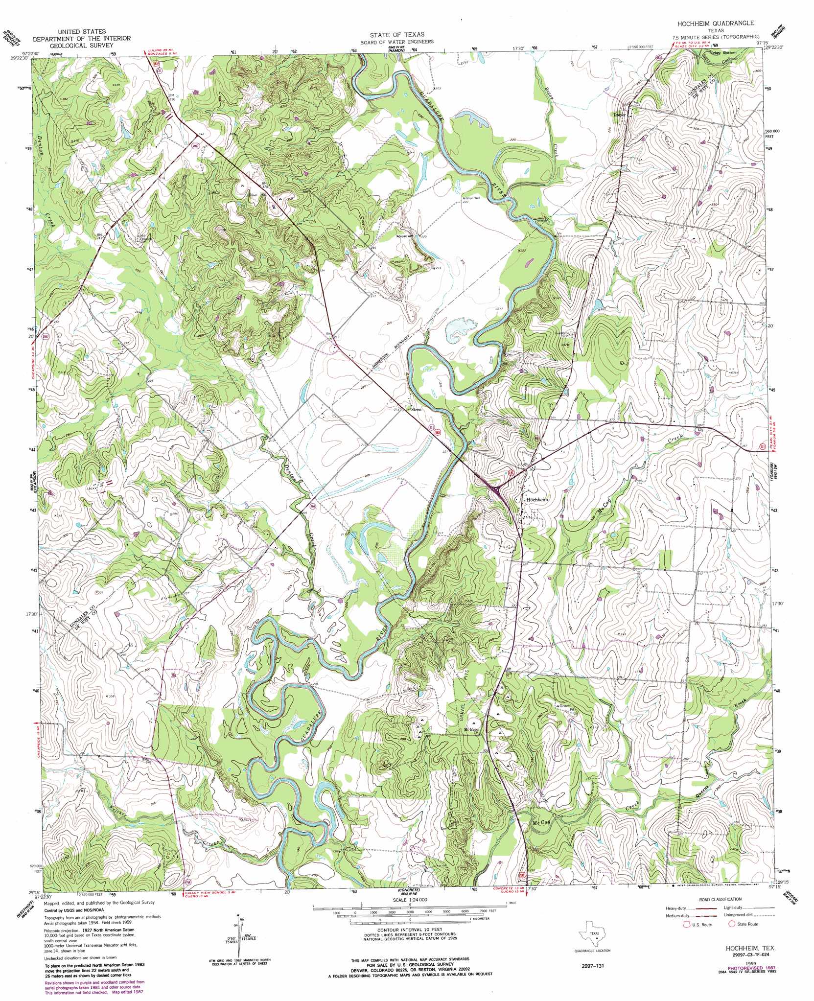
USGS Topo Quad 29097c3 - 1:24,000 scale
| Topo Map Name: | Hochheim |
| USGS Topo Quad ID: | 29097c3 |
| Print Size: | ca. 21 1/4" wide x 27" high |
| Southeast Coordinates: | 29.25° N latitude / 97.25° W longitude |
| Map Center Coordinates: | 29.3125° N latitude / 97.3125° W longitude |
| U.S. State: | TX |
| Filename: | o29097c3.jpg |
| Download Map JPG Image: | Hochheim topo map 1:24,000 scale |
| Map Type: | Topographic |
| Topo Series: | 7.5´ |
| Map Scale: | 1:24,000 |
| Source of Map Images: | United States Geological Survey (USGS) |
| Alternate Map Versions: |
Hochheim TX 1959, updated 1960 Download PDF Buy paper map Hochheim TX 1959, updated 1975 Download PDF Buy paper map Hochheim TX 1959, updated 1987 Download PDF Buy paper map Hochheim TX 2010 Download PDF Buy paper map Hochheim TX 2013 Download PDF Buy paper map Hochheim TX 2016 Download PDF Buy paper map |
1:24,000 Topo Quads surrounding Hochheim
Ottine |
Gonzales North |
Dilworth |
Moulton |
Komensky |
Cost |
Gonzales South |
Hamon |
Shiner |
Wied |
Pilgrim |
Cheapside |
Hochheim |
Yoakum |
Sweet Home |
Sample |
Westhoff |
Concrete |
Edgar |
Terryville |
New Davy |
Blackwell Lake |
Cuero |
Verhelle |
Fordtran |
> Back to 29097a1 at 1:100,000 scale
> Back to 29096a1 at 1:250,000 scale
> Back to U.S. Topo Maps home
Hochheim topo map: Gazetteer
Hochheim: Bends
Turkey Bottom elevation 78m 255′Hochheim: Populated Places
Dreyer elevation 90m 295′Hochheim elevation 108m 354′
Steen elevation 65m 213′
Hochheim: Streams
Boggy Creek elevation 59m 193′Denton Creek elevation 58m 190′
Fulcher Creek elevation 52m 170′
Queens Creek elevation 70m 229′
Hochheim digital topo map on disk
Buy this Hochheim topo map showing relief, roads, GPS coordinates and other geographical features, as a high-resolution digital map file on DVD: