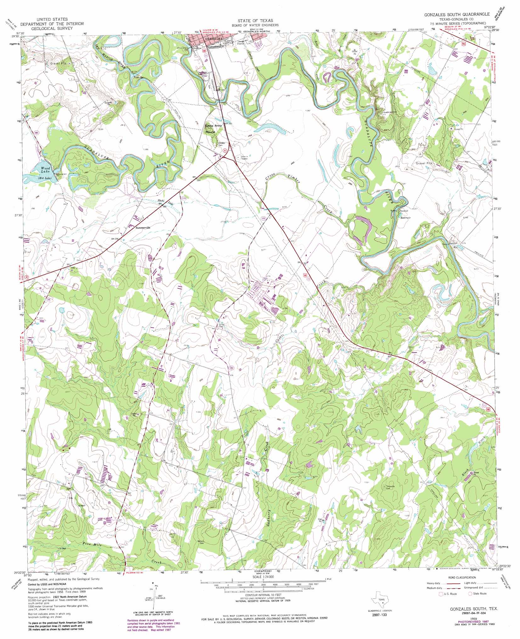
Gonzales South Topo Map Texas
To zoom in, hover over the map of Gonzales South
USGS Topo Quad 29097d4 - 1:24,000 scale
| Topo Map Name: | Gonzales South |
| USGS Topo Quad ID: | 29097d4 |
| Print Size: | ca. 21 1/4" wide x 27" high |
| Southeast Coordinates: | 29.375° N latitude / 97.375° W longitude |
| Map Center Coordinates: | 29.4375° N latitude / 97.4375° W longitude |
| U.S. State: | TX |
| Filename: | o29097d4.jpg |
| Download Map JPG Image: | Gonzales South topo map 1:24,000 scale |
| Map Type: | Topographic |
| Topo Series: | 7.5´ |
| Map Scale: | 1:24,000 |
| Source of Map Images: | United States Geological Survey (USGS) |
| Alternate Map Versions: |
Gonzales South TX 1959, updated 1960 Download PDF Buy paper map Gonzales South TX 1959, updated 1974 Download PDF Buy paper map Gonzales South TX 1959, updated 1987 Download PDF Buy paper map Gonzales South TX 2010 Download PDF Buy paper map Gonzales South TX 2013 Download PDF Buy paper map Gonzales South TX 2016 Download PDF Buy paper map |
1:24,000 Topo Quads surrounding Gonzales South
Luling |
Harwood |
Sandy Fork |
Waelder |
Flatonia Nw |
Belmont |
Ottine |
Gonzales North |
Dilworth |
Moulton |
Leesville |
Cost |
Gonzales South |
Hamon |
Shiner |
Smiley |
Pilgrim |
Cheapside |
Hochheim |
Yoakum |
Bald Mound |
Sample |
Westhoff |
Concrete |
Edgar |
> Back to 29097a1 at 1:100,000 scale
> Back to 29096a1 at 1:250,000 scale
> Back to U.S. Topo Maps home
Gonzales South topo map: Gazetteer
Gonzales South: Dams
Gonzales Dam elevation 75m 246′Wood Lake Dam elevation 83m 272′
Gonzales South: Lakes
Stahl Lake elevation 85m 278′Gonzales South: Parks
Independence Park elevation 83m 272′Gonzales South: Populated Places
Summerville elevation 90m 295′Gonzales South: Reservoirs
Gonzales Lake elevation 75m 246′H-5 Lake elevation 83m 272′
Wood Lake elevation 91m 298′
Gonzales South: Streams
Berry Creek elevation 79m 259′Cottle Creek elevation 68m 223′
Cross Timber Creek elevation 70m 229′
Kerr Creek elevation 71m 232′
San Marcos River elevation 77m 252′
Tinsley Creek elevation 75m 246′
Gonzales South: Summits
Santa Anna Mound elevation 95m 311′Gonzales South digital topo map on disk
Buy this Gonzales South topo map showing relief, roads, GPS coordinates and other geographical features, as a high-resolution digital map file on DVD: