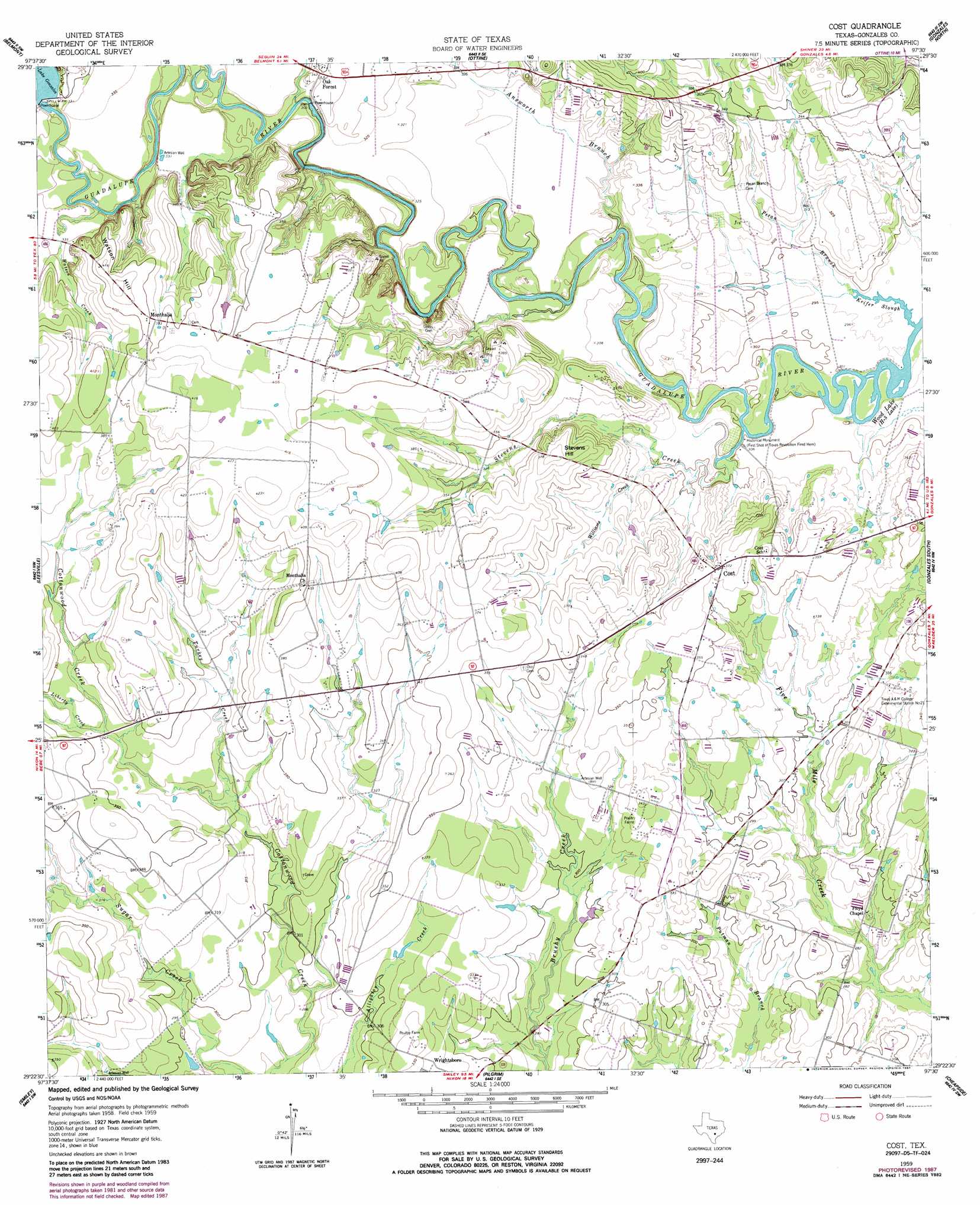
Cost Topo Map Texas
To zoom in, hover over the map of Cost
USGS Topo Quad 29097d5 - 1:24,000 scale
| Topo Map Name: | Cost |
| USGS Topo Quad ID: | 29097d5 |
| Print Size: | ca. 21 1/4" wide x 27" high |
| Southeast Coordinates: | 29.375° N latitude / 97.5° W longitude |
| Map Center Coordinates: | 29.4375° N latitude / 97.5625° W longitude |
| U.S. State: | TX |
| Filename: | o29097d5.jpg |
| Download Map JPG Image: | Cost topo map 1:24,000 scale |
| Map Type: | Topographic |
| Topo Series: | 7.5´ |
| Map Scale: | 1:24,000 |
| Source of Map Images: | United States Geological Survey (USGS) |
| Alternate Map Versions: |
Cost TX 1959, updated 1960 Download PDF Buy paper map Cost TX 1959, updated 1981 Download PDF Buy paper map Cost TX 1959, updated 1987 Download PDF Buy paper map Cost TX 2010 Download PDF Buy paper map Cost TX 2013 Download PDF Buy paper map Cost TX 2016 Download PDF Buy paper map |
1:24,000 Topo Quads surrounding Cost
Kingsbury |
Luling |
Harwood |
Sandy Fork |
Waelder |
Darst Creek |
Belmont |
Ottine |
Gonzales North |
Dilworth |
Dewville |
Leesville |
Cost |
Gonzales South |
Hamon |
Nixon |
Smiley |
Pilgrim |
Cheapside |
Hochheim |
Gillett |
Bald Mound |
Sample |
Westhoff |
Concrete |
> Back to 29097a1 at 1:100,000 scale
> Back to 29096a1 at 1:250,000 scale
> Back to U.S. Topo Maps home
Cost topo map: Gazetteer
Cost: Dams
M A Wade Dam elevation 92m 301′Cost: Populated Places
Cost elevation 113m 370′Monthalia elevation 119m 390′
Oak Forest elevation 106m 347′
Cost: Reservoirs
Lake Gonzales elevation 101m 331′M A Wade Lake elevation 92m 301′
Cost: Streams
Answorth Branch elevation 92m 301′Keifer Slough elevation 89m 291′
Liberty Creek elevation 100m 328′
Pecan Branch elevation 89m 291′
Stevens Creek elevation 90m 295′
Turkey Creek elevation 94m 308′
Watson Creek elevation 93m 305′
Williams Creek elevation 91m 298′
Cost: Summits
Stevens Hill elevation 119m 390′Watson Hill elevation 128m 419′
Cost digital topo map on disk
Buy this Cost topo map showing relief, roads, GPS coordinates and other geographical features, as a high-resolution digital map file on DVD: