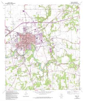
Seguin Topo Map Texas
To zoom in, hover over the map of Seguin
USGS Topo Quad 29097e8 - 1:24,000 scale
| Topo Map Name: | Seguin |
| USGS Topo Quad ID: | 29097e8 |
| Print Size: | ca. 21 1/4" wide x 27" high |
| Southeast Coordinates: | 29.5° N latitude / 97.875° W longitude |
| Map Center Coordinates: | 29.5625° N latitude / 97.9375° W longitude |
| U.S. State: | TX |
| Filename: | o29097e8.jpg |
| Download Map JPG Image: | Seguin topo map 1:24,000 scale |
| Map Type: | Topographic |
| Topo Series: | 7.5´ |
| Map Scale: | 1:24,000 |
| Source of Map Images: | United States Geological Survey (USGS) |
| Alternate Map Versions: |
Seguin TX 1964, updated 1966 Download PDF Buy paper map Seguin TX 1964, updated 1975 Download PDF Buy paper map Seguin TX 1964, updated 1994 Download PDF Buy paper map Seguin TX 2010 Download PDF Buy paper map Seguin TX 2013 Download PDF Buy paper map Seguin TX 2016 Download PDF Buy paper map |
1:24,000 Topo Quads surrounding Seguin
> Back to 29097e1 at 1:100,000 scale
> Back to 29096a1 at 1:250,000 scale
> Back to U.S. Topo Maps home
Seguin topo map: Gazetteer
Seguin: Airports
Elm Creek Airpark elevation 165m 541′Geronimo Field elevation 170m 557′
Guadalupe Hospital Heliport elevation 160m 524′
Joe Fleming Field elevation 146m 479′
Randolph Air Force Base Auxiliary Airport elevation 161m 528′
Seguin: Crossings
Interchange 607 elevation 171m 561′Interchange 609 elevation 182m 597′
Interchange 610 elevation 172m 564′
Interchange 612 elevation 169m 554′
Seguin: Dams
Dam Number 4 elevation 151m 495′Dietz Lake Dam elevation 150m 492′
Guadalupe-Blanco River Authority Tp-4 Dam elevation 151m 495′
Max Starcke Dam elevation 147m 482′
Nolte Dam elevation 138m 452′
Saffold Dam elevation 142m 465′
Seguin: Flats
Cantau Flat elevation 137m 449′Seguin: Parks
Bauer Park elevation 164m 538′Central Park elevation 160m 524′
Fairgrounds Ball Park elevation 151m 495′
Matador Stadium elevation 164m 538′
Max Starcke Park elevation 148m 485′
Nolte Island Recreation Area elevation 141m 462′
Riverview Park elevation 145m 475′
Seguin: Populated Places
Dugger elevation 161m 528′Seguin elevation 159m 521′
Seguin: Reservoirs
Dietz Lake elevation 150m 492′Lake Placid elevation 151m 495′
Max Starcke Reservoir elevation 147m 482′
Meadow Lake elevation 138m 452′
Seguin: Springs
Walnut Springs elevation 164m 538′Seguin: Streams
Cantau Creek elevation 127m 416′Cottonwood Creek elevation 135m 442′
Geronimo Creek elevation 129m 423′
Konde Branch elevation 137m 449′
Krams Creek elevation 135m 442′
Walnut Branch elevation 138m 452′
Seguin digital topo map on disk
Buy this Seguin topo map showing relief, roads, GPS coordinates and other geographical features, as a high-resolution digital map file on DVD:


